SlideShare ist ein Scribd-Unternehmen logo
1 von 25
Interpreting Wetlands and Deepwater 
                  Habitats from Aerial Imagery
                  Habitats from Aerial Imagery
                        Online Education

                            Robert F. Goodwin, GISP
                             GIS/Remote Sensing Analyst
                           RS&GIS, Michigan State University
                           RS&GIS, Michigan State University
                                 goodwinr@msu.edu


                                                               May 2011


http://www.rsgis.msu.edu
Where we’ve been – Where we're going

     RS&GIS has been developing and teaching geospatial 
     courses since the early 1970s
        Image interpretation, processing, orthorectification
        Image interpretation, processing, orthorectification
        Raster processing and analysis
        Vector analysis, Cartography
     Due to shrinking budgets, instruction has been moving 
     online
        NRCS  Introduction to Aerial Image Interpretation 
        NRCS – Introduction to Aerial Image Interpretation
        NRCS – Introduction to Digital Remote Sensing
        Image Interpretation for the NRI
        Interpreting Wetlands and Deepwater Habitats from Aerial 
        Imagery


                                     Remote Sensing & GIS Research and Outreach Services
 2                                                           http://www.rsgis.msu.edu
Why this course?
    Wetland identification and classification educational 
    offerings focus mainly on the field side of things
    There are limited geospatial educational opportunities 
    There are limited geospatial educational opportunities
    concerning wetland interpretation
    Interpreting wetlands from remotely‐sensed imagery is a 
    necessary skill for natural resource professionals
       Conservation, Mitigation, Enhancement
       Traditional surveys (manual delineation)
       Traditional surveys (manual delineation)
       Ground‐truthing and QC
       Training site identification for other classification activities
    Few people know how to accurately interpret wetlands 
    from remotely‐sensed imagery
    Offering online instruction can be cost‐effective
    Offering online instruction can be cost effective
                                       Remote Sensing & GIS Research and Outreach Services
3                                                              http://www.rsgis.msu.edu
Course Layout


                Remote Sensing & GIS Research and Outreach Services
4                                       http://www.rsgis.msu.edu
Getting Started


                  Remote Sensing & GIS Research and Outreach Services
 5                                        http://www.rsgis.msu.edu
Part 1


         Remote Sensing & GIS Research and Outreach Services
 6                               http://www.rsgis.msu.edu
Part 2


         Remote Sensing & GIS Research and Outreach Services
 7                               http://www.rsgis.msu.edu
Part 2…continued


                   Remote Sensing & GIS Research and Outreach Services
8                                          http://www.rsgis.msu.edu
Part 3


         Remote Sensing & GIS Research and Outreach Services
 9                               http://www.rsgis.msu.edu
Part 3…continued


                   Remote Sensing & GIS Research and Outreach Services
10                                         http://www.rsgis.msu.edu
Approach
 The course follows the federal standard
     Classification of Wetlands and Deepwater Habitats of the 
     United States (Cowardin, et. al)
                    (         ,     )


                                  Remote Sensing & GIS Research and Outreach Services
11                                                        http://www.rsgis.msu.edu
Approach
 Teaches interpretation to the “Class” level
     In many cases, interpretation beyond the class level from 
     aerial imagery is unreliable, particularly without multi‐
               g y               ,p           y
     temporal data


                                  Remote Sensing & GIS Research and Outreach Services
12                                                        http://www.rsgis.msu.edu
Approach
 Not just imagery
     Ancillary data plays a big part in the interpretation 
     p
     process


                                    Remote Sensing & GIS Research and Outreach Services
13                                                          http://www.rsgis.msu.edu
Approach
 “Multi” Approach
     Multi‐temporal, Multi‐spectral
     Supplemented with ground and oblique imagery
     Supplemented with ground and oblique imagery


                               Remote Sensing & GIS Research and Outreach Services
14                                                     http://www.rsgis.msu.edu
Approach
 Try not to sound like a textbook
 Break up the monotony…
     Virtual field trips using web browser or virtual globe
     Virtual field trips using web browser or virtual globe
     Image‐based self assessments
     Hands‐on exercises


                                   Remote Sensing & GIS Research and Outreach Services
15                                                         http://www.rsgis.msu.edu
Virtual Field Trips


                      Remote Sensing & GIS Research and Outreach Services
 16                                           http://www.rsgis.msu.edu
Virtual Field Trips


                      Remote Sensing & GIS Research and Outreach Services
 17                                           http://www.rsgis.msu.edu
Remote Sensing & GIS Research and Outreach Services
18                           http://www.rsgis.msu.edu
Self‐Assessments


                   Remote Sensing & GIS Research and Outreach Services
19                                         http://www.rsgis.msu.edu
Hands‐on Exercises
  ESRI ArcGIS exercises
     Both 9.x and 10.x instructions
     Interpret imagery in a GIS environment
     Interpret imagery in a GIS environment


                                 Remote Sensing & GIS Research and Outreach Services
20                                                       http://www.rsgis.msu.edu
Remote Sensing & GIS Research and Outreach Services
21                           http://www.rsgis.msu.edu
Remote Sensing & GIS Research and Outreach Services
22                           http://www.rsgis.msu.edu
Remote Sensing & GIS Research and Outreach Services
23                           http://www.rsgis.msu.edu
Summary…
 LOTS of information!
 When do you stop adding examples?
 Technical content can be challenging to present 
 Technical content can be challenging to present
 appropriately
 Hardware and software requirements may hinder some 
 folks
 It is important to keep it interesting
 It is NOT for everyone – Must be motivated
    i      f                     b      i  d
 Cost‐effective way of training the masses
     Flexible
     Unlimited enrollment


                            Remote Sensing & GIS Research and Outreach Services
24                                                  http://www.rsgis.msu.edu
Questions?
       Q ti ?
     goodwinr@msu.edu


               Remote Sensing & GIS Research and Outreach Services
25                                     http://www.rsgis.msu.edu

Weitere ähnliche Inhalte

Andere mochten auch

Geomorphology applications
Geomorphology applicationsGeomorphology applications
Geomorphology applicationsvyshalik
 
British petroleum & gulf oil spill of 2010
British petroleum & gulf oil spill of 2010British petroleum & gulf oil spill of 2010
British petroleum & gulf oil spill of 2010Aditi Podder
 
Geometry and types of aerial photographs
Geometry and types of aerial photographsGeometry and types of aerial photographs
Geometry and types of aerial photographsPooja Kumari
 
Remote sensing and image interpretation
Remote sensing and image interpretationRemote sensing and image interpretation
Remote sensing and image interpretationMd. Nazir Hossain
 
Image Characteristic & Interpretation
Image Characteristic & InterpretationImage Characteristic & Interpretation
Image Characteristic & InterpretationWAlid Salem
 
Principle of aerial photography and types.ppt
Principle of aerial photography and types.pptPrinciple of aerial photography and types.ppt
Principle of aerial photography and types.pptsrinivas2036
 
Deepwater Horizon Oil Spill Overview Presentation
Deepwater Horizon Oil Spill Overview PresentationDeepwater Horizon Oil Spill Overview Presentation
Deepwater Horizon Oil Spill Overview PresentationRichard Allaway
 
Introduction to aerial photography and photogrammetry.ppt
Introduction to aerial photography and photogrammetry.pptIntroduction to aerial photography and photogrammetry.ppt
Introduction to aerial photography and photogrammetry.pptsrinivas2036
 
Lecture on photogrammetry
Lecture on photogrammetryLecture on photogrammetry
Lecture on photogrammetryWaleed Liaqat
 
Lecture 1-aerial photogrammetry
Lecture 1-aerial photogrammetryLecture 1-aerial photogrammetry
Lecture 1-aerial photogrammetryVidhi Khokhani
 
Remote Sensing PPT
Remote Sensing PPTRemote Sensing PPT
Remote Sensing PPTAmal Murali
 
BP's Deepwater Oil Spill Case Study Analysis - Business Ethics
BP's Deepwater Oil Spill Case Study Analysis - Business EthicsBP's Deepwater Oil Spill Case Study Analysis - Business Ethics
BP's Deepwater Oil Spill Case Study Analysis - Business EthicsÔn Thi
 

Andere mochten auch (16)

Geomorphology applications
Geomorphology applicationsGeomorphology applications
Geomorphology applications
 
British petroleum & gulf oil spill of 2010
British petroleum & gulf oil spill of 2010British petroleum & gulf oil spill of 2010
British petroleum & gulf oil spill of 2010
 
Geometry and types of aerial photographs
Geometry and types of aerial photographsGeometry and types of aerial photographs
Geometry and types of aerial photographs
 
Remote sensing and image interpretation
Remote sensing and image interpretationRemote sensing and image interpretation
Remote sensing and image interpretation
 
Data collection
Data collectionData collection
Data collection
 
Image Characteristic & Interpretation
Image Characteristic & InterpretationImage Characteristic & Interpretation
Image Characteristic & Interpretation
 
Oil spills
Oil spillsOil spills
Oil spills
 
Principle of aerial photography and types.ppt
Principle of aerial photography and types.pptPrinciple of aerial photography and types.ppt
Principle of aerial photography and types.ppt
 
Deepwater Horizon Oil Spill Overview Presentation
Deepwater Horizon Oil Spill Overview PresentationDeepwater Horizon Oil Spill Overview Presentation
Deepwater Horizon Oil Spill Overview Presentation
 
Introduction of photogrammetry
Introduction of photogrammetryIntroduction of photogrammetry
Introduction of photogrammetry
 
Introduction to aerial photography and photogrammetry.ppt
Introduction to aerial photography and photogrammetry.pptIntroduction to aerial photography and photogrammetry.ppt
Introduction to aerial photography and photogrammetry.ppt
 
Introduction to Aerial Photogrammetry
Introduction to Aerial PhotogrammetryIntroduction to Aerial Photogrammetry
Introduction to Aerial Photogrammetry
 
Lecture on photogrammetry
Lecture on photogrammetryLecture on photogrammetry
Lecture on photogrammetry
 
Lecture 1-aerial photogrammetry
Lecture 1-aerial photogrammetryLecture 1-aerial photogrammetry
Lecture 1-aerial photogrammetry
 
Remote Sensing PPT
Remote Sensing PPTRemote Sensing PPT
Remote Sensing PPT
 
BP's Deepwater Oil Spill Case Study Analysis - Business Ethics
BP's Deepwater Oil Spill Case Study Analysis - Business EthicsBP's Deepwater Oil Spill Case Study Analysis - Business Ethics
BP's Deepwater Oil Spill Case Study Analysis - Business Ethics
 

Ähnlich wie Interpreting Wetlands and Deepwater Habitats from Aerial Imagery

GIS and Remote Sensing: Charting New Courses in Spatial Discovery
GIS and Remote Sensing: Charting New Courses in Spatial DiscoveryGIS and Remote Sensing: Charting New Courses in Spatial Discovery
GIS and Remote Sensing: Charting New Courses in Spatial DiscoverySIG Pune
 
2012 Education Track, Designing and Developing a New Online Graduate Geospati...
2012 Education Track, Designing and Developing a New Online Graduate Geospati...2012 Education Track, Designing and Developing a New Online Graduate Geospati...
2012 Education Track, Designing and Developing a New Online Graduate Geospati...GIS in the Rockies
 
On the esri contribution to the gis edu community
On the esri contribution to the gis edu communityOn the esri contribution to the gis edu community
On the esri contribution to the gis edu communityJan Willem van Eck
 
Marcus Badger Distance learning fieldwork
Marcus Badger   Distance learning fieldworkMarcus Badger   Distance learning fieldwork
Marcus Badger Distance learning fieldworkfieldwork_ntf
 
Beyond Tracing Paper
Beyond Tracing PaperBeyond Tracing Paper
Beyond Tracing PaperGeoBlogs
 
The Future is Mapped: Geoinformatics Education in India
The Future is Mapped: Geoinformatics Education in IndiaThe Future is Mapped: Geoinformatics Education in India
The Future is Mapped: Geoinformatics Education in IndiaSIG Pune
 
Coursera spatialcomputing 2014
Coursera spatialcomputing 2014Coursera spatialcomputing 2014
Coursera spatialcomputing 2014Feng Guo
 
Portfolio_Juvair Hossan_KU_BD.pdf
Portfolio_Juvair Hossan_KU_BD.pdfPortfolio_Juvair Hossan_KU_BD.pdf
Portfolio_Juvair Hossan_KU_BD.pdfJuvairHossan1
 
Mapping the Human Environment
Mapping the Human EnvironmentMapping the Human Environment
Mapping the Human EnvironmentJohn Reiser
 
GIS Day at BCC 2012
GIS Day at BCC 2012GIS Day at BCC 2012
GIS Day at BCC 2012John Reiser
 
Course announcement
Course announcementCourse announcement
Course announcementWaterCap
 
Investigating the Domain of Geoinformatics: An Opening to an Electronic Age
Investigating the Domain of Geoinformatics: An Opening to an Electronic AgeInvestigating the Domain of Geoinformatics: An Opening to an Electronic Age
Investigating the Domain of Geoinformatics: An Opening to an Electronic AgeSIG Pune
 
Discovering the World of Geoinformatics: MSc Geoinformatics Colleges in India
Discovering the World of Geoinformatics: MSc Geoinformatics Colleges in IndiaDiscovering the World of Geoinformatics: MSc Geoinformatics Colleges in India
Discovering the World of Geoinformatics: MSc Geoinformatics Colleges in IndiaSIG Pune
 

Ähnlich wie Interpreting Wetlands and Deepwater Habitats from Aerial Imagery (20)

GIS and Remote Sensing: Charting New Courses in Spatial Discovery
GIS and Remote Sensing: Charting New Courses in Spatial DiscoveryGIS and Remote Sensing: Charting New Courses in Spatial Discovery
GIS and Remote Sensing: Charting New Courses in Spatial Discovery
 
2012 Education Track, Designing and Developing a New Online Graduate Geospati...
2012 Education Track, Designing and Developing a New Online Graduate Geospati...2012 Education Track, Designing and Developing a New Online Graduate Geospati...
2012 Education Track, Designing and Developing a New Online Graduate Geospati...
 
Doescher_Resume
Doescher_ResumeDoescher_Resume
Doescher_Resume
 
On the esri contribution to the gis edu community
On the esri contribution to the gis edu communityOn the esri contribution to the gis edu community
On the esri contribution to the gis edu community
 
Marcus Badger Distance learning fieldwork
Marcus Badger   Distance learning fieldworkMarcus Badger   Distance learning fieldwork
Marcus Badger Distance learning fieldwork
 
Deus GIS Portfolio
Deus GIS PortfolioDeus GIS Portfolio
Deus GIS Portfolio
 
Beyond Tracing Paper
Beyond Tracing PaperBeyond Tracing Paper
Beyond Tracing Paper
 
The Future is Mapped: Geoinformatics Education in India
The Future is Mapped: Geoinformatics Education in IndiaThe Future is Mapped: Geoinformatics Education in India
The Future is Mapped: Geoinformatics Education in India
 
Coursera spatialcomputing 2014
Coursera spatialcomputing 2014Coursera spatialcomputing 2014
Coursera spatialcomputing 2014
 
Mapping the Way
Mapping the WayMapping the Way
Mapping the Way
 
Portfolio_Juvair Hossan_KU_BD.pdf
Portfolio_Juvair Hossan_KU_BD.pdfPortfolio_Juvair Hossan_KU_BD.pdf
Portfolio_Juvair Hossan_KU_BD.pdf
 
Mapping the Human Environment
Mapping the Human EnvironmentMapping the Human Environment
Mapping the Human Environment
 
GIS Day at BCC 2012
GIS Day at BCC 2012GIS Day at BCC 2012
GIS Day at BCC 2012
 
Course announcement
Course announcementCourse announcement
Course announcement
 
Investigating the Domain of Geoinformatics: An Opening to an Electronic Age
Investigating the Domain of Geoinformatics: An Opening to an Electronic AgeInvestigating the Domain of Geoinformatics: An Opening to an Electronic Age
Investigating the Domain of Geoinformatics: An Opening to an Electronic Age
 
Kinzel_cv_Aug2015
Kinzel_cv_Aug2015Kinzel_cv_Aug2015
Kinzel_cv_Aug2015
 
Geospatial_Center_Brochure_2016
Geospatial_Center_Brochure_2016Geospatial_Center_Brochure_2016
Geospatial_Center_Brochure_2016
 
The 'where' in education
The 'where' in educationThe 'where' in education
The 'where' in education
 
Discovering the World of Geoinformatics: MSc Geoinformatics Colleges in India
Discovering the World of Geoinformatics: MSc Geoinformatics Colleges in IndiaDiscovering the World of Geoinformatics: MSc Geoinformatics Colleges in India
Discovering the World of Geoinformatics: MSc Geoinformatics Colleges in India
 
Portfolio.pdf
Portfolio.pdfPortfolio.pdf
Portfolio.pdf
 

Kürzlich hochgeladen

Fostering Friendships - Enhancing Social Bonds in the Classroom
Fostering Friendships - Enhancing Social Bonds  in the ClassroomFostering Friendships - Enhancing Social Bonds  in the Classroom
Fostering Friendships - Enhancing Social Bonds in the ClassroomPooky Knightsmith
 
Understanding Accommodations and Modifications
Understanding  Accommodations and ModificationsUnderstanding  Accommodations and Modifications
Understanding Accommodations and ModificationsMJDuyan
 
Jual Obat Aborsi Hongkong ( Asli No.1 ) 085657271886 Obat Penggugur Kandungan...
Jual Obat Aborsi Hongkong ( Asli No.1 ) 085657271886 Obat Penggugur Kandungan...Jual Obat Aborsi Hongkong ( Asli No.1 ) 085657271886 Obat Penggugur Kandungan...
Jual Obat Aborsi Hongkong ( Asli No.1 ) 085657271886 Obat Penggugur Kandungan...ZurliaSoop
 
Google Gemini An AI Revolution in Education.pptx
Google Gemini An AI Revolution in Education.pptxGoogle Gemini An AI Revolution in Education.pptx
Google Gemini An AI Revolution in Education.pptxDr. Sarita Anand
 
Sociology 101 Demonstration of Learning Exhibit
Sociology 101 Demonstration of Learning ExhibitSociology 101 Demonstration of Learning Exhibit
Sociology 101 Demonstration of Learning Exhibitjbellavia9
 
Graduate Outcomes Presentation Slides - English
Graduate Outcomes Presentation Slides - EnglishGraduate Outcomes Presentation Slides - English
Graduate Outcomes Presentation Slides - Englishneillewis46
 
ICT Role in 21st Century Education & its Challenges.pptx
ICT Role in 21st Century Education & its Challenges.pptxICT Role in 21st Century Education & its Challenges.pptx
ICT Role in 21st Century Education & its Challenges.pptxAreebaZafar22
 
REMIFENTANIL: An Ultra short acting opioid.pptx
REMIFENTANIL: An Ultra short acting opioid.pptxREMIFENTANIL: An Ultra short acting opioid.pptx
REMIFENTANIL: An Ultra short acting opioid.pptxDr. Ravikiran H M Gowda
 
How to Give a Domain for a Field in Odoo 17
How to Give a Domain for a Field in Odoo 17How to Give a Domain for a Field in Odoo 17
How to Give a Domain for a Field in Odoo 17Celine George
 
Exploring_the_Narrative_Style_of_Amitav_Ghoshs_Gun_Island.pptx
Exploring_the_Narrative_Style_of_Amitav_Ghoshs_Gun_Island.pptxExploring_the_Narrative_Style_of_Amitav_Ghoshs_Gun_Island.pptx
Exploring_the_Narrative_Style_of_Amitav_Ghoshs_Gun_Island.pptxPooja Bhuva
 
How to setup Pycharm environment for Odoo 17.pptx
How to setup Pycharm environment for Odoo 17.pptxHow to setup Pycharm environment for Odoo 17.pptx
How to setup Pycharm environment for Odoo 17.pptxCeline George
 
Accessible Digital Futures project (20/03/2024)
Accessible Digital Futures project (20/03/2024)Accessible Digital Futures project (20/03/2024)
Accessible Digital Futures project (20/03/2024)Jisc
 
HMCS Vancouver Pre-Deployment Brief - May 2024 (Web Version).pptx
HMCS Vancouver Pre-Deployment Brief - May 2024 (Web Version).pptxHMCS Vancouver Pre-Deployment Brief - May 2024 (Web Version).pptx
HMCS Vancouver Pre-Deployment Brief - May 2024 (Web Version).pptxmarlenawright1
 
How to Create and Manage Wizard in Odoo 17
How to Create and Manage Wizard in Odoo 17How to Create and Manage Wizard in Odoo 17
How to Create and Manage Wizard in Odoo 17Celine George
 
Key note speaker Neum_Admir Softic_ENG.pdf
Key note speaker Neum_Admir Softic_ENG.pdfKey note speaker Neum_Admir Softic_ENG.pdf
Key note speaker Neum_Admir Softic_ENG.pdfAdmir Softic
 
Jamworks pilot and AI at Jisc (20/03/2024)
Jamworks pilot and AI at Jisc (20/03/2024)Jamworks pilot and AI at Jisc (20/03/2024)
Jamworks pilot and AI at Jisc (20/03/2024)Jisc
 
FSB Advising Checklist - Orientation 2024
FSB Advising Checklist - Orientation 2024FSB Advising Checklist - Orientation 2024
FSB Advising Checklist - Orientation 2024Elizabeth Walsh
 
Basic Civil Engineering first year Notes- Chapter 4 Building.pptx
Basic Civil Engineering first year Notes- Chapter 4 Building.pptxBasic Civil Engineering first year Notes- Chapter 4 Building.pptx
Basic Civil Engineering first year Notes- Chapter 4 Building.pptxDenish Jangid
 
Single or Multiple melodic lines structure
Single or Multiple melodic lines structureSingle or Multiple melodic lines structure
Single or Multiple melodic lines structuredhanjurrannsibayan2
 
Application orientated numerical on hev.ppt
Application orientated numerical on hev.pptApplication orientated numerical on hev.ppt
Application orientated numerical on hev.pptRamjanShidvankar
 

Kürzlich hochgeladen (20)

Fostering Friendships - Enhancing Social Bonds in the Classroom
Fostering Friendships - Enhancing Social Bonds  in the ClassroomFostering Friendships - Enhancing Social Bonds  in the Classroom
Fostering Friendships - Enhancing Social Bonds in the Classroom
 
Understanding Accommodations and Modifications
Understanding  Accommodations and ModificationsUnderstanding  Accommodations and Modifications
Understanding Accommodations and Modifications
 
Jual Obat Aborsi Hongkong ( Asli No.1 ) 085657271886 Obat Penggugur Kandungan...
Jual Obat Aborsi Hongkong ( Asli No.1 ) 085657271886 Obat Penggugur Kandungan...Jual Obat Aborsi Hongkong ( Asli No.1 ) 085657271886 Obat Penggugur Kandungan...
Jual Obat Aborsi Hongkong ( Asli No.1 ) 085657271886 Obat Penggugur Kandungan...
 
Google Gemini An AI Revolution in Education.pptx
Google Gemini An AI Revolution in Education.pptxGoogle Gemini An AI Revolution in Education.pptx
Google Gemini An AI Revolution in Education.pptx
 
Sociology 101 Demonstration of Learning Exhibit
Sociology 101 Demonstration of Learning ExhibitSociology 101 Demonstration of Learning Exhibit
Sociology 101 Demonstration of Learning Exhibit
 
Graduate Outcomes Presentation Slides - English
Graduate Outcomes Presentation Slides - EnglishGraduate Outcomes Presentation Slides - English
Graduate Outcomes Presentation Slides - English
 
ICT Role in 21st Century Education & its Challenges.pptx
ICT Role in 21st Century Education & its Challenges.pptxICT Role in 21st Century Education & its Challenges.pptx
ICT Role in 21st Century Education & its Challenges.pptx
 
REMIFENTANIL: An Ultra short acting opioid.pptx
REMIFENTANIL: An Ultra short acting opioid.pptxREMIFENTANIL: An Ultra short acting opioid.pptx
REMIFENTANIL: An Ultra short acting opioid.pptx
 
How to Give a Domain for a Field in Odoo 17
How to Give a Domain for a Field in Odoo 17How to Give a Domain for a Field in Odoo 17
How to Give a Domain for a Field in Odoo 17
 
Exploring_the_Narrative_Style_of_Amitav_Ghoshs_Gun_Island.pptx
Exploring_the_Narrative_Style_of_Amitav_Ghoshs_Gun_Island.pptxExploring_the_Narrative_Style_of_Amitav_Ghoshs_Gun_Island.pptx
Exploring_the_Narrative_Style_of_Amitav_Ghoshs_Gun_Island.pptx
 
How to setup Pycharm environment for Odoo 17.pptx
How to setup Pycharm environment for Odoo 17.pptxHow to setup Pycharm environment for Odoo 17.pptx
How to setup Pycharm environment for Odoo 17.pptx
 
Accessible Digital Futures project (20/03/2024)
Accessible Digital Futures project (20/03/2024)Accessible Digital Futures project (20/03/2024)
Accessible Digital Futures project (20/03/2024)
 
HMCS Vancouver Pre-Deployment Brief - May 2024 (Web Version).pptx
HMCS Vancouver Pre-Deployment Brief - May 2024 (Web Version).pptxHMCS Vancouver Pre-Deployment Brief - May 2024 (Web Version).pptx
HMCS Vancouver Pre-Deployment Brief - May 2024 (Web Version).pptx
 
How to Create and Manage Wizard in Odoo 17
How to Create and Manage Wizard in Odoo 17How to Create and Manage Wizard in Odoo 17
How to Create and Manage Wizard in Odoo 17
 
Key note speaker Neum_Admir Softic_ENG.pdf
Key note speaker Neum_Admir Softic_ENG.pdfKey note speaker Neum_Admir Softic_ENG.pdf
Key note speaker Neum_Admir Softic_ENG.pdf
 
Jamworks pilot and AI at Jisc (20/03/2024)
Jamworks pilot and AI at Jisc (20/03/2024)Jamworks pilot and AI at Jisc (20/03/2024)
Jamworks pilot and AI at Jisc (20/03/2024)
 
FSB Advising Checklist - Orientation 2024
FSB Advising Checklist - Orientation 2024FSB Advising Checklist - Orientation 2024
FSB Advising Checklist - Orientation 2024
 
Basic Civil Engineering first year Notes- Chapter 4 Building.pptx
Basic Civil Engineering first year Notes- Chapter 4 Building.pptxBasic Civil Engineering first year Notes- Chapter 4 Building.pptx
Basic Civil Engineering first year Notes- Chapter 4 Building.pptx
 
Single or Multiple melodic lines structure
Single or Multiple melodic lines structureSingle or Multiple melodic lines structure
Single or Multiple melodic lines structure
 
Application orientated numerical on hev.ppt
Application orientated numerical on hev.pptApplication orientated numerical on hev.ppt
Application orientated numerical on hev.ppt
 

Interpreting Wetlands and Deepwater Habitats from Aerial Imagery

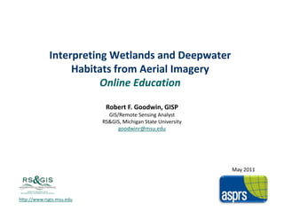
  • 1. Interpreting Wetlands and Deepwater  Habitats from Aerial Imagery Habitats from Aerial Imagery Online Education Robert F. Goodwin, GISP GIS/Remote Sensing Analyst RS&GIS, Michigan State University RS&GIS, Michigan State University goodwinr@msu.edu May 2011 http://www.rsgis.msu.edu
  • 2. Where we’ve been – Where we're going RS&GIS has been developing and teaching geospatial  courses since the early 1970s Image interpretation, processing, orthorectification Image interpretation, processing, orthorectification Raster processing and analysis Vector analysis, Cartography Due to shrinking budgets, instruction has been moving  online NRCS  Introduction to Aerial Image Interpretation  NRCS – Introduction to Aerial Image Interpretation NRCS – Introduction to Digital Remote Sensing Image Interpretation for the NRI Interpreting Wetlands and Deepwater Habitats from Aerial  Imagery Remote Sensing & GIS Research and Outreach Services 2 http://www.rsgis.msu.edu
  • 3. Why this course? Wetland identification and classification educational  offerings focus mainly on the field side of things There are limited geospatial educational opportunities  There are limited geospatial educational opportunities concerning wetland interpretation Interpreting wetlands from remotely‐sensed imagery is a  necessary skill for natural resource professionals Conservation, Mitigation, Enhancement Traditional surveys (manual delineation) Traditional surveys (manual delineation) Ground‐truthing and QC Training site identification for other classification activities Few people know how to accurately interpret wetlands  from remotely‐sensed imagery Offering online instruction can be cost‐effective Offering online instruction can be cost effective Remote Sensing & GIS Research and Outreach Services 3 http://www.rsgis.msu.edu
  • 4. Course Layout Remote Sensing & GIS Research and Outreach Services 4 http://www.rsgis.msu.edu
  • 5. Getting Started Remote Sensing & GIS Research and Outreach Services 5 http://www.rsgis.msu.edu
  • 6. Part 1 Remote Sensing & GIS Research and Outreach Services 6 http://www.rsgis.msu.edu
  • 7. Part 2 Remote Sensing & GIS Research and Outreach Services 7 http://www.rsgis.msu.edu
  • 8. Part 2…continued Remote Sensing & GIS Research and Outreach Services 8 http://www.rsgis.msu.edu
  • 9. Part 3 Remote Sensing & GIS Research and Outreach Services 9 http://www.rsgis.msu.edu
  • 10. Part 3…continued Remote Sensing & GIS Research and Outreach Services 10 http://www.rsgis.msu.edu
  • 11. Approach The course follows the federal standard Classification of Wetlands and Deepwater Habitats of the  United States (Cowardin, et. al) ( , ) Remote Sensing & GIS Research and Outreach Services 11 http://www.rsgis.msu.edu
  • 12. Approach Teaches interpretation to the “Class” level In many cases, interpretation beyond the class level from  aerial imagery is unreliable, particularly without multi‐ g y ,p y temporal data Remote Sensing & GIS Research and Outreach Services 12 http://www.rsgis.msu.edu
  • 13. Approach Not just imagery Ancillary data plays a big part in the interpretation  p process Remote Sensing & GIS Research and Outreach Services 13 http://www.rsgis.msu.edu
  • 14. Approach “Multi” Approach Multi‐temporal, Multi‐spectral Supplemented with ground and oblique imagery Supplemented with ground and oblique imagery Remote Sensing & GIS Research and Outreach Services 14 http://www.rsgis.msu.edu
  • 15. Approach Try not to sound like a textbook Break up the monotony… Virtual field trips using web browser or virtual globe Virtual field trips using web browser or virtual globe Image‐based self assessments Hands‐on exercises Remote Sensing & GIS Research and Outreach Services 15 http://www.rsgis.msu.edu
  • 16. Virtual Field Trips Remote Sensing & GIS Research and Outreach Services 16 http://www.rsgis.msu.edu
  • 17. Virtual Field Trips Remote Sensing & GIS Research and Outreach Services 17 http://www.rsgis.msu.edu
  • 18. Remote Sensing & GIS Research and Outreach Services 18 http://www.rsgis.msu.edu
  • 19. Self‐Assessments Remote Sensing & GIS Research and Outreach Services 19 http://www.rsgis.msu.edu
  • 20. Hands‐on Exercises ESRI ArcGIS exercises Both 9.x and 10.x instructions Interpret imagery in a GIS environment Interpret imagery in a GIS environment Remote Sensing & GIS Research and Outreach Services 20 http://www.rsgis.msu.edu
  • 21. Remote Sensing & GIS Research and Outreach Services 21 http://www.rsgis.msu.edu
  • 22. Remote Sensing & GIS Research and Outreach Services 22 http://www.rsgis.msu.edu
  • 23. Remote Sensing & GIS Research and Outreach Services 23 http://www.rsgis.msu.edu
  • 24. Summary… LOTS of information! When do you stop adding examples? Technical content can be challenging to present  Technical content can be challenging to present appropriately Hardware and software requirements may hinder some  folks It is important to keep it interesting It is NOT for everyone – Must be motivated i f b i d Cost‐effective way of training the masses Flexible Unlimited enrollment Remote Sensing & GIS Research and Outreach Services 24 http://www.rsgis.msu.edu
  • 25. Questions? Q ti ? goodwinr@msu.edu Remote Sensing & GIS Research and Outreach Services 25 http://www.rsgis.msu.edu