SlideShare ist ein Scribd-Unternehmen logo
1 von 35
Downloaden Sie, um offline zu lesen
Eyes Over Puget Sound
Field log   Weather          Water column            Aerial photos         Ferry and Satellite       Moorings


                      Surface Conditions Report
                         October, 17th 2011

                                                                                             Start here


   Up-to-date observations of visible water quality conditions in Puget Sound and the Strait of Juan de Fuca
Field log      Weather    Water column   Aerial photos       Ferry and Satellite     Moorings

    Present Conditions at a Glance
                                         Personal flight impression                p. 3-4
                                         First fog then skies are clear,
       Mya Keyzers                       the pattern shows that fall is here!
  Laura Friedenberg
                                         Weather conditions                     p. 5
                                         Warm afternoons with colder nights make cooler-
                                         than-normal conditions; sunlight stronger in the
       Skip Albertson                    north.

                                         Aerial photography                    p. 7-26
     Dr. Christopher                     Brown-red blooms in Carr Inlet and Budd Inlet.
              Krembs                     Green bloom near Squaxin Island.

                                         Ferry and satellite                 p. 27-32
            Dr. Brandon                  Temperatures decrease and blooms fade as the
             Sackmann                    summer growing season comes to an end.

                                         In-situ mooring data                      p. 32-33
                                         Dissolved oxygen trends still vary
            David Mora
                                         geographically.
Personal flight impression
Field log    Weather             Water column          Aerial photos         Ferry and Satellite       Moorings

                                                     Marine Flight 1 (Coast)
                                          October is usually the foggiest month of the year, and we were
                                        effected by it the morning of the Coast flight. Patchy fog over the
                                        South Sound delayed us, but as soon as our pilot landed in
                                        Olympia, we were on our way to the coast. When we arrived
                                        there, skies were clear and cloudless, and much to our surprise the
                                        temperature was warm. Our first stop was Grays Harbor, where
                                        there was a distinct brown river plume that reached far into the
        Mya collecting samples          middle of the harbor.

   Fog and Clear Skies                    While we were flying along the coast to Willapa Bay, we watched
                                        surfers and beachcombers enjoying the beautiful weather. We also
                                        saw patches of brown algae in the surf. In Willapa Bay we saw a
                                        few flocks of snow geese flying around.

                                           At the end of our flight, we flew past the Capital building for our
                                        landing in Budd Inlet. We got an aerial view of people camping out
                                        near the capital as part of the Occupy Olympia movement. The
                                        flight went quickly and smoothly, and we were happy to be out on
                                        such a nice day!
  Pilot Kevin Thomson, Kenmore Air
Personal flight impression
Field log       Weather               Water column               Aerial photos   Ferry and Satellite            Moorings


       1
                                                             3         1
                                                         2

                                                     5

        River Plume in Grays Harbor                          4                           Occupy Olympia Movement


   2                                                                                4


                                                3


           Brown Algae on the Coast                  Tide Line in Grays Harbor    Clear Skies and River Plume in Willapa Bay
Weather of the last two months 10-17-2011
 Field log            Weather                      Water column                            Aerial photos                        Ferry and Satellite                            Moorings

   Meteorological conditions typically explain up to half of the variance in observed marine variables (Moore et
   al. 2008), particularly in shallower waters like those of South Puget Sound. I summarized the specific conditions
   prevalent during the past two weeks, from north to south, below.

  Summary:
  Air temperatures during the
  past few days have been
  cooler than average, with
  warm afternoons but colder
  nights. Light availability has
  been higher to the north
  and inland.

  Coastal and northern rivers
  have been running lower
  than normal, except in
  Central Sound where the
  Puyallup and Skagit had
  higher flows last week.

  Winds have been from
  predominantly the north,
  with southerlies last week.
Moore et al. 2008. Local and large-scale climate forcing of Puget Sound oceanographic properties on seasonal to interdecadal timescales. Limnol. Oceanogr., 53(5), 1746–1758
Water conditions of the previous month
Field log   Weather         Water column          Aerial photos        Ferry and Satellite     Moorings


     Section is currently in development:
     We will present CTD measurements from our Marine Flight Program and discuss observations in the
     temporal context of Ecology’s Long-Term Marine Monitoring data. The focus will rest on anomalies of
     physical and optical variables throughout the water column.
Aerial Photography, Summary 10-17-2011
Field log    Weather             Water column              Aerial photos      Ferry and Satellite   Moorings
Comment:         Red-brown blooms in Budd Inlet, Carr Inlet and other South Sound bays. Jelly fish
                 in Budd Inlet (resembles conditions of 10-17-2011)
                             --- Start exploring aerial observations and click here! ---
Red-brown bloom and jelly fish, Budd Inlet
                                                         Mixing and Fronts:


                                                Front
                                                         Dana Passage, clear water surfacing on western
                                                         side

                                                         Suspended sediment:
                                                Plume    No observations


                                                         Visible blooms:
                                                Bloom


                                                         Brown-red: Budd Inlet, Carr Inlet (north west side)
                                                         Green: North of Squaxin Island
                                                         Turquoise : Budd Inlet south end

                                                         Debris
                                                Debris


                                                         Some filaments in South Sound. Central basin clear

    Cloud banks affected flight route!
Field log           Weather             Water column        Aerial photos         Ferry and Satellite    Moorings


                                                                            Aerial Photography
                                                                            Image guide
                                                                1
                                                       15


                                                            2


                                                                            Flight Information:
                                         14                                 Morning flight:
                                                                            Low clouds, altitude 1000ft, no wind
                               13                                           (visibility limited, dark)
                              11
                                                                            Evening flight:
                     10                 12    3
                                                                            Cloud banks affected flight route
                                         4                                  Visibility limited, altitude 2500ft
                9
            8                           6                                   Observational maps Central Sound
            7                       5                                       Observational maps South Sound
1                            Aerial photography                                     Navigate

Field log   Weather        Water column       Aerial photos     Ferry and Satellite   Moorings


            Urban waterways. Location: Seattle, Fremont and Ballard, 10:09 AM
2                           Aerial photography                                      Navigate

Field log   Weather       Water column       Aerial photos     Ferry and Satellite    Moorings


            Recovery activity around sunken barge. Location: West Seattle, 10:14 AM
3                          Aerial photography                                     Navigate

Field log   Weather      Water column       Aerial photos     Ferry and Satellite   Moorings


   What a magnificent place we live in! Location: Above Carr Inlet (South Sound), 10:31 AM
4                              Aerial photography                               Navigate

Field log   Weather     Water column       Aerial photos    Ferry and Satellite   Moorings


                                               Bloom
                        Debris


 Blooming activity seen between clouds. Location: Henderson Inlet (South Sound), 10:32 AM
5                                     Aerial photography                             Navigate

Field log   Weather      Water column            Aerial photos   Ferry and Satellite   Moorings


                                                                              Debris
                           jelly fish


                                                     Bloom


                Red-brown bloom. Location: Budd Inlet (South Sound), 4:20 PM
6                             Aerial photography                                              Navigate

Field log    Weather       Water column          Aerial photos            Ferry and Satellite   Moorings


                                             Bloom


                                                                 Debris


      Red-brown bloom with abrupt transition and surface debris. Location: Budd Inlet (South
                                       Sound), 4:21 PM
7                           Aerial photography                                     Navigate

Field log   Weather      Water column       Aerial photos     Ferry and Satellite   Moorings


                                                Bloom
                                                                                    Debris


       Red-brown bloom, and surface debris. Location: Budd Inlet (South Sound), 4:21 PM
8                           Aerial photography                                     Navigate

Field log   Weather       Water column       Aerial photos     Ferry and Satellite   Moorings


                                                                Bloom
                                                                                      Debris


              Red-brown bloom, surface debris. Location: Budd Inlet (South Sound), 4:23 PM
9                           Aerial photography                                                 Navigate

Field log     Weather     Water column        Aerial photos                Ferry and Satellite   Moorings


                                           sailboat


                                                      jelly fish
            jelly fish                                                          jelly fish


                                                              jelly fish


   Jellyfish aggregations, see sailboat for scale. Location: Budd Inlet (South Sound), 4:24 PM
10                             Aerial photography                                      Navigate

Field log    Weather       Water column        Aerial photos     Ferry and Satellite    Moorings


                                                                                           Bloom
                                                   Debris


            Surface debris filament. Location: Squaxin Passage (South Sound), 4:30 PM
11                             Aerial photography                                      Navigate

Field log    Weather       Water column           Aerial photos   Ferry and Satellite   Moorings


                                          Bloom


            Algae bloom. Location: Next to Squaxin Island (South Sound), 4:30PM
12                           Aerial photography                                     Navigate

Field log   Weather      Water column        Aerial photos     Ferry and Satellite   Moorings


    Clear water surfacing in Dana Passage. Location: Dana Passage, across Henderson Island
                                    (South Sound), 4:31 PM
13                           Aerial photography                                           Navigate

Field log   Weather       Water column       Aerial photos           Ferry and Satellite   Moorings


                                                             Bloom


                 Red-Brown bloom. Location: Carr Inlet (South Sound), 4:38 PM
14                           Aerial photography                                            Navigate

Field log   Weather       Water column            Aerial photos       Ferry and Satellite   Moorings


                                         Debris


                                                              Bloom


                 Red-Brown bloom. Location: Carr Inlet (South Sound), 4:38 PM
15                           Aerial photography                                        Navigate

Field log   Weather       Water column        Aerial photos      Ferry and Satellite    Moorings


Clear condition. Location: From Bainbridge Island into Elliott Bay, Seattle (Central Sound), 4:54
                                             PM
Field log   Weather         Water column               Aerial photos              Ferry and Satellite   Moorings


                Aerial photography observations in Central Sound                                        Navigate

                                                Date: 10-17-2011
                      Morning                                                           Evening


                                        1

                                                                                               15

                                            2


                            Numbers on map refer to picture numbers for spatial reference
Field log     Weather               Water column   Aerial photos          Ferry and Satellite   Moorings


            Navigate


                                                                                    3

                                                                              4
      Aerial
   photography

 Observations in
  South Sound:
                                                                               14
   10-17-2011
                                                                     13

                                                                11
                                                           10             12
                                                       9
                                                   8                      6
  Numbers on map refer to picture                  7                  5
   numbers for spatial reference
Field log   Weather   Water column   Aerial photos         Ferry and Satellite   Moorings

                      Legend to map annotations                                  Navigate


                                                     Comments:
                                                     Maps are produced by observers
                                                     during and after flight and
                                                     intended to give an approximate
                                                     reconstruction of surface
                                                     conditions on scales that connect
                                                     to and overlap with satellite images
                                                     in the following section.
Daily ferry and satellite observations in
            Central Sound, 10-17-2011
Field log   Weather        Water column                 Aerial photos           Ferry and Satellite          Moorings
Contact: brandon.sackmann@ecy.wa.gov

                                                                                17 Oct                          17 Oct


                                                                                                                    Fouling


                                                            Current Conditions: Minimal surface fluorescence
                                                            in Central Sound (fouling observed on 17 Oct. AM
                                                            transect); lowest values in Strait of Juan de Fuca;
                                                            surface temperatures in Central Sound range from
                                                            11.5-12.5 °C and 10-11 °C in Strait of Juan de Fuca.

                      MERIS True Color image used for               --- Daily ‘Quick-Look’ Products Available ---
                      spatial context (19 February          (http://www.ecy.wa.gov/programs/eap/mar_wat/eops/clipper.html)
                      2011). Image is not coincident
                      with ferry data shown on right
Field log   Weather          Water column   Aerial photos   Ferry and Satellite   Moorings


 Temperatures decrease
 and blooms fade as the
summer growing season
     comes to an end in
          Puget Sound


        Late September saw a
   dramatic transition to much
             cooler sea surface
      temperatures and lower
          fluorescence values
     throughout Puget Sound.
Field log   Weather          Water column   Aerial photos   Ferry and Satellite   Moorings


  CDOM fluorescence as
         an indicator July
                    24
                       of
 freshwater influence in
         Central Sound

  A primary source of Colored
     Dissolved Organic Matter
    (CDOM) to Puget Sound is
                  from rivers.

 Recent rainfall and increased
  river discharge has lead to a
 highly colored pulse of water
  seen moving from Whidbey
     Basin into Central Sound.
Field log   Weather          Water column   Aerial photos   Ferry and Satellite   Moorings


 Interactive Google KML
 products now available
       for Clipper-based
               products!

Google-friendly KML products
can now be downloaded from
                 our website:

http://www.ecy.wa.gov/progra
ms/eap/mar_wat/eops/clipper
                       .html

  These products complement
       our standard daily PDF
products. To minimize file size
    the KML point-based data
        have been binned to a
        standard Lat/Lon grid.
Field log   Weather           Water column          Aerial photos    Ferry and Satellite        Moorings


     Estuarine Algal Proxy
                     (EAP)
   Ecology is exploring a hybrid                                                           18 Oct
        algal proxy that blends
         characteristics of both
Fluorescence Line Height (FLH)
     and Maximum Chlorophyll
                    Index (MCI)

       EAP is calculated as the
  maximum of MERIS bands 8
     (681 nm) and 9 (709 nm)
       above a linear baseline
   between bands 7 (665 nm)
              and 10 (753 nm)

   EAP captures separate algal
      blooms in Carr and Budd
  Inlets. Blooms were visually
     identified in aerial photos
               taken on 17 Oct.

                                             *** Aerial Photographs of South Sound Blooms ***
Mooring observation from
                10/4-10/18/2011
Field log     Weather         Water column           Aerial photos         Ferry and Satellite   Moorings
  Go to our mooring site at: http://www.ecy.wa.gov/programs/eap/mar_wat/moorings.html
  1. Mukilteo, Whidbey Basin near Everett: DO and temperature decreased while salinity increased at
     depth (14-18 m, NB). Surface salinity and temperature decreased as stratification strengthened.
     Mean values:

        NB:    DO: 5.9 mg/L (down 0.9 mg/L)      Surface:   Temp: 12.0°C (down 0.4 °C)
               Temp: 11.8°C (down 0.8°C)                    Salinity: 27.6 PSU (down 1.5 PSU)
               Salinity: 29.8 PSU (up 0.1 PSU)

  2. Manchester, Central Sound: DO at depth (11 m, NB) increased while temperature decreased. Near
      surface temperature decreased. Mean values:

        NB:    DO: 6.1 mg/L (up 0.5 mg/L)        Surface:   Temp: 12.0°C (down 0.4°C)
               Temp: 12.0°C (down 0.3°C)                    Salinity: 29.9 PSU
               Salinity: 30.0 PSU

  3. Squaxin Passage (South Sound) near Olympia: Temperature at depth (5 m) decreased. Mean values:

               DO: 6.7 mg/L
               Temp: 13.5°C (down 0.8 °C)
               Salinity: 29.0 PSU
                                                                     Real-time data online (click)
Field log   Weather          Water column   Aerial photos          Ferry and Satellite           Moorings

             Water Masses and DO from our Moorings: 10/4-10/18/2011


Units mg DO/L


                                   -0.9
per 2 weeks
                      +0.5


      variable

                                                     Left Panel: Probability of finding a specific density
                                                     over the past two-week period. High probability
                                                     shown in warm colors.
                                                     Right Panel: Dissolved oxygen concentration in
                                                     relation to salinity. High probability shown in warm
                                                     colors.
Field log    Weather         Water column               Aerial photos            Ferry and Satellite          Moorings

       Get your data from Ecology’s Environmental Assessment Program

   Long – Term                                                                                      Real – Time
Monitoring Network                                                                                Sensor Network


                             Ecology’s long-term marine
                                 monitoring stations
         Aerial survey:                                                                            Ferry and satellite :
  ftp://www.ecy.wa.gov/eap                                                                      brandon.sackmann@ecy.w
         /Flight_Blog/                                                                                    a.gov
                                    Ferry track
                                    Morning flight
                                    Evening flight


     Access core                                                                                  Access mooring
    monitoring data:                           Freshwater Report:
                                               ftp://ecy.wa.gov/eap/Freshwater
                                                                                                       data:
   http://www.ecy.wa.gov/a                                                                       http://www.ecy.wa.gov/pr
                                               Report/Ambient_Monitoring-
   pps/eap/marinewq/mwda                                                                         ograms/eap/mar_wat/mo
                                               Monthly_Summary.html
           taset.asp                                                                                    orings.html
Field log   Weather          Water column            Aerial photos          Ferry and Satellite        Moorings
     You may subscribe or unsubscribe to the Eyes Over Puget Sound email listserv by going to this link:
                http://listserv.wa.gov/cgi-bin/wa?A0=ECOLOGY-EYES-OVER-PUGET-SOUND

                              We are looking for feedback to improve our products.

                                            Dr. Christopher Krembs
                                             ckre461@ecy.wa.gov

                                            Marine Monitoring Unit
                                      Environmental Assessment Program
                                          WA Department of Ecology


                         Many thanks to our business partners: Clipper Navigation, Swantown Marina and Kenmore Air.

Weitere ähnliche Inhalte

Was ist angesagt? (18)

Eops 2014 04_21
Eops 2014 04_21Eops 2014 04_21
Eops 2014 04_21
 
Eops 2013 08_21
Eops 2013 08_21Eops 2013 08_21
Eops 2013 08_21
 
Eops 2013 10_28
Eops 2013 10_28Eops 2013 10_28
Eops 2013 10_28
 
Eops 2016 02_08
Eops 2016 02_08Eops 2016 02_08
Eops 2016 02_08
 
El Nino and La Nina
El Nino and La Nina El Nino and La Nina
El Nino and La Nina
 
Eops 2013 12_31
Eops 2013 12_31Eops 2013 12_31
Eops 2013 12_31
 
Eops 2015 10_6
Eops 2015 10_6Eops 2015 10_6
Eops 2015 10_6
 
Eops 2017 7_24
Eops 2017 7_24Eops 2017 7_24
Eops 2017 7_24
 
La nina and_el_nino3
La nina and_el_nino3La nina and_el_nino3
La nina and_el_nino3
 
Lecture13 oct23-bb(1)
Lecture13 oct23-bb(1)Lecture13 oct23-bb(1)
Lecture13 oct23-bb(1)
 
Climatic changes - el nino and la nina
Climatic changes - el nino and la ninaClimatic changes - el nino and la nina
Climatic changes - el nino and la nina
 
Eops 2015 4_29
Eops 2015 4_29Eops 2015 4_29
Eops 2015 4_29
 
Eops 2015 8_4
Eops 2015 8_4Eops 2015 8_4
Eops 2015 8_4
 
Eops 2015 9_21
Eops 2015 9_21Eops 2015 9_21
Eops 2015 9_21
 
Eops 2014 08_18
Eops 2014 08_18Eops 2014 08_18
Eops 2014 08_18
 
Eops 2013 11_21
Eops 2013 11_21Eops 2013 11_21
Eops 2013 11_21
 
Eops 2017 6_5
Eops 2017 6_5Eops 2017 6_5
Eops 2017 6_5
 
Eops 2014 07_28
Eops 2014 07_28Eops 2014 07_28
Eops 2014 07_28
 

Ähnlich wie Eops 2011 10_17 (20)

Eops 2012 03_19
Eops 2012 03_19Eops 2012 03_19
Eops 2012 03_19
 
Eops 2012 03_19
Eops 2012 03_19Eops 2012 03_19
Eops 2012 03_19
 
Eops 2012 05_14
Eops 2012 05_14Eops 2012 05_14
Eops 2012 05_14
 
Eops 2011 09_12
Eops 2011 09_12Eops 2011 09_12
Eops 2011 09_12
 
EOPS_2011_10_17.pdf
EOPS_2011_10_17.pdfEOPS_2011_10_17.pdf
EOPS_2011_10_17.pdf
 
Eops 2013 01_15
Eops 2013 01_15Eops 2013 01_15
Eops 2013 01_15
 
EOPS_2011_12_05.pdf
EOPS_2011_12_05.pdfEOPS_2011_12_05.pdf
EOPS_2011_12_05.pdf
 
Eops 2012 02_27
Eops 2012 02_27Eops 2012 02_27
Eops 2012 02_27
 
EOPS_2012_03_19.pdf
EOPS_2012_03_19.pdfEOPS_2012_03_19.pdf
EOPS_2012_03_19.pdf
 
Eops 2013 05_20
Eops 2013 05_20Eops 2013 05_20
Eops 2013 05_20
 
Eops 2013 05_20
Eops 2013 05_20Eops 2013 05_20
Eops 2013 05_20
 
Eops 2013 11_21
Eops 2013 11_21Eops 2013 11_21
Eops 2013 11_21
 
EOPS_2012_02_27.pdf
EOPS_2012_02_27.pdfEOPS_2012_02_27.pdf
EOPS_2012_02_27.pdf
 
Eops 2013 06_17
Eops 2013 06_17Eops 2013 06_17
Eops 2013 06_17
 
Eops 2013 06_17
Eops 2013 06_17Eops 2013 06_17
Eops 2013 06_17
 
Eops 2013 07_15
Eops 2013 07_15Eops 2013 07_15
Eops 2013 07_15
 
Eops 2014 05_12
Eops 2014 05_12Eops 2014 05_12
Eops 2014 05_12
 
Eops 2012 01_30
Eops 2012 01_30Eops 2012 01_30
Eops 2012 01_30
 
EOPS_2011_09_12.pdf
EOPS_2011_09_12.pdfEOPS_2011_09_12.pdf
EOPS_2011_09_12.pdf
 
Eops 2013 04_08
Eops 2013 04_08Eops 2013 04_08
Eops 2013 04_08
 

Mehr von Christopher Krembs (15)

Eops 2015 9_21
Eops 2015 9_21Eops 2015 9_21
Eops 2015 9_21
 
Eops 2015 7_6
Eops 2015 7_6Eops 2015 7_6
Eops 2015 7_6
 
Eops 2015 6_8
Eops 2015 6_8Eops 2015 6_8
Eops 2015 6_8
 
Eops 2015 3_24
Eops 2015 3_24Eops 2015 3_24
Eops 2015 3_24
 
Eops 2015 2_17
Eops 2015 2_17Eops 2015 2_17
Eops 2015 2_17
 
Eops 2015 1_28
Eops 2015 1_28Eops 2015 1_28
Eops 2015 1_28
 
Eops 2014 12_30
Eops 2014 12_30Eops 2014 12_30
Eops 2014 12_30
 
Eops 2014 10_29
Eops 2014 10_29Eops 2014 10_29
Eops 2014 10_29
 
Eops 2014 09_16
Eops 2014 09_16Eops 2014 09_16
Eops 2014 09_16
 
Eops 2013 09_11
Eops 2013 09_11Eops 2013 09_11
Eops 2013 09_11
 
Eops 2014 10_29
Eops 2014 10_29Eops 2014 10_29
Eops 2014 10_29
 
Eops 2014 09_16
Eops 2014 09_16Eops 2014 09_16
Eops 2014 09_16
 
Eops 2014 06_23
Eops 2014 06_23Eops 2014 06_23
Eops 2014 06_23
 
Eops 2014 03_24
Eops 2014 03_24Eops 2014 03_24
Eops 2014 03_24
 
Eops 2014 02_04
Eops 2014 02_04Eops 2014 02_04
Eops 2014 02_04
 

Kürzlich hochgeladen

FULL ENJOY - 9953040155 Call Girls in Paschim Vihar | Delhi
FULL ENJOY - 9953040155 Call Girls in Paschim Vihar | DelhiFULL ENJOY - 9953040155 Call Girls in Paschim Vihar | Delhi
FULL ENJOY - 9953040155 Call Girls in Paschim Vihar | DelhiMalviyaNagarCallGirl
 
Zagor VČ OP 055 - Oluja nad Haitijem.pdf
Zagor VČ OP 055 - Oluja nad Haitijem.pdfZagor VČ OP 055 - Oluja nad Haitijem.pdf
Zagor VČ OP 055 - Oluja nad Haitijem.pdfStripovizijacom
 
Bur Dubai Call Girls O58993O4O2 Call Girls in Bur Dubai
Bur Dubai Call Girls O58993O4O2 Call Girls in Bur DubaiBur Dubai Call Girls O58993O4O2 Call Girls in Bur Dubai
Bur Dubai Call Girls O58993O4O2 Call Girls in Bur Dubaidajasot375
 
FULL ENJOY - 9953040155 Call Girls in Moti Nagar | Delhi
FULL ENJOY - 9953040155 Call Girls in Moti Nagar | DelhiFULL ENJOY - 9953040155 Call Girls in Moti Nagar | Delhi
FULL ENJOY - 9953040155 Call Girls in Moti Nagar | DelhiMalviyaNagarCallGirl
 
Olivia Cox. intertextual references.pptx
Olivia Cox. intertextual references.pptxOlivia Cox. intertextual references.pptx
Olivia Cox. intertextual references.pptxLauraFagan6
 
Greater Noida Call Girls : ☎ 8527673949, Low rate Call Girls
Greater Noida Call Girls : ☎ 8527673949, Low rate Call GirlsGreater Noida Call Girls : ☎ 8527673949, Low rate Call Girls
Greater Noida Call Girls : ☎ 8527673949, Low rate Call Girlsashishs7044
 
Benjamin Portfolio Process Work Slideshow
Benjamin Portfolio Process Work SlideshowBenjamin Portfolio Process Work Slideshow
Benjamin Portfolio Process Work Slideshowssuser971f6c
 
MinSheng Gaofeng Estate commercial storyboard
MinSheng Gaofeng Estate commercial storyboardMinSheng Gaofeng Estate commercial storyboard
MinSheng Gaofeng Estate commercial storyboardjessica288382
 
Bare And Wild Creation, Curio Shop, Tucumcari NM
Bare And Wild Creation, Curio Shop, Tucumcari NMBare And Wild Creation, Curio Shop, Tucumcari NM
Bare And Wild Creation, Curio Shop, Tucumcari NMroute66connected
 
Karol Bagh Call Girls : ☎ 8527673949, Low rate Call Girls
Karol Bagh Call Girls : ☎ 8527673949, Low rate Call GirlsKarol Bagh Call Girls : ☎ 8527673949, Low rate Call Girls
Karol Bagh Call Girls : ☎ 8527673949, Low rate Call Girlsashishs7044
 
9654467111 Call Girls In Noida Sector 62 Short 1500 Night 6000
9654467111 Call Girls In Noida Sector 62 Short 1500 Night 60009654467111 Call Girls In Noida Sector 62 Short 1500 Night 6000
9654467111 Call Girls In Noida Sector 62 Short 1500 Night 6000Sapana Sha
 
Laxmi Nagar Call Girls : ☎ 8527673949, Low rate Call Girls
Laxmi Nagar Call Girls : ☎ 8527673949, Low rate Call GirlsLaxmi Nagar Call Girls : ☎ 8527673949, Low rate Call Girls
Laxmi Nagar Call Girls : ☎ 8527673949, Low rate Call Girlsashishs7044
 
Mandi House Call Girls : ☎ 8527673949, Low rate Call Girls
Mandi House Call Girls : ☎ 8527673949, Low rate Call GirlsMandi House Call Girls : ☎ 8527673949, Low rate Call Girls
Mandi House Call Girls : ☎ 8527673949, Low rate Call Girlsashishs7044
 
Retail Store Scavanger Hunt - Foundation College Park
Retail Store Scavanger Hunt - Foundation College ParkRetail Store Scavanger Hunt - Foundation College Park
Retail Store Scavanger Hunt - Foundation College Parkjosebenzaquen
 
Call Girl in Bur Dubai O5286O4116 Indian Call Girls in Bur Dubai By VIP Bur D...
Call Girl in Bur Dubai O5286O4116 Indian Call Girls in Bur Dubai By VIP Bur D...Call Girl in Bur Dubai O5286O4116 Indian Call Girls in Bur Dubai By VIP Bur D...
Call Girl in Bur Dubai O5286O4116 Indian Call Girls in Bur Dubai By VIP Bur D...dajasot375
 
FULL ENJOY - 9953040155 Call Girls in Mahipalpur | Delhi
FULL ENJOY - 9953040155 Call Girls in Mahipalpur | DelhiFULL ENJOY - 9953040155 Call Girls in Mahipalpur | Delhi
FULL ENJOY - 9953040155 Call Girls in Mahipalpur | DelhiMalviyaNagarCallGirl
 
Call Girls in Islamabad | 03070433345 | Call Girl Service
Call Girls in Islamabad | 03070433345 | Call Girl ServiceCall Girls in Islamabad | 03070433345 | Call Girl Service
Call Girls in Islamabad | 03070433345 | Call Girl ServiceAyesha Khan
 
How Can You Get Dubai Call Girls +971564860409 Call Girls Dubai?
How Can You Get Dubai Call Girls +971564860409 Call Girls Dubai?How Can You Get Dubai Call Girls +971564860409 Call Girls Dubai?
How Can You Get Dubai Call Girls +971564860409 Call Girls Dubai?kexey39068
 

Kürzlich hochgeladen (20)

FULL ENJOY - 9953040155 Call Girls in Paschim Vihar | Delhi
FULL ENJOY - 9953040155 Call Girls in Paschim Vihar | DelhiFULL ENJOY - 9953040155 Call Girls in Paschim Vihar | Delhi
FULL ENJOY - 9953040155 Call Girls in Paschim Vihar | Delhi
 
Zagor VČ OP 055 - Oluja nad Haitijem.pdf
Zagor VČ OP 055 - Oluja nad Haitijem.pdfZagor VČ OP 055 - Oluja nad Haitijem.pdf
Zagor VČ OP 055 - Oluja nad Haitijem.pdf
 
Bur Dubai Call Girls O58993O4O2 Call Girls in Bur Dubai
Bur Dubai Call Girls O58993O4O2 Call Girls in Bur DubaiBur Dubai Call Girls O58993O4O2 Call Girls in Bur Dubai
Bur Dubai Call Girls O58993O4O2 Call Girls in Bur Dubai
 
FULL ENJOY - 9953040155 Call Girls in Moti Nagar | Delhi
FULL ENJOY - 9953040155 Call Girls in Moti Nagar | DelhiFULL ENJOY - 9953040155 Call Girls in Moti Nagar | Delhi
FULL ENJOY - 9953040155 Call Girls in Moti Nagar | Delhi
 
Olivia Cox. intertextual references.pptx
Olivia Cox. intertextual references.pptxOlivia Cox. intertextual references.pptx
Olivia Cox. intertextual references.pptx
 
Greater Noida Call Girls : ☎ 8527673949, Low rate Call Girls
Greater Noida Call Girls : ☎ 8527673949, Low rate Call GirlsGreater Noida Call Girls : ☎ 8527673949, Low rate Call Girls
Greater Noida Call Girls : ☎ 8527673949, Low rate Call Girls
 
Benjamin Portfolio Process Work Slideshow
Benjamin Portfolio Process Work SlideshowBenjamin Portfolio Process Work Slideshow
Benjamin Portfolio Process Work Slideshow
 
MinSheng Gaofeng Estate commercial storyboard
MinSheng Gaofeng Estate commercial storyboardMinSheng Gaofeng Estate commercial storyboard
MinSheng Gaofeng Estate commercial storyboard
 
Bare And Wild Creation, Curio Shop, Tucumcari NM
Bare And Wild Creation, Curio Shop, Tucumcari NMBare And Wild Creation, Curio Shop, Tucumcari NM
Bare And Wild Creation, Curio Shop, Tucumcari NM
 
Karol Bagh Call Girls : ☎ 8527673949, Low rate Call Girls
Karol Bagh Call Girls : ☎ 8527673949, Low rate Call GirlsKarol Bagh Call Girls : ☎ 8527673949, Low rate Call Girls
Karol Bagh Call Girls : ☎ 8527673949, Low rate Call Girls
 
9654467111 Call Girls In Noida Sector 62 Short 1500 Night 6000
9654467111 Call Girls In Noida Sector 62 Short 1500 Night 60009654467111 Call Girls In Noida Sector 62 Short 1500 Night 6000
9654467111 Call Girls In Noida Sector 62 Short 1500 Night 6000
 
Call~Girl in Rajendra Nagar New Delhi 8448380779 Full Enjoy Escort Service
Call~Girl in Rajendra Nagar New Delhi 8448380779 Full Enjoy Escort ServiceCall~Girl in Rajendra Nagar New Delhi 8448380779 Full Enjoy Escort Service
Call~Girl in Rajendra Nagar New Delhi 8448380779 Full Enjoy Escort Service
 
Laxmi Nagar Call Girls : ☎ 8527673949, Low rate Call Girls
Laxmi Nagar Call Girls : ☎ 8527673949, Low rate Call GirlsLaxmi Nagar Call Girls : ☎ 8527673949, Low rate Call Girls
Laxmi Nagar Call Girls : ☎ 8527673949, Low rate Call Girls
 
Mandi House Call Girls : ☎ 8527673949, Low rate Call Girls
Mandi House Call Girls : ☎ 8527673949, Low rate Call GirlsMandi House Call Girls : ☎ 8527673949, Low rate Call Girls
Mandi House Call Girls : ☎ 8527673949, Low rate Call Girls
 
Retail Store Scavanger Hunt - Foundation College Park
Retail Store Scavanger Hunt - Foundation College ParkRetail Store Scavanger Hunt - Foundation College Park
Retail Store Scavanger Hunt - Foundation College Park
 
Call Girl in Bur Dubai O5286O4116 Indian Call Girls in Bur Dubai By VIP Bur D...
Call Girl in Bur Dubai O5286O4116 Indian Call Girls in Bur Dubai By VIP Bur D...Call Girl in Bur Dubai O5286O4116 Indian Call Girls in Bur Dubai By VIP Bur D...
Call Girl in Bur Dubai O5286O4116 Indian Call Girls in Bur Dubai By VIP Bur D...
 
FULL ENJOY - 9953040155 Call Girls in Mahipalpur | Delhi
FULL ENJOY - 9953040155 Call Girls in Mahipalpur | DelhiFULL ENJOY - 9953040155 Call Girls in Mahipalpur | Delhi
FULL ENJOY - 9953040155 Call Girls in Mahipalpur | Delhi
 
Call Girls in Islamabad | 03070433345 | Call Girl Service
Call Girls in Islamabad | 03070433345 | Call Girl ServiceCall Girls in Islamabad | 03070433345 | Call Girl Service
Call Girls in Islamabad | 03070433345 | Call Girl Service
 
call girls in Noida New Ashok Nagar 🔝 >༒8448380779 🔝 genuine Escort Service 🔝...
call girls in Noida New Ashok Nagar 🔝 >༒8448380779 🔝 genuine Escort Service 🔝...call girls in Noida New Ashok Nagar 🔝 >༒8448380779 🔝 genuine Escort Service 🔝...
call girls in Noida New Ashok Nagar 🔝 >༒8448380779 🔝 genuine Escort Service 🔝...
 
How Can You Get Dubai Call Girls +971564860409 Call Girls Dubai?
How Can You Get Dubai Call Girls +971564860409 Call Girls Dubai?How Can You Get Dubai Call Girls +971564860409 Call Girls Dubai?
How Can You Get Dubai Call Girls +971564860409 Call Girls Dubai?
 

Eops 2011 10_17

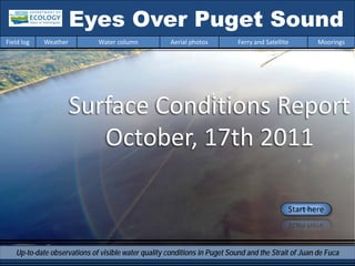
  • 1. Eyes Over Puget Sound Field log Weather Water column Aerial photos Ferry and Satellite Moorings Surface Conditions Report October, 17th 2011 Start here Up-to-date observations of visible water quality conditions in Puget Sound and the Strait of Juan de Fuca
  • 2. Field log Weather Water column Aerial photos Ferry and Satellite Moorings Present Conditions at a Glance Personal flight impression p. 3-4 First fog then skies are clear, Mya Keyzers the pattern shows that fall is here! Laura Friedenberg Weather conditions p. 5 Warm afternoons with colder nights make cooler- than-normal conditions; sunlight stronger in the Skip Albertson north. Aerial photography p. 7-26 Dr. Christopher Brown-red blooms in Carr Inlet and Budd Inlet. Krembs Green bloom near Squaxin Island. Ferry and satellite p. 27-32 Dr. Brandon Temperatures decrease and blooms fade as the Sackmann summer growing season comes to an end. In-situ mooring data p. 32-33 Dissolved oxygen trends still vary David Mora geographically.
  • 3. Personal flight impression Field log Weather Water column Aerial photos Ferry and Satellite Moorings Marine Flight 1 (Coast) October is usually the foggiest month of the year, and we were effected by it the morning of the Coast flight. Patchy fog over the South Sound delayed us, but as soon as our pilot landed in Olympia, we were on our way to the coast. When we arrived there, skies were clear and cloudless, and much to our surprise the temperature was warm. Our first stop was Grays Harbor, where there was a distinct brown river plume that reached far into the Mya collecting samples middle of the harbor. Fog and Clear Skies While we were flying along the coast to Willapa Bay, we watched surfers and beachcombers enjoying the beautiful weather. We also saw patches of brown algae in the surf. In Willapa Bay we saw a few flocks of snow geese flying around. At the end of our flight, we flew past the Capital building for our landing in Budd Inlet. We got an aerial view of people camping out near the capital as part of the Occupy Olympia movement. The flight went quickly and smoothly, and we were happy to be out on such a nice day! Pilot Kevin Thomson, Kenmore Air
  • 4. Personal flight impression Field log Weather Water column Aerial photos Ferry and Satellite Moorings 1 3 1 2 5 River Plume in Grays Harbor 4 Occupy Olympia Movement 2 4 3 Brown Algae on the Coast Tide Line in Grays Harbor Clear Skies and River Plume in Willapa Bay
  • 5. Weather of the last two months 10-17-2011 Field log Weather Water column Aerial photos Ferry and Satellite Moorings Meteorological conditions typically explain up to half of the variance in observed marine variables (Moore et al. 2008), particularly in shallower waters like those of South Puget Sound. I summarized the specific conditions prevalent during the past two weeks, from north to south, below. Summary: Air temperatures during the past few days have been cooler than average, with warm afternoons but colder nights. Light availability has been higher to the north and inland. Coastal and northern rivers have been running lower than normal, except in Central Sound where the Puyallup and Skagit had higher flows last week. Winds have been from predominantly the north, with southerlies last week. Moore et al. 2008. Local and large-scale climate forcing of Puget Sound oceanographic properties on seasonal to interdecadal timescales. Limnol. Oceanogr., 53(5), 1746–1758
  • 6. Water conditions of the previous month Field log Weather Water column Aerial photos Ferry and Satellite Moorings Section is currently in development: We will present CTD measurements from our Marine Flight Program and discuss observations in the temporal context of Ecology’s Long-Term Marine Monitoring data. The focus will rest on anomalies of physical and optical variables throughout the water column.
  • 7. Aerial Photography, Summary 10-17-2011 Field log Weather Water column Aerial photos Ferry and Satellite Moorings Comment: Red-brown blooms in Budd Inlet, Carr Inlet and other South Sound bays. Jelly fish in Budd Inlet (resembles conditions of 10-17-2011) --- Start exploring aerial observations and click here! --- Red-brown bloom and jelly fish, Budd Inlet Mixing and Fronts: Front Dana Passage, clear water surfacing on western side Suspended sediment: Plume No observations Visible blooms: Bloom Brown-red: Budd Inlet, Carr Inlet (north west side) Green: North of Squaxin Island Turquoise : Budd Inlet south end Debris Debris Some filaments in South Sound. Central basin clear Cloud banks affected flight route!
  • 8. Field log Weather Water column Aerial photos Ferry and Satellite Moorings Aerial Photography Image guide 1 15 2 Flight Information: 14 Morning flight: Low clouds, altitude 1000ft, no wind 13 (visibility limited, dark) 11 Evening flight: 10 12 3 Cloud banks affected flight route 4 Visibility limited, altitude 2500ft 9 8 6 Observational maps Central Sound 7 5 Observational maps South Sound
  • 9. 1 Aerial photography Navigate Field log Weather Water column Aerial photos Ferry and Satellite Moorings Urban waterways. Location: Seattle, Fremont and Ballard, 10:09 AM
  • 10. 2 Aerial photography Navigate Field log Weather Water column Aerial photos Ferry and Satellite Moorings Recovery activity around sunken barge. Location: West Seattle, 10:14 AM
  • 11. 3 Aerial photography Navigate Field log Weather Water column Aerial photos Ferry and Satellite Moorings What a magnificent place we live in! Location: Above Carr Inlet (South Sound), 10:31 AM
  • 12. 4 Aerial photography Navigate Field log Weather Water column Aerial photos Ferry and Satellite Moorings Bloom Debris Blooming activity seen between clouds. Location: Henderson Inlet (South Sound), 10:32 AM
  • 13. 5 Aerial photography Navigate Field log Weather Water column Aerial photos Ferry and Satellite Moorings Debris jelly fish Bloom Red-brown bloom. Location: Budd Inlet (South Sound), 4:20 PM
  • 14. 6 Aerial photography Navigate Field log Weather Water column Aerial photos Ferry and Satellite Moorings Bloom Debris Red-brown bloom with abrupt transition and surface debris. Location: Budd Inlet (South Sound), 4:21 PM
  • 15. 7 Aerial photography Navigate Field log Weather Water column Aerial photos Ferry and Satellite Moorings Bloom Debris Red-brown bloom, and surface debris. Location: Budd Inlet (South Sound), 4:21 PM
  • 16. 8 Aerial photography Navigate Field log Weather Water column Aerial photos Ferry and Satellite Moorings Bloom Debris Red-brown bloom, surface debris. Location: Budd Inlet (South Sound), 4:23 PM
  • 17. 9 Aerial photography Navigate Field log Weather Water column Aerial photos Ferry and Satellite Moorings sailboat jelly fish jelly fish jelly fish jelly fish Jellyfish aggregations, see sailboat for scale. Location: Budd Inlet (South Sound), 4:24 PM
  • 18. 10 Aerial photography Navigate Field log Weather Water column Aerial photos Ferry and Satellite Moorings Bloom Debris Surface debris filament. Location: Squaxin Passage (South Sound), 4:30 PM
  • 19. 11 Aerial photography Navigate Field log Weather Water column Aerial photos Ferry and Satellite Moorings Bloom Algae bloom. Location: Next to Squaxin Island (South Sound), 4:30PM
  • 20. 12 Aerial photography Navigate Field log Weather Water column Aerial photos Ferry and Satellite Moorings Clear water surfacing in Dana Passage. Location: Dana Passage, across Henderson Island (South Sound), 4:31 PM
  • 21. 13 Aerial photography Navigate Field log Weather Water column Aerial photos Ferry and Satellite Moorings Bloom Red-Brown bloom. Location: Carr Inlet (South Sound), 4:38 PM
  • 22. 14 Aerial photography Navigate Field log Weather Water column Aerial photos Ferry and Satellite Moorings Debris Bloom Red-Brown bloom. Location: Carr Inlet (South Sound), 4:38 PM
  • 23. 15 Aerial photography Navigate Field log Weather Water column Aerial photos Ferry and Satellite Moorings Clear condition. Location: From Bainbridge Island into Elliott Bay, Seattle (Central Sound), 4:54 PM
  • 24. Field log Weather Water column Aerial photos Ferry and Satellite Moorings Aerial photography observations in Central Sound Navigate Date: 10-17-2011 Morning Evening 1 15 2 Numbers on map refer to picture numbers for spatial reference
  • 25. Field log Weather Water column Aerial photos Ferry and Satellite Moorings Navigate 3 4 Aerial photography Observations in South Sound: 14 10-17-2011 13 11 10 12 9 8 6 Numbers on map refer to picture 7 5 numbers for spatial reference
  • 26. Field log Weather Water column Aerial photos Ferry and Satellite Moorings Legend to map annotations Navigate Comments: Maps are produced by observers during and after flight and intended to give an approximate reconstruction of surface conditions on scales that connect to and overlap with satellite images in the following section.
  • 27. Daily ferry and satellite observations in Central Sound, 10-17-2011 Field log Weather Water column Aerial photos Ferry and Satellite Moorings Contact: brandon.sackmann@ecy.wa.gov 17 Oct 17 Oct Fouling Current Conditions: Minimal surface fluorescence in Central Sound (fouling observed on 17 Oct. AM transect); lowest values in Strait of Juan de Fuca; surface temperatures in Central Sound range from 11.5-12.5 °C and 10-11 °C in Strait of Juan de Fuca. MERIS True Color image used for --- Daily ‘Quick-Look’ Products Available --- spatial context (19 February (http://www.ecy.wa.gov/programs/eap/mar_wat/eops/clipper.html) 2011). Image is not coincident with ferry data shown on right
  • 28. Field log Weather Water column Aerial photos Ferry and Satellite Moorings Temperatures decrease and blooms fade as the summer growing season comes to an end in Puget Sound Late September saw a dramatic transition to much cooler sea surface temperatures and lower fluorescence values throughout Puget Sound.
  • 29. Field log Weather Water column Aerial photos Ferry and Satellite Moorings CDOM fluorescence as an indicator July 24 of freshwater influence in Central Sound A primary source of Colored Dissolved Organic Matter (CDOM) to Puget Sound is from rivers. Recent rainfall and increased river discharge has lead to a highly colored pulse of water seen moving from Whidbey Basin into Central Sound.
  • 30. Field log Weather Water column Aerial photos Ferry and Satellite Moorings Interactive Google KML products now available for Clipper-based products! Google-friendly KML products can now be downloaded from our website: http://www.ecy.wa.gov/progra ms/eap/mar_wat/eops/clipper .html These products complement our standard daily PDF products. To minimize file size the KML point-based data have been binned to a standard Lat/Lon grid.
  • 31. Field log Weather Water column Aerial photos Ferry and Satellite Moorings Estuarine Algal Proxy (EAP) Ecology is exploring a hybrid 18 Oct algal proxy that blends characteristics of both Fluorescence Line Height (FLH) and Maximum Chlorophyll Index (MCI) EAP is calculated as the maximum of MERIS bands 8 (681 nm) and 9 (709 nm) above a linear baseline between bands 7 (665 nm) and 10 (753 nm) EAP captures separate algal blooms in Carr and Budd Inlets. Blooms were visually identified in aerial photos taken on 17 Oct. *** Aerial Photographs of South Sound Blooms ***
  • 32. Mooring observation from 10/4-10/18/2011 Field log Weather Water column Aerial photos Ferry and Satellite Moorings Go to our mooring site at: http://www.ecy.wa.gov/programs/eap/mar_wat/moorings.html 1. Mukilteo, Whidbey Basin near Everett: DO and temperature decreased while salinity increased at depth (14-18 m, NB). Surface salinity and temperature decreased as stratification strengthened. Mean values: NB: DO: 5.9 mg/L (down 0.9 mg/L) Surface: Temp: 12.0°C (down 0.4 °C) Temp: 11.8°C (down 0.8°C) Salinity: 27.6 PSU (down 1.5 PSU) Salinity: 29.8 PSU (up 0.1 PSU) 2. Manchester, Central Sound: DO at depth (11 m, NB) increased while temperature decreased. Near surface temperature decreased. Mean values: NB: DO: 6.1 mg/L (up 0.5 mg/L) Surface: Temp: 12.0°C (down 0.4°C) Temp: 12.0°C (down 0.3°C) Salinity: 29.9 PSU Salinity: 30.0 PSU 3. Squaxin Passage (South Sound) near Olympia: Temperature at depth (5 m) decreased. Mean values: DO: 6.7 mg/L Temp: 13.5°C (down 0.8 °C) Salinity: 29.0 PSU Real-time data online (click)
  • 33. Field log Weather Water column Aerial photos Ferry and Satellite Moorings Water Masses and DO from our Moorings: 10/4-10/18/2011 Units mg DO/L -0.9 per 2 weeks +0.5 variable Left Panel: Probability of finding a specific density over the past two-week period. High probability shown in warm colors. Right Panel: Dissolved oxygen concentration in relation to salinity. High probability shown in warm colors.
  • 34. Field log Weather Water column Aerial photos Ferry and Satellite Moorings Get your data from Ecology’s Environmental Assessment Program Long – Term Real – Time Monitoring Network Sensor Network Ecology’s long-term marine monitoring stations Aerial survey: Ferry and satellite : ftp://www.ecy.wa.gov/eap brandon.sackmann@ecy.w /Flight_Blog/ a.gov Ferry track Morning flight Evening flight Access core Access mooring monitoring data: Freshwater Report: ftp://ecy.wa.gov/eap/Freshwater data: http://www.ecy.wa.gov/a http://www.ecy.wa.gov/pr Report/Ambient_Monitoring- pps/eap/marinewq/mwda ograms/eap/mar_wat/mo Monthly_Summary.html taset.asp orings.html
  • 35. Field log Weather Water column Aerial photos Ferry and Satellite Moorings You may subscribe or unsubscribe to the Eyes Over Puget Sound email listserv by going to this link: http://listserv.wa.gov/cgi-bin/wa?A0=ECOLOGY-EYES-OVER-PUGET-SOUND We are looking for feedback to improve our products. Dr. Christopher Krembs ckre461@ecy.wa.gov Marine Monitoring Unit Environmental Assessment Program WA Department of Ecology Many thanks to our business partners: Clipper Navigation, Swantown Marina and Kenmore Air.