
Recommended
More Related Content
What's hot
What's hot (20)
Viewers also liked
Viewers also liked (20)
Similar to NS2 3.3 Wind and Weather
Similar to NS2 3.3 Wind and Weather (20)
More from Bishop Kenny NJROTC NS1/NS2
More from Bishop Kenny NJROTC NS1/NS2 (20)
Recently uploaded
Recently uploaded (20)
NS2 3.3 Wind and Weather
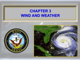
- 1. CHAPTER 3 WIND AND WEATHER
- 2. Air in motion is called wind. Winds blow because they are attempting to achieve a balance in atmospheric pressure caused by the unequal heating of the Earth’s surface.
- 3. Wind Air in natural motion, as that moving horizontally at any velocity along the Earth’s surface
- 4. Winds blow from high-pressure to low-pressure areas.
- 5. The strength of winds depends on the distance of the high from the low and the difference in pressure (gradient) between the two areas.
- 6. Gradient The rate of change with respect to distance of a variable quantity, as temperature or pressure, in the direction of maximum change
- 7. 60° 30° 30° 60° There is a continual flow of wind over the face of the Earth as the result of uneven heating. These winds are called trade winds, prevailing westerlies, and polar easterlies.
- 8. Trade Winds Any of the nearly constant easterly winds that dominate most of the tropics and subtropics throughout the world, blowing mainly from the northeast in the Northern Hemisphere, and from the southeast in the Southern Hemisphere
- 9. Prevailing Westerlies Any semipermanent belt of westerly winds, especially those that prevail at latitudes lying between the tropical and polar regions of the Earth
- 10. Polar Easterlies A polar wind that blows from the east
- 11. What are the winds between 30 and 60 degrees, both north and south latitudes called? a. Doldrums b. Trade winds c. Prevailing easterlies d. Prevailing westerlies
- 12. What are the winds between 30 and 60 degrees, both north and south latitudes called? a. Doldrums b. Trade winds c. Prevailing easterlies d. Prevailing westerlies
- 13. Two motions of the Earth affect the weather: • Movement of the Earth around the Sun • Rotation of the Earth on its axis
- 14. The Earth’s rotation: • Causes night and day, with consequent heating and cooling of the atmosphere • Produces the major wind belts
- 15. If the Earth did not rotate, the warmer air over the equator would rise and move north and south toward the poles, high above the Earth’s surface. The air would cool as it moved toward the poles, cool and move back toward the equator.
- 16. In the Northern Hemisphere winds curve to the right and in the Southern Hemisphere toward the left. This is called the Coriolis Effect.
- 17. Coriolis Effect The apparent deflection of a body in motion with respect to the Earth, as seen by an observer on Earth, attributed to a fictional force but actually caused by the rotation of the Earth and appearing as a deflection to the right in the Northern Hemisphere and a deflection to the left in the Southern Hemisphere
- 18. 23.5° N 23.5° S Air rises at the equator and moves northward at high latitudes. It eventually sinks and accumulates near the surface, forming a high-pressure area at 30 °N and 30 °S latitude, called the Horse Latitudes.
- 19. Horse Latitudes The latitudes, approximately 30 °N and 30 °S, forming the edges of the trade wind sector, characterized by high atmospheric pressure with calm and light variable winds
- 20. Air always flows outward from the center of a high-pressure area; this is called divergence.
- 22. Air always flows in toward the center of a low-pressure area; this is called convergence.
- 23. Convergence A net flow of air into a given region
- 24. When both high-pressure and low- pressure areas are present, air flows from the high-pressure to the low- pressure area, creating wind.
- 25. What causes the direction of the wind to curve to the right in the Northern Hemisphere and to the left in the Southern Hemisphere? a. The Coriolis effect b. The Borealis effect c. The Trade Winds d. The Stasis effect
- 26. What causes the direction of the wind to curve to the right in the Northern Hemisphere and to the left in the Southern Hemisphere? a. The Coriolis effect b. The Borealis effect c. The Trade Winds d. The Stasis effect
- 27. The equatorial belt of light and variable converging winds is called the doldrums.
- 28. Doldrums A belt of calm and baffling winds north of the equator between the northern and southern trade winds in the Atlantic and Pacific oceans
- 29. In the doldrums: • Temperatures are high • Excessive precipitation occurs • Days go by without a breath of wind • Severe tropical storms begin here
- 30. At the surface and on the pole-ward sides of the doldrums are the bands of easterly winds called the trade winds. The northeast trades were a popular route for sailing vessels and aircraft traveling west.
- 31. The subtropical high-pressure belt is called the Horse Latitudes. These areas generally have fair weather and tend to be cloudless and calm, with weak, undependable winds.
- 32. Prevailing westerlies are found on the pole-ward side of the subtropical highs and are created by the diverging winds of these highs. They provide most of the airflow over the U.S.
- 33. 60° 60° The belt of low pressure known as the polar front zone lies in the area of 60 °N and 60 °S latitudes. These areas are known for their bad weather.
- 34. The polar easterlies are zones of poorly developed surface winds created by outflow from the high pressure at the poles.
- 35. In which band of winds do severe tropical storms usually begin? a. Doldrums b. Trade Winds c. Prevailing easterlies d. Prevailing westerlies
- 36. In which band of winds do severe tropical storms usually begin? a. Doldrums b. Trade Winds c. Prevailing easterlies d. Prevailing westerlies
- 37. 0° 23.5° The revolution of the Earth around the Sun and the Earth’s inclination causes the seasons.
- 38. Tropic of Cancer The Earth is inclined at an angle of 23.5° from the perpendicular to the plane of its orbit of revolution, called the plane of the ecliptic. Tropic of Capricorn
- 39. Tropic of Cancer and Tropic of Capricorn One of either two corresponding parallels of latitude on the terrestrial globe, one about 23.5 °N (Cancer) and the other about 23.5 °S (Capricorn) of the equator, being the boundaries of the Torrid Zone
- 40. Ecliptic The great circle formed by the intersection of the plane of the Earth’s orbit with the celestial sphere The apparent annual path of the Sun in the heavens
- 41. Summer Tropic of Cancer Equator Sun’s rays Tropic of Capricorn In the Northern Hemisphere summer, the Sun’s rays are more direct and deliver more energy per unit area.
- 42. Winter Sun’s rays Tropic of Cancer Equator Tropic of Capricorn In the winter, the Sun’s rays are at a greater angle and deliver less energy. The reverse is true in the Southern Hemisphere.
- 43. Seasonal variations are the result of the Earth’s distance from the Sun. a. TRUE b. FALSE
- 44. Seasonal variations are the result of the Earth’s distance from the Sun. a. TRUE b. FALSE
- 45. The topography of the land and the current of the seas affect winds.
- 46. Three-fourths of the Earth’s surface is water, and three-fourths of the land surfaces are in the Northern Hemisphere.
- 47. In summer the land surfaces heat rapidly and the water areas heat more slowly.
- 48. In winter, the land cools rapidly and the water cools slowly.
- 49. The daily variation temperature over open water is seldom more than 2° or 3°, but 300 miles inland, it can vary 15° or more.
- 50. The difference between the land and sea temperatures cause the pressure belts of the of the primary wind circulation to be broken up into enclosed high- and low-pressure areas, called centers of action.
- 51. North-south winds are caused by the unequal heating of the Earth between the equator and the poles. a. TRUE b. FALSE
- 52. North-south winds are caused by the unequal heating of the Earth between the equator and the poles. a. TRUE b. FALSE
- 53. In the Northern Hemisphere, air flows clockwise around high-pressure centers of action (anticyclones). Generally, fair weather prevails.
- 54. Anticyclones A circulation of winds around a central region of high atmospheric pressure, clockwise in the Northern Hemisphere, counter clockwise in the Southern Hemisphere
- 55. Local high-pressure areas develop anyplace where air cools, compresses, and subsides. When a high develops, the clockwise anticyclonic spiral of air develops, and air begins flowing to surrounding lower-pressure areas.
- 56. Major high-pressure areas exist near the North Pole.
- 57. A high-pressure area exists over Greenland all the time because of the vast icecap.
- 58. Subtropical highs can usually be found southwest of California and near the Azores.
- 59. Each winter the North American High, a continental high, creates icy polar fronts.
- 60. The temperate zone’s coldest temperatures have been recorded in Siberia.
- 61. Where does a high-pressure area constantly exist due to a vast icecap? a. Iceland b. Greenland c. Azores d. Baja California
- 62. Where does a high-pressure area constantly exist due to a vast icecap? a. Iceland b. Greenland c. Azores d. Baja California
- 63. Icelandic Low Aleutian Low Equator The only “permanent” low-pressure area on Earth is the Doldrums Belt near the equator.
- 64. The Japanese Current influences the Aleutian Low off Alaska.
- 65. The Gulf Stream influences the Icelandic Low.
- 66. Migratory Low
- 67. Migratory lows move into lower latitudes from the Polar Front. Such storms often occur in the south-central U.S. and near Cape Hatteras, North Carolina.
- 68. Migratory Low A traveling atmospheric low-pressure system
- 69. Local lows often form directly below large thunderhead clouds.
- 70. Heat lows form over deserts. A low-pressure area lasts most of the summer over the Arizona and California deserts.
- 71. Lows sometimes form on the leeward side of mountain ranges such as the Rocky Mountains in Colorado.
- 72. What condition is formed by the interaction of the polar air to the north and the maritime tropical air to the south? a. Chinooks b. Doldrums c. Migratory lows d. Summer Monsoons
- 73. What condition is formed by the interaction of the polar air to the north and the maritime tropical air to the south? a. Chinooks b. Doldrums c. Migratory lows d. Summer Monsoons
- 74. Some mountain winds are so predictable that they have earned their own names.
- 75. Chinook Foehns Santa Anas
- 76. Chinook Winds A warm, dry wind that blows at intervals down the eastern slopes of the Rocky Mountains
- 77. Santa Anas A weather condition in which strong, hot, dust bearing winds descend to the Pacific coast around Los Angeles from inland desert regions
- 78. Foehns A warm, dry wind descending the north side of the Alps
- 79. Famous mountain winds are the Santa Anas of southern California and the Chinooks of the _________. a. Rockies b. Swiss Alps c. Himalayas d. Adirondacks
- 80. Famous mountain winds are the Santa Anas of southern California and the Chinooks of the _________. a. Rockies b. Swiss Alps c. Himalayas d. Adirondacks
- 81. The most famous valley wind system is the Mistral of southern France that sometimes reaches 60 miles per hour and affects U.S. Sixth Fleet operations.
- 82. Mistral A cold, dry, northerly wind common in southern France and neighboring regions
- 83. Which U.S. fleet must always be on alert for the Mistral when operating in its usual operations area of the western Mediterranean? a. Second b. Third c. Fifth d. Sixth
- 84. Which U.S. fleet must always be on alert for the Mistral when operating in its usual operations area of the western Mediterranean? a. Second b. Third c. Fifth d. Sixth
- 85. Monsoons are seasonal winds characteristic of South and Southeast Asia.
- 86. Monsoons Seasonal winds of the Indian Ocean and southern Asia, blowing from the southwest in summer and from the northeast in winter
- 87. The Summer Monsoon season begins to build when Asia begins to heat up and the water area over the Indian Ocean remains relatively cool. Cherrapunji Bay of Bengal Indian Ocean
- 88. From mid-May until late September, it is not unusual for the Burmese Coast to get 200 inches of rain.
- 89. During the same time, the Himalayan foothills may get 500 inches of rain.
- 90. The greatest rainfall ever recorded was at Cherrapunji, India, during the monsoon with 1,041.78 inches.
- 91. Squalls and typhoons occur over the Bay of Bengal during the summer monsoon.
- 92. Siberia Indian Ocean As the cold season approaches, the continental high over Siberia regenerates and blows from the northeast. The rains cease and a warm, low-pressure area now exists over the Indian Ocean.
- 93. During the winter monsoon there is little rain. Dust in Burma around Mandalay is often 4 - 6 inches thick.
- 94. During winter monsoons, there is little rain. a. TRUE b. FALSE
- 95. During winter monsoons, there is little rain. a. TRUE b. FALSE
- 96. Wind speed is always given in knots.
- 97. Knot A unit of speed equal to one nautical mile or about 1.15 statute miles per hour
- 98. Conversion of Knots To Miles Per Hour (MPH) Knots X 1.15 = MPH Example: 50 knots X 1.15 = 57.5 MPH
- 99. Anemometers are any instrument used to measure wind speed.
- 100. Vane The vane atop the anemometer aligns itself with the direction of the wind.
- 101. Vane A device, as a rod to which a freely rotating pointer is attached, for indicating the direction of the wind
- 102. Sir Francis Beaufort developed the Beaufort Wind Scale to estimate wind speeds from their effect on sails. Sir Francis Beaufort
- 103. Beaufort Wind Scale A scale of wind forces, described by name and range of velocity and classified as from force 0 to force 12
- 104. 0 Calm 1 Light Air Or just sufficient to give steerage way. 2 Light Breeze 1 to 2 knots Or that in which a man-of-war with 3 Gentle Breeze all sail set, and clean full would go 3 to 4 knots 4 Moderate Breeze in smooth water from. 5 to 6 knots 5 Fresh Breeze Royals, etc. Single-reefed topsails and 6 Strong Breeze Or that to which a well-conditioned Top-gal sail 7 Moderate Gale man-of-war could just carry in chase, Double-reefed topsails, etc. full and by. 8 Fresh Gale Treble-reefed topsails, etc. 9 Strong Gale Closed-reefed topsails and courses. 10 Whole Gale 11 Storm Or that which would reduce her storm staysails. 12 Hurricane Or that which no canvas could withstand. Beaufort Wind Scale
- 105. Beaufort’s scale was compared to the Correlative Sea Disturbance Scale, which describes sea state and mean height of waves on a scale of 0 - 9 to determine sea conditions.
- 106. Correlative Sea Disturbance Scale
- 107. By convention, wind direction is specified according to the compass direction or geographic point of origin from which the wind blows.
- 108. What instrument is used to measure wind speed? a. Anemometer b. Hydrometer c. Hygrometer d. Metrometer
- 109. What instrument is used to measure wind speed? a. Anemometer b. Hydrometer c. Hygrometer d. Metrometer
- 110. The Correlative Sea Disturbance Scale measures sea state and wave ________. a. color b. height c. density d. salinity
- 111. The Correlative Sea Disturbance Scale measures sea state and wave ________. a. color b. height c. density d. salinity
- 112. Q.1. What is “air in motion?”
- 113. Q.1. What is “air in motion?” A.1. Wind
- 114. Q.2. What causes the winds to blow?
- 115. Q.2. What causes the winds to blow? A.2. Winds blow because they are attempting to achieve a balance in atmospheric pressure.
- 116. Q.3. What causes unequal distribution of atmospheric pressure?
- 117. Q.3. What causes unequal distribution of atmospheric pressure? A.3. Unequal solar heating of the Earth
- 118. Q.4. What is the strength of wind dependent upon?
- 119. Q.4. What is the strength of wind dependent upon? A.4. The distance of the high from the low and the difference in pressure (the gradient) between the two areas
- 120. Q.5. What name is given to a band of easterly winds that extends from the equator to 30°, both north and south?
- 121. Q.5. What name is given to a band of easterly winds that extends from the equator to 30°, both north and south? A.5. Trade winds
- 122. Q.6. What is probably the most famous valley wind system?
- 123. Q.6. What is probably the most famous valley wind system? A.6. Mistral of southern France
- 124. Q.7. An apparent force that deflects moving air currents as a result of the Earth's rotation is referred to as what?
- 125. Q.7. An apparent force that deflects moving air currents as a result of the Earth's rotation is referred to as what? A.7. Coriolis effect
- 126. Q.8. In what direction is wind flow deflected in the Northern Hemisphere?
- 127. Q.8. In what direction is wind flow deflected in the Northern Hemisphere? A.8. To the right
- 128. Q.9. Which pressure system is created by subsiding (sinking) air?
- 129. Q.9. Which pressure system is created by subsiding (sinking) air? A.9. High pressure
- 130. Q.10. The equatorial belt of light and variable converging winds is called what?
- 131. Q.10. The equatorial belt of light and variable converging winds is called what? A.10. Doldrums
- 132. Q.11. Where are the doldrums areas located on Earth?
- 133. Q.11. Where are the doldrums areas located on Earth? A.11. In ocean areas near the equator
- 134. Q.12. In what direction is wind flow deflected in the Southern Hemisphere?
- 135. Q.12. In what direction is wind flow deflected in the Southern Hemisphere? A.12. To the left
- 136. Q.13. What is the name of a low- pressure cell associated with the polar front and influenced by the Japanese current?
- 137. Q.13. What is the name of a low- pressure cell associated with the polar front and influenced by the Japanese current? A.13. Aleutian low off Alaska
- 138. Q.14. What effect does the Earth's revolution and inclination have on the weather?
- 139. Q.14. What effect does the Earth's revolution and inclination have on the weather? A.14. It causes seasonal changes.
- 140. Q.15. Where is the polar frontal zone located?
- 141. Q.15. Where is the polar frontal zone located? A.15. At about 60° north and south latitudes
- 142. Q.16. How are land masses distributed between the Northern and Southern Hemispheres?
- 143. Q.16. How are land masses distributed between the Northern and Southern Hemispheres? A.16. Approximately 75% in the Northern Hemisphere and approximately 25% in the Southern Hemisphere
- 144. Q.17. Where is the only “permanent” low-pressure area?
- 145. Q.17. Where is the only “permanent” low-pressure area? A.17. Doldrum belt
- 146. Q.18. High- and low-pressure areas are also known as what?
- 147. Q.18. High- and low-pressure areas are also known as what? A.18. Centers of action
- 148. Q.19. What is the direction of wind flow around a high-pressure center?
- 149. Q.19. What is the direction of wind flow around a high-pressure center? A.19. Clockwise
- 150. Q.20. What highs are found southwest of California and near the Azores in the Atlantic?
- 151. Q.20. What highs are found southwest of California and near the Azores in the Atlantic? A.20. Subtropical
- 152. Q.21. What are three mountain winds?
- 153. Q.21. What are three mountain winds? A.21. The Chinook Winds of the Rockies, the Santa Anas of southern California, and the foehns of the Swiss and French Alps
- 154. Q.22. According to international agreement, how is wind speed given?
- 155. Q.22. According to international agreement, how is wind speed given? A.22. In knots
- 156. Q.23. What is the Beaufort Scale?
- 157. Q.23. What is the Beaufort Scale? A.23. A scale developed by Sir Francis Beaufort of the British Royal Navy to estimate wind speeds
- 158. Q.24. What is an instrument used to measure wind speed aboard ship?
- 159. Q.24. What is an instrument used to measure wind speed aboard ship? A.24. Anemometer