Paper Climate Adaptation In The IJsseldelta
•
1 like•276 views

Published at World Water Forum 2009 (Istanbul)

Recommended
Recommended
More Related Content
Featured
Featured (20)
Paper Climate Adaptation In The IJsseldelta
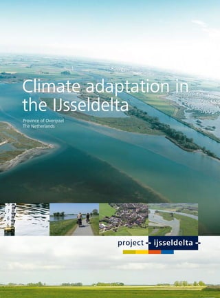
- 1. Climate adaptation in the IJsseldelta Province of Overijssel The Netherlands
- 2. Climate change in the IJsseldelta The river IJssel in the Netherlands is a major branch of the river Rhine, the 3rd largest river of Europe. It discharges its flows to the Lake IJsselmeer, which was a former sea (Zuiderzee) that was closed off in 1932 by a big dam (Afsluitdijk). The IJsseldelta is a low-lying area that is threatened by floods from both the river IJssel and from the Lake IJsselmeer (figure 1). IJsseldelta Figure 1: IJsseldelta in a transboundary perspective of the river Figure 2: Extreme high water in the IJsseldelta in 2015 (red graph) and effect of Rhine in Europe. the bypass on the water level (blue graph). Although the delta and its major cities Zwolle and Kampen up to 40 cm in 2015 (figure 2) and up to 1 m in the long term are protected from flooding by dikes, the safety standards (2050-2100). Further knowledge about the effects of climate can’t be guaranteed in the near future because of the effects change is generated within the national research programme of climate change. Predictions of climate models indicate that ‘Knowledge for Climate’, in which IJsseldelta is participating. the extreme high water levels of the river IJssel will rise with
- 3. Spatial challenges Several major spatial developments are planned in the IJsseldelta the IJsseldelta area, with a strong focus on climate adaptation. in the coming decades. The municipality of Kampen has planned The challenge was to combine and integrate several spatial some 4000 houses, a new railway line (the Hanzelijn) is being developments (housing, infrastructure, leisure, nature, constructed at the moment and two highways (N50 and N23) agriculture), together with the construction of a so-called will be reconstructed in the area. Furthermore, a river bypass is bypass of the river IJssel (figure 3). foreseen as one of the international measures to increase safety against flooding along the river Rhine system. All these separate, potentially conflicting spatial developments are coordinated in Project IJsseldelta. In 2005 the Province of Overijssel initiated the process of drawing a sustainable development plan for Figure 3: The spatial challenge of Project IJsseldelta: - to combine and integrate developments together with the river bypass in the southwest (the arrows on the map); - to prevent large scale developments in the northeast of the delta, which will also preserve the resilience of this area to adapt to climate change in the future (the green area on the map). Room for the River The bypass is one of the international measures along the river the bypass some 350 hectares will be added to the floodplains Rhine system to increase safety against flooding. Instead of of the delta of the river IJssel. This means a break with the building higher and stronger dikes a new strategy has been past, because for centuries space has been taken from the chosen: to add space to the floodplains of the rivers. This river. For example, in 1850 the floodplains of the big rivers in strategy - a small revolution and a real ‘paradigm shift’ in water the Netherlands had about 3 times more space compared with management - is being adopted within the Dutch programme the situation at the moment. The effect of the restoration of ‘Room for the River’. Instead of a foe, water is becoming the floodplains in the IJsseldelta is that the water levels of the more and more a friend for the planners and water managers river IJssel will decrease substantially during situations of high nowadays. Project IJsseldelta is a good exponent of this new river discharges. This contributes to the safety and resilience philosophy in water management. With the construction of of the area.
- 4. Sustainable development planning Although the Province of Overijssel plays a major role in the project as a director of the planning process, it is very much dependent upon others. As a matter of fact, the plan for the IJsseldelta is made in close cooperation with the stakeholders such as the municipalities, neighbour provinces, the water boards and many non-governmental organizations in the region. The municipality of Kampen, water board Groot Salland and the Province of Flevoland are the most important partners in the region. But the national Government has an decisive position in the project too. The national ministries involved are the Ministry of Figure 4: Broad and intense public participation during the phase of the Masterplan. The participation process started with 5 Housing, Spatial Planning and the Environment, the different, initial scenarios for the future of IJsseldelta. During the Ministry of Agriculture, Nature and Food Quality and process a 6th scenario, developed by the public, was added. This the Ministry of Transport, Public Works and Water scenario became an essential building block for the Masterplan. Management. And last but not least, the public is mobilized to participate (figure 4). The collaborative approach as applied in Project IJsseldelta has proven to be a successful recipe for sustainable development planning. The Ministry of Housing, Spatial Planning and the Environment awarded Project IJsseldelta as a “best practice”. The project has received a lot of attention in the media and many members of the national parliament and government have already visited the delta, including Prime Minister Balkenende. In spring 2006 the Prince of the Netherlands, who has a special interest in water management, came to see the area (figure 5). Figure 5: Visit of Prince Willem Alexander to the IJsseldelta. Figure 6: Map of the IJsseldelta in 1724, with the path of the bypass.
- 5. The Overijssel approach: spatial integration and public participation In 2007 a gentlemen’s agreement was signed by In 2006 the Masterplan IJsseldelta came out. Within the 11 governmental organizations, with the intention to Masterplan the 6 spatial challenges in the area (housing, work together to implement the Masterplan. Another infrastructure, leisure, nature, agriculture and river bypass) 11 non-governmental organizations supported the plan. are combined and integrated. One could say, that the result Recently, the spatial plans of the Provinces of Overijssel and has become more than the sum of its parts. The Masterplan is Flevoland have been reviewed. A strategic environmental broadly supported by the public, because it is based upon a (impact) assessment (SEA) was part of this review. Within draft of the bypass (the 6th scenario, see figure 4) that was this SEA several alternatives for the Masterplan were studied. made by the public (mostly farmers, assisted by planners and Also a so-called most environmentally friendly alternative. professionals). A vital element in the process of gaining public The decision making process has led to several modifications support for the plan were the face-to-face meetings with the of the Masterplan. The current plan resembles in almost every people at ‘the kitchen table’. Worth mentioning is that the aspect the most environmentally friendly alternative of the SEA. bypass follows the alignment of an old sea arm that still can The figure below gives an impression of the current plan be seen on an historical map of the IJsseldelta area of 1724 (figure 7). (figure 6). outlet water reed water-oriented houses fairway crossovers lift-lock intake & marshes with bypass tunnel marshes new train ecological new railway station corridor Figure 7: Bird’s eye perspective of the plan IJsseldelta (autumn 2008).
- 6. Water as a motor for nature development A central issue in the plan-making process is how to coop with the dynamics of the water. On the one hand there is the desire to regulate the water level and fluctuations of the water level in the bypass as much as possible. The reason to do this is the wish to prevent the effects of water seepage in the vicinity of the bypass. On the other hand there is the desire to utilize the dynamics of the water as a ‘motor’ for nature development. Frequent inundations - caused by high water in the river as well as by situations of storm in Lake IJsselmeer - are an important mechanism for the creation of special habitats (e.g. water reed, marshes and flats) that are characteristic for river deltas. Figure 8 shows how storm situations in Lake IJsselmeer can penetrate in the bypass. Current level (-70 cm) Water level Lake IJsselmeer (-20 cm) 10 x a year (+ 20 cm) 3 x a year (+ 40 cm) 1 x a year (+ 60 cm) 1 x in 2 years (+ 80 cm) Figure 8: Inundations of the bypass caused by storm on Lake IJsselmeer. An interesting frame of reference for Project IJsseldelta is Lake Peipsi at the border of Estonia and Russia (figure 9). Especially as an example for nature development and water dynamics. Lake Peipsi has a lot in common with Lake IJsselmeer, but one of the main differences is, is that the first is more natural and the latter more artificial. As ‘twin lakes’ they can learn a lot from each other and for the Ministry of Transport, Public Works and Water Management this has been the reason for a joint cooperation between Dutch, Estonian and Russian specialists. Figure 9: Lake Peipsi as a frame of reference for Project IJsseldelta. The visibility of frequent inundations and variable water levels is also of importance for keeping and raising the awareness of the public for such an elusive matter as climate change. This issue of awareness raising is addressed in the Dutch knowledge impuls programme ‘Living with Water’, in which (international) project consortia collaborate on achieving changes in water management.
- 7. Implementation Consequences of the advice of the Delta Committee The review of the - above mentioned - provincial plans is a next In 2007 the Government of the Netherlands requested an step towards the implementation of the plan. Financing the independent Committee of State (the Delta Committee) to project (which will cost about €325 million in total) is another give its advice on climate change and flood protection in important aspect that needs to be arranged in the beginning the Netherlands for the next century. The Delta Committee of 2009. Already €30 million has been invested, as a part of presented her advice in September 2008. The Committee has these total costs, to finance the necessary adaptations of the made twelve recommendations in order to increase the level infrastructure. A new railway is already under construction; of flood protection and to safeguard the fresh water supply. Two of them are of major importance for the IJsseldelta. The first one underlines the necessity to implement the long term ‘Room for the River’ measures - such as the river bypass - as soon as possible. The second one is to increase the level of the Lake IJsselmeer with a maximum of 1.5 m in the long term. This recommendation will also affect the IJsseldelta and - as a consequence - additional measures might be necessary. Possibly, a combination of a river bypass with the enlargement of the summer bed is already necessary in 2015 or shortly after. The combination of the two measures can even be an advantage, because in that case the sediment of the river IJssel can be used to construct the dikes of the river bypass or the embankment that is needed for housing development. Figure 10: Impression of housing development on a (climate proof) dike (source: Municipality of Kampen). One of the most recent ideas is to develop a climate proof dike the bypass will cross this railway two times. Furthermore, the - a kind of super dike along the river bypass - that at the same Province of Overijssel has funded €20 million for anticipatory time can act as an embankment for housing development. purchases of land and real estate (on a voluntary basis) in the Figure 10 gives an impression of how housing development bypass area. on a (climate proof) dike might look like. At this moment the environmental impact assessment (EIA) is being made for the review of the local land use plan and the ‘dike displacement plan’. One of the challenges for coming period will be to find ways to prevent, mitigate or compensate Information the effects of water seepage. The final step, after the finish of the formal plan procedures, will be the application for licenses For further information about and permits. When everything goes according to plan and Project IJsseldelta visit our website: without delay, the construction of the dikes, sluices, bridges, www.ijsseldelta.info dams and a storm-surge barrier will start in 2011. This tight time schedule is a necessity because the bypass needs to be Or contact: operational in 2015. In case the river bypass won’t or can’t Arjan Otten be implemented in 2015, a cheaper, less complex - but also Province of Overijssel less sustainable - short term alternative will be carried out to PO Box 10078 protect the IJsseldelta against flooding: the enlargement of the 8000 GB Zwolle summer bed of the river IJssel (over a length of 22 kilometers, the Netherlands with an average depth of 1.5 meter). tel. +31 (0)38 499 81 08 e-mail: a.otten@overijssel.nl
- 8. www.ijsseldelta.info The photo of the Great White Egret is taken in the IJsseldelta (by Ed van Zoonen) Public partners of project IJsseldelta Main consultants Province of Overijssel Province of Flevoland Municipality of Kampen DHV Consultancy and Engineering Municipality of Dronten Municipality of Oldebroek Municipality of Zwolle H+N+S Landscape Architects Waterboard Groot Salland Waterboard Zuiderzeeland Staatsbosbeheer Ministry of Transport, Public Ministry of Housing, Spatial Ministry of Agriculture, Works and Water Management Planning and the Environment Nature and Food Quality