SlideShare ist ein Scribd-Unternehmen logo
1 von 25
Cartographers   affect how we perceive  our  world
Representing the earth A geographical map is a two-dimensional, geometrically accurate representation of a three-dimensional  space. Inevitably,  however,  distortion is  introduced when  a globe is made  to lay  flat. This teacher uses a physical map of Europe to explain his point.
Ancient  map Claudius  Ptolemy   (150 AD)   map  drawn from Ptolemy's coordinates for a 1482 edition of his  Geographia
Types of map projections ,[object Object],[object Object],[object Object],[object Object],[object Object],Each introduces some error inherent when three-dimensional sphere is flattened into two dimensions.
The earth is round. The challenge of any world map is to represent a round earth on a flat surface.   Which projection?
Map Projections
Cylindrical Projection:  is based on a cylinder tangent to the equator. Good for  equatorial regions  but greatly distorted at  high latitudes .
Though the  Mercator projection  is particularly good for navigation, it becomes increasingly distorted toward the poles, resulting in areas appearing much larger than they actually are. Mercator projection
 
The  distortion  caused by a Mercator projection  makes Greenland appear larger than Australia when, in fact, it’s one-third its size.
The  Eckert projection  tries to keep the  countries in relative proportion but still  flattens out near the poles.
The  Peters projection  is an area-accurate map
The Robinson projection The  Robinson projection  is based on tables   of coordinates. The projection distorts shape, area, scale, and distance in an attempt to balance the errors of projection properties.
 
Polar This projection is used by pilots to determine the shortest route between two points on the globe.
Upside down?   Depends on our pre-conceptions
Differences between map projections
 
Map Symbols Legend Compass Rose These keys should be included on any map to which they apply Strait Isthmus Scale
Landsat ,[object Object]
Global Positioning Systems (GPS) ,[object Object]
“ Like a huge piece of orange peel that refuses to be flattened without tearing at the edges, the globe cannot be forced into two dimensions without distortion. But that distortion can now be minimised  “ Atlas technology
Geographic Information Systems (GIS) ,[object Object]
Links ,[object Object],[object Object]
Links

Weitere ähnliche Inhalte

Was ist angesagt?

Was ist angesagt? (20)

Map Projections ―concepts, classes and usage
Map Projections ―concepts, classes and usage Map Projections ―concepts, classes and usage
Map Projections ―concepts, classes and usage
 
Types of maps
Types of mapsTypes of maps
Types of maps
 
The geographer’s tools
The geographer’s toolsThe geographer’s tools
The geographer’s tools
 
Types of Map Scales
Types of Map ScalesTypes of Map Scales
Types of Map Scales
 
Scale - Geography Skill
Scale - Geography SkillScale - Geography Skill
Scale - Geography Skill
 
Types of maps
Types of maps Types of maps
Types of maps
 
Map Projections
Map ProjectionsMap Projections
Map Projections
 
Map projections
Map projectionsMap projections
Map projections
 
Introduction to Maps
Introduction to MapsIntroduction to Maps
Introduction to Maps
 
Geographic coordinate system & map projection
Geographic coordinate system & map projectionGeographic coordinate system & map projection
Geographic coordinate system & map projection
 
Projections and coordinate system
Projections and coordinate systemProjections and coordinate system
Projections and coordinate system
 
Map reading
Map readingMap reading
Map reading
 
Cartography lec #4
Cartography lec #4Cartography lec #4
Cartography lec #4
 
Computer application in geography
Computer application in geographyComputer application in geography
Computer application in geography
 
Gis georeference
Gis georeferenceGis georeference
Gis georeference
 
Cartography intro
Cartography introCartography intro
Cartography intro
 
History of cartography
History of cartographyHistory of cartography
History of cartography
 
Map Projection
Map ProjectionMap Projection
Map Projection
 
Types of maps
Types of mapsTypes of maps
Types of maps
 
Map Parts
Map PartsMap Parts
Map Parts
 

Andere mochten auch

Geo Skills 1 -Map Types
Geo Skills 1 -Map TypesGeo Skills 1 -Map Types
Geo Skills 1 -Map TypesTriciaMowat
 
Different Types of Maps
Different Types of MapsDifferent Types of Maps
Different Types of Mapscpbrown10
 
Latitude and longitude powerpoint
Latitude and longitude  powerpointLatitude and longitude  powerpoint
Latitude and longitude powerpointHeatherP
 
Map Essentials (TODALSIGS)
Map Essentials (TODALSIGS)Map Essentials (TODALSIGS)
Map Essentials (TODALSIGS)jbartley
 
Concrete (slump test)
Concrete (slump test)Concrete (slump test)
Concrete (slump test)Geo Dimaks
 
The movements of the Earth
The movements of the Earth  The movements of the Earth
The movements of the Earth Mariadebiologia
 
Geography: Different Kinds Of Maps
Geography: Different Kinds Of MapsGeography: Different Kinds Of Maps
Geography: Different Kinds Of MapsDan Klumper
 
Internal structure of the earth
Internal structure of the earthInternal structure of the earth
Internal structure of the earthSayed Burhan Atal
 
4 m's of production
4 m's of production 4 m's of production
4 m's of production Robert Counts
 
Lines of Latitude and Longitude – PowerPoint
Lines of Latitude and Longitude – PowerPointLines of Latitude and Longitude – PowerPoint
Lines of Latitude and Longitude – PowerPointYaryalitsa
 
Assessment of the musclo skletal system
Assessment of the musclo skletal systemAssessment of the musclo skletal system
Assessment of the musclo skletal systemMohamed Mansor
 
Geographic information system
Geographic information systemGeographic information system
Geographic information systemSumanta Das
 
GIS presentation
GIS presentationGIS presentation
GIS presentationarniontech
 
Conjunctions powerpoint
Conjunctions powerpointConjunctions powerpoint
Conjunctions powerpointBeth Neitz
 
Lost in Cultural Translation
Lost in Cultural TranslationLost in Cultural Translation
Lost in Cultural TranslationVanessa Vela
 
The Business of Social Media
The Business of Social Media The Business of Social Media
The Business of Social Media Dave Kerpen
 
10 Steps of Project Management in Digital Agencies
10 Steps of Project Management in Digital Agencies 10 Steps of Project Management in Digital Agencies
10 Steps of Project Management in Digital Agencies Alemsah Ozturk
 

Andere mochten auch (20)

Geo Skills 1 -Map Types
Geo Skills 1 -Map TypesGeo Skills 1 -Map Types
Geo Skills 1 -Map Types
 
Different Types of Maps
Different Types of MapsDifferent Types of Maps
Different Types of Maps
 
Latitude and longitude powerpoint
Latitude and longitude  powerpointLatitude and longitude  powerpoint
Latitude and longitude powerpoint
 
Map Essentials (TODALSIGS)
Map Essentials (TODALSIGS)Map Essentials (TODALSIGS)
Map Essentials (TODALSIGS)
 
Time zones Introduction
Time zones Introduction Time zones Introduction
Time zones Introduction
 
Concrete (slump test)
Concrete (slump test)Concrete (slump test)
Concrete (slump test)
 
The movements of the Earth
The movements of the Earth  The movements of the Earth
The movements of the Earth
 
Geography: Different Kinds Of Maps
Geography: Different Kinds Of MapsGeography: Different Kinds Of Maps
Geography: Different Kinds Of Maps
 
Map Elements
Map ElementsMap Elements
Map Elements
 
Internal structure of the earth
Internal structure of the earthInternal structure of the earth
Internal structure of the earth
 
4 m's of production
4 m's of production 4 m's of production
4 m's of production
 
Lines of Latitude and Longitude – PowerPoint
Lines of Latitude and Longitude – PowerPointLines of Latitude and Longitude – PowerPoint
Lines of Latitude and Longitude – PowerPoint
 
Assessment of the musclo skletal system
Assessment of the musclo skletal systemAssessment of the musclo skletal system
Assessment of the musclo skletal system
 
Geographic information system
Geographic information systemGeographic information system
Geographic information system
 
GIS presentation
GIS presentationGIS presentation
GIS presentation
 
Conjunctions powerpoint
Conjunctions powerpointConjunctions powerpoint
Conjunctions powerpoint
 
Lost in Cultural Translation
Lost in Cultural TranslationLost in Cultural Translation
Lost in Cultural Translation
 
The Business of Social Media
The Business of Social Media The Business of Social Media
The Business of Social Media
 
Flyer
FlyerFlyer
Flyer
 
10 Steps of Project Management in Digital Agencies
10 Steps of Project Management in Digital Agencies 10 Steps of Project Management in Digital Agencies
10 Steps of Project Management in Digital Agencies
 

Ähnlich wie Maps Ppt

Maps as Models of Earth
Maps as Models of EarthMaps as Models of Earth
Maps as Models of Earthmlong24
 
Maps as Models of Earth
Maps as Models of EarthMaps as Models of Earth
Maps as Models of Earthmlong24
 
Chapter 6 3
Chapter 6 3Chapter 6 3
Chapter 6 3llaub
 
Geography skills handbook1
Geography skills handbook1Geography skills handbook1
Geography skills handbook1kjanchild
 
PROJECTIONS & COORDINATE SYSTEMS-1.pptx
PROJECTIONS & COORDINATE SYSTEMS-1.pptxPROJECTIONS & COORDINATE SYSTEMS-1.pptx
PROJECTIONS & COORDINATE SYSTEMS-1.pptxSaitarunKuna
 
Cartography Unit_ 3.pptx
Cartography Unit_ 3.pptxCartography Unit_ 3.pptx
Cartography Unit_ 3.pptxwarkisafile1
 
Maps And Globes Are Models Of The Earth
Maps And Globes Are Models Of The EarthMaps And Globes Are Models Of The Earth
Maps And Globes Are Models Of The Earthmrmartella
 
Ch. 1.2--Geographer's Tools
Ch. 1.2--Geographer's ToolsCh. 1.2--Geographer's Tools
Ch. 1.2--Geographer's ToolsJohn Hext
 
Chapter 6 Section 3 (maps)
Chapter 6 Section 3 (maps)Chapter 6 Section 3 (maps)
Chapter 6 Section 3 (maps)Mr. Motuk
 
(Research Project) Satellites : Applications in Topography
(Research Project) Satellites : Applications in Topography (Research Project) Satellites : Applications in Topography
(Research Project) Satellites : Applications in Topography Ahmed Nassar
 

Ähnlich wie Maps Ppt (20)

Maps as Models of Earth
Maps as Models of EarthMaps as Models of Earth
Maps as Models of Earth
 
Maps as Models of Earth
Maps as Models of EarthMaps as Models of Earth
Maps as Models of Earth
 
Chapter 6 3
Chapter 6 3Chapter 6 3
Chapter 6 3
 
Geography skills handbook1
Geography skills handbook1Geography skills handbook1
Geography skills handbook1
 
Unit 1 wiki
Unit 1 wikiUnit 1 wiki
Unit 1 wiki
 
PROJECTIONS & COORDINATE SYSTEMS-1.pptx
PROJECTIONS & COORDINATE SYSTEMS-1.pptxPROJECTIONS & COORDINATE SYSTEMS-1.pptx
PROJECTIONS & COORDINATE SYSTEMS-1.pptx
 
Projection
ProjectionProjection
Projection
 
Chapter two
Chapter twoChapter two
Chapter two
 
datum
datumdatum
datum
 
Chapter 2:3 Maps
Chapter 2:3 MapsChapter 2:3 Maps
Chapter 2:3 Maps
 
Cartography Unit_ 3.pptx
Cartography Unit_ 3.pptxCartography Unit_ 3.pptx
Cartography Unit_ 3.pptx
 
Unit1 160131210057
Unit1 160131210057Unit1 160131210057
Unit1 160131210057
 
Exploring geography
Exploring geographyExploring geography
Exploring geography
 
Maps And Globes Are Models Of The Earth
Maps And Globes Are Models Of The EarthMaps And Globes Are Models Of The Earth
Maps And Globes Are Models Of The Earth
 
Ch. 1.2--Geographer's Tools
Ch. 1.2--Geographer's ToolsCh. 1.2--Geographer's Tools
Ch. 1.2--Geographer's Tools
 
Chapter 6 Section 3 (maps)
Chapter 6 Section 3 (maps)Chapter 6 Section 3 (maps)
Chapter 6 Section 3 (maps)
 
Introduction to geography
Introduction to geographyIntroduction to geography
Introduction to geography
 
Map & globes
Map & globesMap & globes
Map & globes
 
Geography Handbook
Geography HandbookGeography Handbook
Geography Handbook
 
(Research Project) Satellites : Applications in Topography
(Research Project) Satellites : Applications in Topography (Research Project) Satellites : Applications in Topography
(Research Project) Satellites : Applications in Topography
 

Mehr von Donald Johnson (20)

Andes mts
Andes mtsAndes mts
Andes mts
 
Andes mts
Andes mtsAndes mts
Andes mts
 
Sweden Template T 3
Sweden Template T 3Sweden Template T 3
Sweden Template T 3
 
The Industrial Revolution
The Industrial RevolutionThe Industrial Revolution
The Industrial Revolution
 
Slovakia Template T 2
Slovakia Template T 2Slovakia Template T 2
Slovakia Template T 2
 
Italy Template T 2
Italy Template T 2Italy Template T 2
Italy Template T 2
 
Culture
CultureCulture
Culture
 
Biomes
BiomesBiomes
Biomes
 
Hurricane Ike
Hurricane IkeHurricane Ike
Hurricane Ike
 
Four Seasons
Four SeasonsFour Seasons
Four Seasons
 
Hurricanes2
Hurricanes2Hurricanes2
Hurricanes2
 
Great Wall
Great WallGreat Wall
Great Wall
 
Hills And Mountains
Hills And MountainsHills And Mountains
Hills And Mountains
 
Africa South Sahara
Africa South SaharaAfrica South Sahara
Africa South Sahara
 
Classical Rome2
Classical Rome2Classical Rome2
Classical Rome2
 
Iranian Culture
Iranian CultureIranian Culture
Iranian Culture
 
East Africa Chap19 B
East Africa Chap19 BEast Africa Chap19 B
East Africa Chap19 B
 
Ra Expedition
Ra ExpeditionRa Expedition
Ra Expedition
 
South America2
South America2South America2
South America2
 
Brazil
BrazilBrazil
Brazil
 

Kürzlich hochgeladen

UGC NET Paper 1 Mathematical Reasoning & Aptitude.pdf
UGC NET Paper 1 Mathematical Reasoning & Aptitude.pdfUGC NET Paper 1 Mathematical Reasoning & Aptitude.pdf
UGC NET Paper 1 Mathematical Reasoning & Aptitude.pdfNirmal Dwivedi
 
microwave assisted reaction. General introduction
microwave assisted reaction. General introductionmicrowave assisted reaction. General introduction
microwave assisted reaction. General introductionMaksud Ahmed
 
Spellings Wk 3 English CAPS CARES Please Practise
Spellings Wk 3 English CAPS CARES Please PractiseSpellings Wk 3 English CAPS CARES Please Practise
Spellings Wk 3 English CAPS CARES Please PractiseAnaAcapella
 
The basics of sentences session 3pptx.pptx
The basics of sentences session 3pptx.pptxThe basics of sentences session 3pptx.pptx
The basics of sentences session 3pptx.pptxheathfieldcps1
 
How to Give a Domain for a Field in Odoo 17
How to Give a Domain for a Field in Odoo 17How to Give a Domain for a Field in Odoo 17
How to Give a Domain for a Field in Odoo 17Celine George
 
Dyslexia AI Workshop for Slideshare.pptx
Dyslexia AI Workshop for Slideshare.pptxDyslexia AI Workshop for Slideshare.pptx
Dyslexia AI Workshop for Slideshare.pptxcallscotland1987
 
General Principles of Intellectual Property: Concepts of Intellectual Proper...
General Principles of Intellectual Property: Concepts of Intellectual  Proper...General Principles of Intellectual Property: Concepts of Intellectual  Proper...
General Principles of Intellectual Property: Concepts of Intellectual Proper...Poonam Aher Patil
 
Grant Readiness 101 TechSoup and Remy Consulting
Grant Readiness 101 TechSoup and Remy ConsultingGrant Readiness 101 TechSoup and Remy Consulting
Grant Readiness 101 TechSoup and Remy ConsultingTechSoup
 
Third Battle of Panipat detailed notes.pptx
Third Battle of Panipat detailed notes.pptxThird Battle of Panipat detailed notes.pptx
Third Battle of Panipat detailed notes.pptxAmita Gupta
 
Unit-IV; Professional Sales Representative (PSR).pptx
Unit-IV; Professional Sales Representative (PSR).pptxUnit-IV; Professional Sales Representative (PSR).pptx
Unit-IV; Professional Sales Representative (PSR).pptxVishalSingh1417
 
Unit-IV- Pharma. Marketing Channels.pptx
Unit-IV- Pharma. Marketing Channels.pptxUnit-IV- Pharma. Marketing Channels.pptx
Unit-IV- Pharma. Marketing Channels.pptxVishalSingh1417
 
SKILL OF INTRODUCING THE LESSON MICRO SKILLS.pptx
SKILL OF INTRODUCING THE LESSON MICRO SKILLS.pptxSKILL OF INTRODUCING THE LESSON MICRO SKILLS.pptx
SKILL OF INTRODUCING THE LESSON MICRO SKILLS.pptxAmanpreet Kaur
 
Unit-V; Pricing (Pharma Marketing Management).pptx
Unit-V; Pricing (Pharma Marketing Management).pptxUnit-V; Pricing (Pharma Marketing Management).pptx
Unit-V; Pricing (Pharma Marketing Management).pptxVishalSingh1417
 
On National Teacher Day, meet the 2024-25 Kenan Fellows
On National Teacher Day, meet the 2024-25 Kenan FellowsOn National Teacher Day, meet the 2024-25 Kenan Fellows
On National Teacher Day, meet the 2024-25 Kenan FellowsMebane Rash
 
2024-NATIONAL-LEARNING-CAMP-AND-OTHER.pptx
2024-NATIONAL-LEARNING-CAMP-AND-OTHER.pptx2024-NATIONAL-LEARNING-CAMP-AND-OTHER.pptx
2024-NATIONAL-LEARNING-CAMP-AND-OTHER.pptxMaritesTamaniVerdade
 
Food safety_Challenges food safety laboratories_.pdf
Food safety_Challenges food safety laboratories_.pdfFood safety_Challenges food safety laboratories_.pdf
Food safety_Challenges food safety laboratories_.pdfSherif Taha
 
Mixin Classes in Odoo 17 How to Extend Models Using Mixin Classes
Mixin Classes in Odoo 17  How to Extend Models Using Mixin ClassesMixin Classes in Odoo 17  How to Extend Models Using Mixin Classes
Mixin Classes in Odoo 17 How to Extend Models Using Mixin ClassesCeline George
 
Key note speaker Neum_Admir Softic_ENG.pdf
Key note speaker Neum_Admir Softic_ENG.pdfKey note speaker Neum_Admir Softic_ENG.pdf
Key note speaker Neum_Admir Softic_ENG.pdfAdmir Softic
 

Kürzlich hochgeladen (20)

UGC NET Paper 1 Mathematical Reasoning & Aptitude.pdf
UGC NET Paper 1 Mathematical Reasoning & Aptitude.pdfUGC NET Paper 1 Mathematical Reasoning & Aptitude.pdf
UGC NET Paper 1 Mathematical Reasoning & Aptitude.pdf
 
microwave assisted reaction. General introduction
microwave assisted reaction. General introductionmicrowave assisted reaction. General introduction
microwave assisted reaction. General introduction
 
Spellings Wk 3 English CAPS CARES Please Practise
Spellings Wk 3 English CAPS CARES Please PractiseSpellings Wk 3 English CAPS CARES Please Practise
Spellings Wk 3 English CAPS CARES Please Practise
 
The basics of sentences session 3pptx.pptx
The basics of sentences session 3pptx.pptxThe basics of sentences session 3pptx.pptx
The basics of sentences session 3pptx.pptx
 
Mehran University Newsletter Vol-X, Issue-I, 2024
Mehran University Newsletter Vol-X, Issue-I, 2024Mehran University Newsletter Vol-X, Issue-I, 2024
Mehran University Newsletter Vol-X, Issue-I, 2024
 
How to Give a Domain for a Field in Odoo 17
How to Give a Domain for a Field in Odoo 17How to Give a Domain for a Field in Odoo 17
How to Give a Domain for a Field in Odoo 17
 
Dyslexia AI Workshop for Slideshare.pptx
Dyslexia AI Workshop for Slideshare.pptxDyslexia AI Workshop for Slideshare.pptx
Dyslexia AI Workshop for Slideshare.pptx
 
General Principles of Intellectual Property: Concepts of Intellectual Proper...
General Principles of Intellectual Property: Concepts of Intellectual  Proper...General Principles of Intellectual Property: Concepts of Intellectual  Proper...
General Principles of Intellectual Property: Concepts of Intellectual Proper...
 
Grant Readiness 101 TechSoup and Remy Consulting
Grant Readiness 101 TechSoup and Remy ConsultingGrant Readiness 101 TechSoup and Remy Consulting
Grant Readiness 101 TechSoup and Remy Consulting
 
Third Battle of Panipat detailed notes.pptx
Third Battle of Panipat detailed notes.pptxThird Battle of Panipat detailed notes.pptx
Third Battle of Panipat detailed notes.pptx
 
Unit-IV; Professional Sales Representative (PSR).pptx
Unit-IV; Professional Sales Representative (PSR).pptxUnit-IV; Professional Sales Representative (PSR).pptx
Unit-IV; Professional Sales Representative (PSR).pptx
 
Unit-IV- Pharma. Marketing Channels.pptx
Unit-IV- Pharma. Marketing Channels.pptxUnit-IV- Pharma. Marketing Channels.pptx
Unit-IV- Pharma. Marketing Channels.pptx
 
SKILL OF INTRODUCING THE LESSON MICRO SKILLS.pptx
SKILL OF INTRODUCING THE LESSON MICRO SKILLS.pptxSKILL OF INTRODUCING THE LESSON MICRO SKILLS.pptx
SKILL OF INTRODUCING THE LESSON MICRO SKILLS.pptx
 
Unit-V; Pricing (Pharma Marketing Management).pptx
Unit-V; Pricing (Pharma Marketing Management).pptxUnit-V; Pricing (Pharma Marketing Management).pptx
Unit-V; Pricing (Pharma Marketing Management).pptx
 
On National Teacher Day, meet the 2024-25 Kenan Fellows
On National Teacher Day, meet the 2024-25 Kenan FellowsOn National Teacher Day, meet the 2024-25 Kenan Fellows
On National Teacher Day, meet the 2024-25 Kenan Fellows
 
2024-NATIONAL-LEARNING-CAMP-AND-OTHER.pptx
2024-NATIONAL-LEARNING-CAMP-AND-OTHER.pptx2024-NATIONAL-LEARNING-CAMP-AND-OTHER.pptx
2024-NATIONAL-LEARNING-CAMP-AND-OTHER.pptx
 
Spatium Project Simulation student brief
Spatium Project Simulation student briefSpatium Project Simulation student brief
Spatium Project Simulation student brief
 
Food safety_Challenges food safety laboratories_.pdf
Food safety_Challenges food safety laboratories_.pdfFood safety_Challenges food safety laboratories_.pdf
Food safety_Challenges food safety laboratories_.pdf
 
Mixin Classes in Odoo 17 How to Extend Models Using Mixin Classes
Mixin Classes in Odoo 17  How to Extend Models Using Mixin ClassesMixin Classes in Odoo 17  How to Extend Models Using Mixin Classes
Mixin Classes in Odoo 17 How to Extend Models Using Mixin Classes
 
Key note speaker Neum_Admir Softic_ENG.pdf
Key note speaker Neum_Admir Softic_ENG.pdfKey note speaker Neum_Admir Softic_ENG.pdf
Key note speaker Neum_Admir Softic_ENG.pdf
 

Maps Ppt

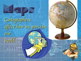
  • 1. Cartographers affect how we perceive our world
  • 2. Representing the earth A geographical map is a two-dimensional, geometrically accurate representation of a three-dimensional space. Inevitably, however, distortion is introduced when a globe is made to lay flat. This teacher uses a physical map of Europe to explain his point.
  • 3. Ancient map Claudius Ptolemy (150 AD) map drawn from Ptolemy's coordinates for a 1482 edition of his Geographia
  • 4.
  • 5. The earth is round. The challenge of any world map is to represent a round earth on a flat surface. Which projection?
  • 7. Cylindrical Projection: is based on a cylinder tangent to the equator. Good for equatorial regions but greatly distorted at high latitudes .
  • 8. Though the Mercator projection is particularly good for navigation, it becomes increasingly distorted toward the poles, resulting in areas appearing much larger than they actually are. Mercator projection
  • 9.  
  • 10. The distortion caused by a Mercator projection makes Greenland appear larger than Australia when, in fact, it’s one-third its size.
  • 11. The Eckert projection tries to keep the countries in relative proportion but still flattens out near the poles.
  • 12. The Peters projection is an area-accurate map
  • 13. The Robinson projection The Robinson projection is based on tables of coordinates. The projection distorts shape, area, scale, and distance in an attempt to balance the errors of projection properties.
  • 14.  
  • 15. Polar This projection is used by pilots to determine the shortest route between two points on the globe.
  • 16. Upside down? Depends on our pre-conceptions
  • 17. Differences between map projections
  • 18.  
  • 19. Map Symbols Legend Compass Rose These keys should be included on any map to which they apply Strait Isthmus Scale
  • 20.
  • 21.
  • 22. “ Like a huge piece of orange peel that refuses to be flattened without tearing at the edges, the globe cannot be forced into two dimensions without distortion. But that distortion can now be minimised “ Atlas technology
  • 23.
  • 24.
  • 25. Links