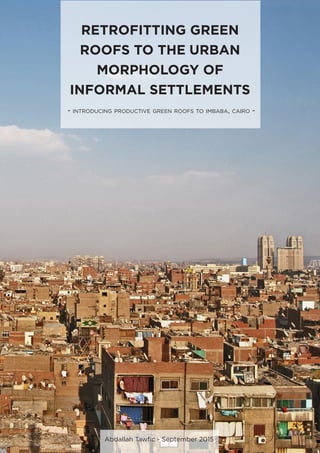
Retrofitting Green Roofs to the Urban Morphology of Informal Settlements - Introducing Productive Green Roofs to Imbaba, Cairo -
•
8 gefällt mir•4,181 views

Master Thesis - Resource Efficiency in Architecture & Planning (REAP) - HafenCity Universität - Hamburg - Germany

Empfohlen
Weitere ähnliche Inhalte
Was ist angesagt?
Was ist angesagt? (20)
Andere mochten auch
Andere mochten auch (11)
Ähnlich wie Retrofitting Green Roofs to the Urban Morphology of Informal Settlements - Introducing Productive Green Roofs to Imbaba, Cairo -
Ähnlich wie Retrofitting Green Roofs to the Urban Morphology of Informal Settlements - Introducing Productive Green Roofs to Imbaba, Cairo - (20)
Kürzlich hochgeladen
Kürzlich hochgeladen (20)
Retrofitting Green Roofs to the Urban Morphology of Informal Settlements - Introducing Productive Green Roofs to Imbaba, Cairo -
- 1. RETROFITTING GREEN ROOFS TO THE URBAN MORPHOLOGY OF INFORMAL SETTLEMENTS - introducing productive green roofs to imbaba, cairo - Abdallah Tawfic - September 2015
- 3. RETROFITTING GREEN ROOFS TO THE URBAN MORPHOLOGY OF INFORMAL SETTLEMENTS - introduCING productive green roofs to imbaba,cairo - A thesis presented to: HafenCity University Prepared by : Abdallah Tawfic In Partial Fulfillment of the Requirements for the Degree: Master of Science in Resource Efficiency in Architecture and Planning HafenCity University, Hamburg, Germany September 2015 © Abdallah Tawfic 2015 Approved by: Professor Wolfgang Dickhaut Professor Heba Khalil (Date) (Signature)
- 4. Calligraphy©HodaIsmail2015 In the name of God, the Compassionate, the Merciful: “And My success is in the hands of God” Hud 011 - Verse 88
- 5. ACKNOWLEDGEMENTS First and foremost, i offer my sincere gratitude to God the almighty for lighting my path, guiding me throughout my life and giving me the strength and patience to improve myself. My first appreciation goes to my family. I would like to express my deep appreciation to my father who always believed in me and who is always pushing me beyond my limits. I would like to thank him for his brilliant opinions and contemporary ideas that added lots of perspective to my studies. I would also like to express my gratitude to my mother, who always raise me up with love, care and respect to others. I would like to thank her for the nonstop wishes and prayers that supported me through lots of critical moments in my life. My amazing brothers and my sister in law, thank you for continuously supporting me. My second appreciation goes to my supervisor Professor Wolfgang Dickhaut. Thank you for all kind of support that you offered throughout my studies, and for giving me the chance to do something that could one day benefit my country. I would also like to thank my second supervisor Professor Heba Khalil for supporting me and helping me out with all the possible data. I would like to thank all my close friends for being supportive throughout my studies. A special thank you to Laila for her continuous support and care and for helping me throughout my thesis. I would also like to thank the German Cooperation (GIZ) for giving me some of their time and providing me with valuable data. Finally, i would like to thank all my colleagues and friends of REAP 5th generation. Thank you for the good times, the stories and the values that you shared with me throughout the last two years. PRELIMINARY MATERIAL I
- 6. DECLARATION OF AUTHORSHIP To the best of my knowledge I hereby declare that I have written this thesis submitted in part of the fulfillment of the Master of Science degree in Resource Efficiency in Architecture and Planning to the Hafencity University, without any help from others and without the use of documents and aids other than those cited according to established academic citation rules, and that it has not been submitted at any other university for any degree. (Date) (Signature) PRELIMINARY MATERIAL II
- 7. PROLOGUE The urban growth of Cairo over the last few decades has resulted in a deteriorated and defective urban fabric. Cairo has experienced a tremendous urbanization in the form of informal settlements in the past 5 decades. A recent study showed that more than half of Cairo’s built up area is unplanned construction [15] . Complemented by a massive population growth, informal settlements is one of the most environmentally degraded urban areas in Cairo. Those areas have expanded over a huge portion of agriculture land resulting in the loss of valuable production opportunities. Additionally, this unplanned transformation that follows the agricultural basin subdivision resulted in a compact construction pattern that lack open or green spaces. Urban agriculture is increasingly spreading in towns and cities. Cities has shifted the use of existing parks, vacant lots and building rooftops to urban agriculture practices, in an attempt to serve the enormous demands of urban food supply. Urban Agriculture has been presented in many literature as a resilient strategy that provides multidimensional benefits for urban dwellers. UA has proved to impact food security in urban areas, stimulate local economies through generating jobs, and positively impact the environment through introduced green spaces. This thesis investigates the urban morphology of one of Cairo’s densely populated informal settlement, presenting an attempt to utilize urban agriculture concept as a tool to redefine open spaces, generate income and provide healthy food for the locals through rooftop farming practices. However, the dissemination of rooftop farming in informal areas would require further research due to the lack of strategic guidelines and instruments that could manage and formalize rooftop food production on a district scale. Keywords: urbanization, informal settlements, open spaces, urban agriculture , rooftop farming, food security, local economies, income generation PRELIMINARY MATERIAL III
- 8. TABLE OF CONTENTS 1.INTRODUCTION 16 1.1. INFORMAL SETTLEMENTS IN CAIRO.......................................................................................17 1.2. THE TERMINOLOGY......................................................................................................... 19 1.3. PROBLEM STATEMENT..........................................................................................................20 1.4. IMPORTANCE OF THIS STUDY...............................................................................................23 1.5. RESEARCH OBJECTIVES.........................................................................................................24 1.6. RESEARCH QUESTIONS HYPOTHESIS................................................................................. 24 1.7. RESEARCH METHODOLOGY.................................................................................................26 1.7.1. Research Theme................................................................................................................26 1.7.2. Research Methods Design..................................................................................................28 1.7.3. Research Structure..............................................................................................................30 1.7.4. Data Collection..................................................................................................................30 1.8. RESEARCH LIMITATIONS.......................................................................................................31 1.9. OVERVIEW OF IMBABA..........................................................................................................32 1.9.1. Why Imbaba...................................................................................................................32 1.9.2. Geopraphy Climate........................................................................................................33 1.9.3. Demographics.................................................................................................................33 2. DEPTH ANALYSIS 36 2.1. URBAN MORPHOLOGY.........................................................................................................36 2.1.1. Building Typology...............................................................................................................36 2.1.2. Water Resources...............................................................................................................38 2.1.3. Socioeconomic Potential......................................................................................................39 2.2. OPEN/GREEN SPACES..........................................................................................................40 2.2.1. Streets Heirarchy...............................................................................................................41 3.GREEN ROOFS 50 3.1. BENEFITS OF GREEN ROOFS..................................................................................................50 3.1.1. Aesthatic Value..................................................................................................................50 3.1.2. Water Management............................................................................................................50 3.1.3. Natural Habitat Biodiversity....................................................................................................51 3.1.4. Reduce Urban Heat Island effect..............................................................................................51 3.2. URBAN AGRICULTURE.............................................................................................................53 3.3. ROOFTOP AGRICULTURE.........................................................................................................54 3.3.1. Rooftop Agriculture systems....................................................................................................55 3.3.2. Potentials of Rooftop Agriculture Systems....................................................................................61 3.3.3. Constraints of Rooftop Agriculture............................................................................................64 3.4. CASE STUDIES.......................................................................................................................66 3.4.1. Ezbet El Nasr Rooftop Agricultural Project....................................................................................66 3.4.2. Lufa Farms Project...............................................................................................................71 IV PRELIMINARY MATERIAL
- 9. 4. THE RETROFIT 76 4.1. SYSTEM APPLICATION IN IMBABA...................................................................................................77 4.2. FRAMEWORK FOR STRATEGIC SUSTAINABLE DEVELOPMENT..............................................................78 4.2.1. The Generic 5 levels Framework....................................................................................................79 4.3. PARAMETERS OF DESIGN..............................................................................................................82 4.3.1. Strategic Location....................................................................................................................82 4.3.2. Selection Criteria....................................................................................................................83 4.3.3. Project Structure.....................................................................................................................84 4.3.4. Household Scale....................................................................................................................86 4.4. EXPECTED IMPACTS.....................................................................................................................91 4.5. CORPORATE IDENTITY.................................................................................................................98 4.6. SWOT ANALYSIS......................................................................................................................100 5. PRODUCTIVE GREEN ROOFS 10 5.1. IMBABA FARMS BUSINESS MODEL..............................................................................................104 5.1.1. Economic Feasibility..............................................................................................................104 5.2. PRODUCTIVE GREEN ROOFS.....................................................................................................107 5.2.1. Dissemenation Potential........................................................................................................108 5.2.2. Policy Instruments................................................................................................................109 5.2.3. Challenges Limitations.......................................................................................................110 6. CONCLUSION 112 7. REFERENCES 116 8. APPENDICES 123 V PRELIMINARY MATERIAL
- 10. LIST OF FIGURES Figure 1: The different facets of urbanization processes.......................................................16 Figure 2: Schematic map of the Built-up Area of Greater Cairo Region (GCR) in 2012...........17 Figure 3: Schematic map of the informal settlements of Greater Cairo Region (GCR) in 2012....19 Figure 4: Classifications of The Urban Areas and The Informal Areas of Cairo........................20 Figure 5: Formal Vs. Informal Building Standards...............................................................22 Figure 6: The Funnel Paradigm Diagram..........................................................................26 Figure 7: The Generic 5 levels Framework explaning the Framwork for Strategic Susutainable Development (FSSD).......................................................................................27 Figure 8: The Generic 5 levels Framework applied to the research topic...............................28 Figure 9: The sequence that created the structure of the research..........................................29 Figure 10: Schematic overview of the Urban Development in Imbaba through time..................32 Figure 11: Location of Imbaba in the Greater Cairo Region (GCR).......................................33 Figure 12: Components of a Typical house unit in Imbaba..................................................37 Figure 13: The Incremental Building transformation through time in Imbaba.............................37 Figure 15: Phosphate levels in water samples of the tested parcels in Imbaba.........................39 Figure 16: Agricutural land transformation in Imbaba........................................................41 Figure 17: Section through a Narrow street in Imbaba.......................................................42 Figure 18: Section through a Typical street in Imbaba.......................................................43 Figure 19: Section through a Main street in Imbaba...........................................................43 Figure 20: A Narrow (3-4 m) street in Imbaba..................................................................44 Figure 21: A Narrow (4-6 m) street in Imbaba..................................................................44 Figure 22: A typical street (6-8 m) in Imbaba....................................................................45 Figure 23: A typical street (8-12m) in Imbaba...................................................................45 Figure 24: A main street (12-22m) in Imbaba...................................................................46 Figure 25: A main street (12-22m) in Imbaba...................................................................46 Figure 26: Giza Park in Imbaba: a project excuted on a part of the previous airport land.........47 Figure 27: Urban Heat Island Effect................................................................................51 Figure 28: Contribution of Green Roofs to the sustainability of the urban environment...............52 Figure 29: Challenges facing Green Roofs.......................................................................52 Figure 30: Integration of Urban Agriculture and Green Roofs..............................................54 Figure 31: Benefits of Rooftop Agriculture.........................................................................54 Figure 32: Basic elements of an Agricultural Green Roof (AGR)...........................................55 Figure 33: Extensive and Intensive Green Roofs Systems.....................................................56 Figure 34: Containers Green Roofs System.......................................................................57 Figure 35: Hydroponic Wick System (Passive)...................................................................58 Figure 36: Hydroponic Ebb Flow system.......................................................................59 Figure 37: Hydroponic Dripping system...........................................................................59 Figure 38: Hydroponic Nutrient Film Technique (N.F. T).....................................................60 Figure 38: Environmental ,Social and Economic Potentials of the Green Roofs systems..............63 Figure 39: Environmental, Social and Economic Potentials of the Green Roofs systems..............63 Figure 40: Summary of the Challenges facing Rooftop Agriculture.........................................66 Figure 41: Location of Ezbet El Nasr in Cairo’s Informal Map ............................................67 Figure 42: Structure of Ezbet El Nasr Rooftop Farming Project..............................................68 Figure 43: Components of Deep Water Hydroponic system implemented in Ezbet El Nasr Rooftop Farming Project................................................................................69 PRELIMINARY MATERIAL VI
- 11. Figure 44: Ezbet El Nasr Rooftop Farming produce............................................................70 Figure 45: Basic Components of a Greenhouse Closed Circuit Hydroponic system..................71 Figure 46: Lufa Farms project benefits..............................................................................72 Figure 47: Lufa Farms Greenhouse Produce......................................................................73 Figure 48: The integration of the urban morphology of Imbaba and the Green Roofs systems forming Imbaba Farms model........................................................................76 Figure 49: Relationship of Imbaba within its corresponding systems......................................79 Figure 50: The Success level applied to the Project............................................................80 Figure 51: The Actions needed for the Success of the Project...............................................81 Figure 52: The Tools needed to achieve the actions that drives the system to success...............82 Figure 53: The potential area selected in Imbaba for the pilot project.................................. 83 Figure 54: Selection Criteria of the project beneficiaries....................................................84 Figure 55: The preliminary Structure of the pilot project......................................................85 Figure 56: The Project future Structure transformation..........................................................86 Figure 57: A plan of a prototype Rooftop farm of 55 m2 ....................................................87 Figure 58: A section through the rooftop farm..................................................................88 Figure 59: A layout designed for a neighborhood rooftops, assigning different crops to the proposed blocks..........................................................................................91 Figure 60: The project expected qualitative impacts..........................................................93 Figure 61: Imbaba Farms different designs of the English Logos...........................................98 Figure 62: Imbaba Farms marketing produce...................................................................98 Figure 63: Imbaba Farms different designs of the Arabic Logos........................................... 99 Figure 64: Imbaba Farms vegetable Basket.....................................................................99 Figure 65: Lettuce production for a 30 m2 hydroponic rooftop farm.....................................105 Figure 66: Expected yielding and profit of hydroponically planted Lettuce per cycle...............106 Figure 67: Expected yielding and profit of hydroponically planted Green Beans per cycle......106 Figure 68: Factors affecting PGRs dissemenation potential................................................109 Figure 69: The three types of Rooftop Agriculture Policy Instruments....................................110 PRELIMINARY MATERIAL VII
- 12. ACRONYMS 5LF 5 Level Framework AGR Agricultural Green Roofs CBO Community Based Organization CSA Community Supported Agriculture CSR Coporate Social Responsibility DE Diatomaceous Earth DO Dissolved Oxygen FSSD Framework for Strategic Sustainable Development GCR Greater Cairo Region GHG Green House Gas GIZ Gesellschaft fur Internationale Zusammenarbiet GOPP General Organization for Physical Planning ISDP Informal Settlements Development Program ISDF Informal Settlements Development Fund LAI Leaf Area Index LECA Light Expanded Clay Aggregate MBI Market Based Instrument MURIS Ministry or Urban Renewal and Informal Settlements NFT Nutrient Film Technique NGO Non Governmental Organization PAH Polycyclic Aromatic Hydrocarbon PDP Participatory Development Program PI Persuasive Instrument PGR Productive Green Roof SP Sustainability Principles UA Urban Agriculture UHI Urban Heat Island UUU Urban Upgrading Unit PRELIMINARY MATERIAL VIII
- 13. .. to all people living in informal settlements. IX
- 15. INTRODUCTION 1.1 INFORMAL SETTLEMENTS IN CAIRO 1.2 THE TERMINOLOGY 1.3 PROBLEM STATEMENT 1.4 IMPORTANCE OF THIS STUDY 1.5 RESEARCH OBJECTIVES 1.6 RESEARCH QUESTIONS HYPOTHESIS 1.7 RESEARCH METHODOLOGY 1.7.1 Research Theme 1.7.2 Research Design Methods 1.7.3 Research Structure 1.7.4 Data Collection 1.8 RESEARCH LIMITATIONS 1.9 OVERVIEW OF IMBABA 1.9.1 Why Imbaba 1.9.2 Geography Climate 1.9.3 Demographics Chapter 1
- 16. 16 ABDALLAH TAWFIC - MASTER THESIS CHAPTER 1- INTRODUCTION The demand for housing opportunities is increasing in urban areas. It is expected that the rise of urban population in the whole world will cross 6 billion inhabitant within the coming 40-70 years [83]. The desire and need for immigration to urban areas is more concentrated in the developing nations compared to developed ones [46]. A study conducted in 2008 to comprehend the urbanization behavior through the years 2000-2005 concluded that the total increase in urban population in developed nations is 500,000 inhabitant/month, with a growth rate of 0.54% compared to the developing world, which accounts to an increase of 5 million inhabitant/month with a growth rate of 2.67% [46]. Housing problems escalated more in developing countries as a result of the disability of governments to provide adapting solutions to the rapid increase in the demand. In other cases the solutions are provided, but does not suit the needs. These actions drive immigrants to search for “their” solutions to this problem. With the lack of regulations and guidelines, demands are relatively fulfilled, but not in the formal way. - Informal growth is the dominating pattern in the urbanization process all over the developing world. It is the way how people supply their needs where their governments fail to do - “ Dr. Heba Khalil - Smart growth Informal areas” Figure 1: The different facets of urbanization processes 1. INTRODUCTION SETTLEMENT ADMINSTRATIVE INCORPORATION INCORPORATION RECLASSIFICATION NO SUITABLE ALTERNATIVES NO LAWS REGULATIONS DEMOGRAPHIC START VILLAGE EXISTING VILLAGE METROPOLITANURBAN CITY PROPER EXISTING TOWN EXISTING CITY AREAAGGLOMERATION TOWN CITY NEW CITY URBAN CLUSTERING INFORMAL SETTLEMENTS NATURAL POPULATION GROWTH NATURAL POPULATION GROWTH RURAL URBAN MIGRATION NATURAL POPULATION GROWTH POPULATION GROWTH URBAN URBAN MIGRATION Authors’s presentation inspired by The World Urbanization prospects diagram ,The 2014 revision , United Nations. [84]
- 17. 17ABDALLAH TAWFIC - MASTER THESIS CHAPTER 1- INTRODUCTION 1.1. INFORMAL SETTLEMENTS IN CAIRO Informal settlements are a fast growing phenomenon spreading all over the developing world. In Egypt, urbanization is concentrated heavily in the capital city of Cairo. About 60 % of all migrants leaving rural areas are headed to the capital [14]. Migration of individuals from the delta and upper Egypt to Cairo started after the Second World War in search for better jobs and proper living standards, causing housing pressure to become a critical situation [26].The phenomenon of Cairo’s informality started growing in the early 60s as a result of the government’s apathy towards the alarming need of housing. In addition, the government was preoccupied with the formation of new socialist zones and prestige heavy industries, ignoring the few unregulated development taking place [15]. Before 1967, the rental control law that froze housing rent to ensure affordability, caused the withdrawal of the private sector from the housing market, resulting -on the long-run- in a deficit in housing stock mainly for lower-income groups [35]. During the period of the war(1967-1973), the government’s financial resources was directed to rebuilding the military forces [35], resulting in a long pause in the formal construction sector [15]. However, the informal construction was continuing to grow to serve the continuous need of immigrants, especially the ones evacuated from the Suez Canal zone [15]. Figure 2: Schematic map of the Built-up Area of Greater Cairo Region (GCR) in 2012 20 km10 km 25 km Authors’ presentation Based on maps derived from “The Parallel City” in 2012 by Noheir El Gendy [15]
- 18. 18 ABDALLAH TAWFIC - MASTER THESIS CHAPTER 1- INTRODUCTION In the mid seventies, the government withdrew from the housing market, leaving the stage to the private sector which was only developing new luxury housing for the middle/high income strata [26]. Families with low income have no choice but to build their houses with their available resources. This caused a housing opportunities gap between low and higher income strata, which eventually led to the spread of informal settlements [35] [26]. In the late 70s, and with the obvious increase of informal settlements, the government produced a series of decrees and laws which inhibit the encroachments against what has been recognized as valuable agricultural land, which are converted by new settlers into building plots [15]. With the rising gap between supply and demand and the government neglect and non-effective solutions, informal housing was the only available resort for the low income strata. Until 1986, studies concluded that almost 40 % of urban population lived in informal settlements occupying 62 % of Greater Cairo’s area [26]. The population growth in Cairo dropped from 3.1% to 1.8% in the 70s - 90s period [15]. During the 90s, Cairo’s urbanization started to slow considerably, forming a new pattern of what is called “stabilization”, as a result of urbanization of large villages and the vast growth of small towns outside the fringes of Cairo [6], resulting in an obvious decrease in rural-urban migration rates [15]. In the year 1994, the government started to acknowledge the problem and launched the first stage of the “Informal Settlement Development Program” (ISDP) to provide basic urban services (electricity , water , sanitary , road paving) for 325 informal settlements allover Egypt [16]. Those efforts were criticized as “slowly coming” and “substandard” and “different from one place to another” as for example many of the wastewater lines in some areas were installed by the settlers’ self efforts [15]. The efforts perceived by the government gave the informal settlement a sense of legalization even though this informal construction activity was lacking land tenure legalization and formalization [35]. It encouraged the phenomenon of agricultural land encroachments since the basic services will be eventually provided [15]. A study in 2002 concluded an increase in Cairo’s informal areas with an annual rate of 3.4 % and population growth of 3.2% (200,000 person) per year compared to the population growth of formal areas which was only 0.8% [15]. In 2004 the government initiated the second stage of the ISDP program under the name of “ Informal Settlements Belting Program”, aiming to develop robust efforts for the restriction of growth of informal areas [16]. In October 2008, a part of “El Deweka” informal settlement was buried under a huge rock that slid from Moqatam hill ,resulting in the death of more than100 tenants. This accident directed the government to establish the “Informal Settlements Development Fund”(ISDF), a new program under a presidential decree #305/2008 [16]. The main goal of this program is to ensure safe housing in Egypt by improving the quality of life of the - Informal settlements in Cairo have departed the stage of bieng neglected or margenlized, as they begin to claim for their rights, not just in facilities and services , but also as a part of the city - “Noheir El Gendy - The parallel City”
- 19. 19ABDALLAH TAWFIC - MASTER THESIS CHAPTER 1- INTRODUCTION reisdents of unsafe areas [16]. Today it is estimated that more than 60% of Cairo’s built up area is informal [1] , accommodating between 12 - 17 million inhabitant [35]. The informal areas of Cairo are continuing to grow to absorb the vast increase in population, transforming from a transient phenomenon to a dominant urban fabric. 1.2. THE TERMINOLOGY The term Informal or “Ashwae” refers to a random or a haphazard activity. Informal settlements or “Ashwaeyat” in Egypt is a term used to indicate deteriorated or underserved urban areas [17]. Throughout the evolution of Ashwaeyat in Egypt, the terminology has been differently interpreted to explain this urban heterogeneous phenomenon. Informal does not have to be unpredictable, unprogrammed or unplanned. On the contrary, it could be explained as the suitable activities in some parts of the city which are opposite to the will of the formal authorities [15]. A common misperception always connect the definition of “informal” to the “Third world slums”- shantytowns, hutments or bidonvilles which are very rarely found in Cairo’s informal areas [27] [15] [67]. A state of relative “inner formality” following a mechanism of certain norms and codes could Figure 3: Schematic map of the informal settlements of Greater Cairo Region (GCR) in 2012 20 km10 km 25 km Authors’ presentation Based on maps derived from “The Parallel City” in 2012 by Noheir El Gendy [15]
- 20. 20 ABDALLAH TAWFIC - MASTER THESIS CHAPTER 1- INTRODUCTION be tracked and analyzed in the what so called “informal” areas, thus the generalized definition of informality is not particularly accurate. After the Deweka accident, the planning regulations in Egypt produced a unified law (#119/2008) concerning all the terms and definitions related to planning and urban development [17]. This law stated that the term “Ashwaeyat” or informal settlements is no longer used by the law and has been replaced by either “unplanned” or “unsafe”[17]. Unplanned areas representing 60 % of urban areas while unsafe represents only 5% [16]. A general description of informal settlements in Cairo are illegally built up areas, violating one or more laws regarding land use, construction and land subdivision [14] [46]. Although informal settlements or Ashwaeyat are often stigmatized and surrounded by many myths describing it as the “negative” or “undesired” part of the city, it is growing extensively to be the norm not the exception [15]. Calling it informal or not does not overlook the potential of growth of this entity ,which represents an obviously recognized sect of the Egyptian urban fabric. 1.3. PROBLEM STATEMENT Informal settlements are covering more than half of Cairo’s urban area [26]. Almost 12 million inhabitants which represents 70 % of Cairo’s population live in so called informal areas [27]. The failure of the government to provide suitable, affordable and viable housing opportunities for middle- low income strata is the substantial reason behind this phenomenon to spread. This resulted in an illegal or semi illegal housing systems built on private or public land [27]. Another reason is the leniency of the law acceptable physical stuctures planned areas unplanned areas urban areas informal areas unsafe areas shanty towns illegal areas legal areas old quarters core villages deteriorated physical stuctures Figure 4: Classifications of The Urban Areas and The Informal Areas of Cairo Authors’ presentation based on the diagram retrieved from “Im- proving Informal Areas in Cairo” by GIZ [29]
- 21. 21ABDALLAH TAWFIC - MASTER THESIS CHAPTER 1- INTRODUCTION in dealing with violators [14], encouraging them to build their desired settlements without thinking about the repercussions. The most common type of informal settlements is the one built on privately owned agricultural lands, which represents 83% of all informal areas of Cairo [15], covering almost half of the total residential areas in Greater Cairo [74]. They are illegal not because of land squatting, since they are privately owned, but because of the violation of different laws regulating land use, land subdivision, sale of lots and construction [14]. This phenomenon started in the 60s when agricultural land owners started selling their relatively small plots to individual house builders [74]. These plots were previously inherited and fragmented into smaller plots following the Islamic law of inheritance [66]. They were sold when the stage was reached that the plot of agricultural land was too small for the owner’s self catering [66]. The main reason encouraging the investment in agricultural land tenure is the property ownership, which is considered a source of security and a cultural tradition in the Egyptian heritage [14]. The location of the informal settlement which is usually near an employment area and the availability of water which is a key factor for livability are the reasons behind the formation of this type of settlements on agricultural land [14]. This type serves a wide range of demography which are not only the urban poor , but middle class educated families, public sector employees, artisans, workshop owners, doctors and lawyers [59] [15] [27] . This type of informal settlements is characterized by very narrow long streets, regular block shapes according to the agricultural basin subdivision ,units with constant depth, different street frontage and heights depending on the affordability of the owner [1]. Apart from some inner pockets in some remote areas, the overall construction quality of this type of informal settlements are reasonably good [15] [27]. The governmental lack of sufficient investments in upgrading or extending networks and maintaining public facilities accumulated lots of challenges regarding both physical infrastructure and social services. Adding to that the overburden of the existing utilities as a result of population growth. These utilities include water sewage systems, electricity, transportation, garbage disposal, accessibility, public/open spaces, health, employment and education [1] [27] [15] [26] [17] [61] . Urbanization and extreme population densities negatively affect the environment by causing pollution and the modification of the local climate of the city [71] [61] [72].The lack of urban planning and the high density of construction in informal settlements of Cairo is resulting in an increased Urban Heat Island (UHI) effect [72]. Green spaces are very limited all over Cairo, rarely located in the formal neighborhoods and almost absent in informal areas [72].Urban green spaces are considered the respiratory lung of a city. They reduces - Informal housing is not ‘backward’ or opposed to modernity as many have come to believe. Nor does it house unproductive members of society. Rather, it is a creation of productive members of society when the formal sector cannot or does not provide housing for them. - “Shawn ODonnell - Are Ashwaeyyat really a problem “
- 22. 22 ABDALLAH TAWFIC - MASTER THESIS CHAPTER 1- INTRODUCTION the high rates of air pollution - normally existing in cities - through the vegetation trapping of carbon, dust and smoke particulates [36]. Moreover, they promotes biodiversity and provide a linkage between rural and urban areas [37]. They also encourage economical growth and investments by increasing surrounding land and property value [22]. Nevertheless, they have many benefits for human health ,providing recreational areas for sports activities thus reducing obesity, stress , rates of airborne diseases and asthmas [37] [36]. With the lack of urban planning and the ability to construct on the total area of land with no minimum setback requirements or open spaces regulations, informal settlements are facing a considerable matter of scarceness of green areas and open spaces. The effect of climate change on poorly designed urban areas and the insufficient open spaces affect the health conditions of the tenants of informal areas. A study on the impacts of climate change on household health conditions in 4 informal settlements in Cairo concluded the deterioration of existing health problems, particularly rates of arthritis ,asthma ,skin rashes ,cold and fever [68]. This study pointed out that the most vulnerable group affected are always little children ,elderly people ,tenants living in top floor apartments and people working outdoors in the sun [68]. Figure 5: Formal Vs. Informal Building Standards Residential Commercial Mixed Use Industrial Private Public 67 % 82 % 12 %33 % Built up Vacant 60 % 100 % 40 % FORMAL INFORMAL ZONE REGULATIONS LAND SUBDIVISON LAWS LOT COVERAGE LAWS Authors’ presentation based on a study Retrieved from “Urban- ization of Agricultural land” by: Mahmoud El Sioufi [14]
- 23. 23ABDALLAH TAWFIC - MASTER THESIS CHAPTER 1- INTRODUCTION Food insecurity is one of urbanization’s negative impacts affecting the Greater Cairo Region (GCR) [2]. The construction of more residential areas on agricultural land reduced the productivity of the agricultural sector, while the vast growth of population increased the demand for food [91]. The reliance on the supply chain that convey food items from rural areas is another reason especially with the shortage and rising prices of gas that makes it difficult to satisfy the needs for the transportation sector [91]. There is a significant correlation between income poverty and poor access to food [87]. Although the highest poverty rates remains in rural upper Egypt, significant levels of poverty and food insecurity are increasing in urban areas (40% between 2009-2011) [87], which are affected by the fluctuations in food prices and the food supply chain more than rural areas [91]. GCR has a larger population of poor (3.8 million) compared to the poor areas of Upper Egypt [87]. The rising rates of poverty in urban areas forces households to cope with strategies that have a negative impact on nutritional values, relying more on less expensive calorie-dense food [87]. Inspite of the countries’ self sufficiency of fruits and vegetables, they registered large increase in the prices (139% and 102% respectively) during the period of 2004-2008 [23]. As a result, very low quantities of fruits and vegetables were consumed by the low income groups in comparison to higher income ones [23] [87]. The results of malnutrition in the poor areas are higher rates of obesity ,stunting and anemia in children [87]. The spread and overpopulation of informal settlements, which are suffering from disparate patterns of poverty complemented by environmentally threatening conditions calls for prompt actions that requires addressing it as a priority focus in the future sustainable development plans of Cairo’s urban structure. This study concentrates on the challenges facing Cairo’s informal settlements, investigating some of the problems that exacerbated in the past decades ,specifically lack of green spaces, food security, unemployment as well as the environmental challenges resulting from urbanization and the formation of those areas. 1.4. IMPORTANCE OF THIS STUDY Covering more than 60% of Cairo’s overall built up areas [1] and accommodating between 12-17 million inhabitant [35], Informal settlements have shifted from being an exceptional phenomenon to the normal trend [15]. This requires developing resilient strategies that ensure its adaptation with the contemporary changes especially that informal settlements are no longer serving only the urban poor, but various demographic layers of the Egyptian society The constraints within which informal areas grow, their location on agricultural land or in unsafe geographical areas, the entrepreneurial initial subdivision, and the ex post facto introduction of infrastruc- ture have all led to several major shortcomings in the quality of life for those living there “GIZ - About Cairo its Informal areas “
- 24. 24 ABDALLAH TAWFIC - MASTER THESIS CHAPTER 1- INTRODUCTION 1.5. RESEARCH OBJECTIVES The main objective of this research is to study and analyze the urban morphology of informal settlements, addressing the problems and investigating smart and sustainable strategies that can mitigate the environmental, social and economic challenges facing it. Imbaba was chosen for this study as one of the oldest informal settlements in Cairo with population crossing 1 million inhabitant, covering an area of 1930 acres [66]. The extremely high urban density of Imbaba oriented this research to study and analyze the building typologies with respect to the structural properties and the materials used in construction. This study also covers a streets hierarchy study which includes an analysis of the quantity and quality of open spaces and green areas. This research explores green roofs technologies through presenting the basic components of the different available systems. In addition, it focuses on rooftop agriculture; a strategy that can provide multi-layered solutions for urban areas affected by food insecurity, lack of green/open spaces, unemployment and poverty. Furthermore, it could provide a mitigation solution for some environmental challenges like UHI effect, GHG emissions and minimizing water losses through stormwater management or the reusing of treated greywater. Additionally, rooftop agriculture can promote social integration between families through interaction and knowledge exchange. This research intends to find a retrofitted green roof system that integrate roof top agriculture with the urban context of Imbaba. The expected impacts could be multidimensional, connected together under the umbrella of improving the livelihood of the tenants. It could also serve as a guide for diversified stakeholders working in the informal settlements’ development sector and aiming to disseminate the concept. 1.6. RESEARCH QUESTIONS HYPOTHESIS The hypothesis of this study states that the continuous encroachments on agriculture land due to the rapid expansion of informal areas and the lack of green/open spaces is threatening the environmental quality and affecting food availability ,quality and prices. This study will investigate the ability of rooftop agriculture to mitigate these problems. Main Research Question Is rooftop farming a suitable solution to mitigate the transformation in the urban morphology of informal settlements which is suffering from deterioration of open space, environmental challenges and poverty? how can rooftop agriculture in informal settlements provide a mutual benefit between the tenants and the environment? What are the main obstacles Research Objectives The presented research objectives help to narrow down the topics that need to be investigated
- 25. 25ABDALLAH TAWFIC - MASTER THESIS CHAPTER 1- INTRODUCTION facing the development of open space in informal settlements? Green Roofs Technologies 1 -Which green roof technologies can be the most beneficial and fits- in terms of technical aspects- in the context of Imbaba to achieve a sustainable development? (load bearing - structural system - wind uplift - waterproofing -irrigation- drainage..etc) 2- What are the differences between the technologies that works for agricultural practices the one used for aesthetic and amenity practices ? (substrate depth- extra elements - maintenance..etc) Retrofitting Rooftop farming to Imbaba 3- How would people of Imbaba react to the concept of rooftop farming ? Is agricultural background an important aspect for acceptance of such concept? Is financial profit from selling the crops the main stimulating element for the success of this concept? what are other stimulating elements that could drive the people to work for the success of this concept? 4- Is there any similar rooftop farming projects in other informal settlements in Cairo? to what extent are they successful (if they are)? what are the dimensioning parameters of the systems used in those projects ? who implemented/ financed those project? what are the aspects taken in consideration to assure the ongoing maintenance and the sustainability of the system? how are those projects marketed to spread the awareness of such system? 5- How can we transfer success stories of rooftop farming from other countries to the informal settlements of Cairo (Imbaba) although the systems ,conditions and needs might differ? what are the constraints/ obstacles that might limit this transfer? Productive Green Roofs for Informal Settlements 6- To what extent can we introduce the concept of Productive Green roofs (PGR) for informal settlements with new parameters which not only provide the normal benefits of conventional green roofs, but also promote the value of food security, job opportunities and economical benefits in the developing countries ? 7- To what extent can the produce of PGRs competes with the ground agricultural produce in terms of Quantity/ Quality ? 8- What are the challenges, obstacles and limitations that can face the implementation? to what extent can it be accepted by the community , the local authorities and the private sector? 9- How can PGRs be institutionalized to provide a legal framework as well as a sustainable guide for governments and developers to facilitate its management and the crops produced? Research Question Hypothesis The hypothesis and research questions help further define the type of information needed to investigate the focus topic
- 26. 26 ABDALLAH TAWFIC - MASTER THESIS CHAPTER 1- INTRODUCTION 1.7. RESEARCH METHODOLOGY This part of the research investigates the guidelines adopted to create the foundation that holds this study together. The Framework for Strategic Sustainable Development (FSSD) was the chosen theme to guide this project through all its stages. The basic understanding of applying the FSSD is presented and then reflected on the focus of this study. The structure of the research is then developed, followed by exploring the process by which the data was collected. 1.7.1. Research Theme Our planet consists of different balanced layers that are integrated together in a system of a certain harmony. Since the beginning of the industrial revolution this system has been suffering from increasing pressure of human society [4]. Climate change , pollution and social inequality are harming the capacity to sustain our ways of life [70]. The “funnel paradigm” is a representation of our systems’ decreasing capacity to support the increasing society in relation to time. Increasing in population have led to the increase in the demand of resources. Moreover, the declining resources due to improper practices will impose higher threats to our socio-ecological system [70]. The Framework for Strategic Sustainable Development (FSSD) is a professionally strict peer reviewed model for managing complexity in planning towards sustainability [70].It is based on a Generic 5 Levels Framework (5LF) which is used in planning any complex system or project [86]. The first level of this framework is the “system”, which is the entity or the place which contains the project that exists within the biosphere and its relationships with the global socio-ecological system [86]. The second level is “success”, which is simply the conditions that must be met inorder TIME DECLINING RESOURCES RESTORATION INCREASING DEMAND FOR RESOURCES EARTH SUSTAINABILITY Figure 6: The Funnel Paradigm Diagram Author’s presentation based on diagram retrieved from “Strategic leadership towards Sustainability”by Joseph Alsford [4]
- 27. 27ABDALLAH TAWFIC - MASTER THESIS CHAPTER 1- INTRODUCTION to define a successful outcome of the project, while eliminating any contributions to violations of Sustainability Principles (SP) [86].The SPs should be taken in consideration as the base of success of the project. It must be assured that nature is not subjected to systematically increasing in the : • Concentration of substances extracted from the Earth’s crust. • Concentration of substances produces by the society. • Degradation by physical means. and that People are not subject to conditions that systematically undermine their capacity to meet their needs [86]. The third level of the 5LF is “Strategic Guidelines” which are the guidelines followed in order to achieve success (Level 2) in the system (Level 1). It follows the concept of “backcasting” from success level [86]. Backcasting is a planning procedure by which a desired future is imagined followed by the question: ‘What do we need to do today to reach this desired successful future goal?’ [70]. The fourth level are the “Actions” that will follow the guidelines (Level 3) that should help move the project or the system toward success (Level 2) and sustainability [86]. The fifth is the “tools” level, which are the additional techniques, instruments, measurements and management tools that used to guide the actions towards achieving the targeted success and moving the project or system towards sustainability [86]. SYSTEM SUCCESS ACTIONS TOOLS STRATEGIC GUIDLINES Society within the biosphere, including social ecological rules which governs the system. Success principles or conditions that define a successful outcome of the planning or project. Strategic guidelines that will help choosing actions that lead to success in the system. Actions thats follow the strategic guidelines to help move the system towards success. Tools that support the actions that help move the system towards success. Figure 7: The Generic 5 levels Framework explaning the Framwork for Strategic Susutainable Development (FSSD) Authors’ presentation based on the data retrieved from “Guidelines for FSSD” by David Waldron [86] - It is important to not get ‘captured’ by the 5LF or the FSSD. Rather, capture it and put it to use - “David Waldron- Guidlines for the FSSD”
- 28. 28 ABDALLAH TAWFIC - MASTER THESIS CHAPTER 1- INTRODUCTION 1.7.2. Research Methods Design The methodology of this research adopts the 5LF as the guideline to build the structure of the study inorder to have a holistic overview of the project planning. Informal settlements generally and Imbaba specifically represents the system of study. for the convenience of the reader the research methods design are presented in the following figures. SYSTEM SUCCESS ACTIONS TOOLS STRATEGIC GUIDELINES Informal Settlements are the main system which contains Imbaba as a subsystem. Better living conditions for Imbaba Residents Environmental: - GHG Reductions - Improved open spaces - UHI effect reduction (limited) Social: - Job Opportunities - Health improvements - Social integration - Food Security Economic: - Income Generation - Achieve better living conditions for imbaba with all the constrains of the sustainability principles - Putting people’s benefit as a first priority Figure 8: The Generic 5 levels Framework applied to the research topic Entities - local CBOs - Rooftop Farming Experts - Research Institutes - Development Agencies Data collection tools - Site Excursions - Workshops - Questionnaires Authors’ presentation inspired by the data retrieved from “Guidelines for FSSD” by David Waldron [86] - Involve local CBOs in project design - include locals in decision making - Utilize unused roof spaces - Promote Rooftop Agriculture - Awareness for the positive effect of fresh and clean food - Create a visual image of the expected future impact - Project monitoring evaluation - Transparent communication
- 29. 29ABDALLAH TAWFIC - MASTER THESIS CHAPTER 1- INTRODUCTION Figure 9: The sequence that created the structure of the research FRAMEWORK FOR STRATEGIC SUSTAINABLE DEVELOPMENT ACADEMIC PAPERS REPORTS EXCURSIONS INTERVIEWS EXPERTS CONSULTATIONS CONFERENCES DATA REVIEW BUILDING TYPOLOGY IMBABA ANALYSIS GREEN ROOFS ANALYSIS GREEN ROOFS TYPES OPEN/GREEN SPACES ROOFTOP AGRICULTURE WATER RESOURCES SOCIOECONOMIC POTENTIAL URBAN AGRICULTURE SYSTEM APPLICATION PGR AGRIBUSINESS THE RETROFIT PRODUCTIVE GREEN ROOFS PROJECT OBJECTIVES DISSEMINATION POTENTIAL DIMENSIONING PARAMETERS CHALLENGES LIMITATIONSEXPECTED IMPACTS POLICY INSTRUMENTS DATAANALYSISSYSTEMDESIGNDATAGATHERING CASE STUDIES Authors’ presentation
- 30. 30 ABDALLAH TAWFIC - MASTER THESIS CHAPTER 1- INTRODUCTION 1.7.3. Research Structure This thesis consists of 6 chapters arranged according to a systematic order. Chapter 1. Includes the previously presented introduction of informal settlements in Cairo, its history and the main problems facing it. Research question and hypothesis are then presented , followed by the methodology adopted and the research system designed. A general overview of Imbaba is presented to give the reader an overall idea of the focus area. Chapter 2. Includes a more detailed analysis of Imbaba, covering the building typologies and construction systems, focusing on materials used and building heights. Water resources and its properties are investigated followed by the social and economic conditions of imbaba’s residents. This chapter also investigates the streets hierarchy of Imbaba and analyzes of the availability, quality and quantity of open/green space . Chapter 3. Includes a study of all green roofs systems including geoponic and hydroponic types with a focus on rooftop agriculture and the systems that can adopt it. This is followed by two case studies of rooftop farming in an informal settlement in Cairo and an international case study “Lufa farms” in Montreal ,Canada. Chapter 4. Represents an integration between chapter 2 and 3, where a retrofit of green roofs is integrated with the context of informal settlements in the form of a project called “Imbaba Farms”, adopting the FSSD as a planning guide. This chapter presents the system application, objectives and the parameters of design of this project as well as the expected impacts that this project could present. Chapter 5. This chapter introduces the concept of Productive Green Roofs for informal settlements and how it can contribute in terms of quantity and quality to the Agricultural business sector. Moreover, this chapter discuss the strategies applied for the dissemination of this concept as well as the obstacles, challenges and limitations that can face it. Chapter 6. Is the general conclusion of this study, presenting the main findings of the research and the future works that can be suggested. 1.7.4. Data Collection The data collected for this study were used to obtain different perspectives from diverse layers of experts in all the related fields of study. The data collected is divided as follows. Literature Review The literature reviewed was divided in to 2 sections, literature related generally to Informal settlements in Cairo and specifically Imbaba, while Research Structure The sequence of the research structure is designed to ensure the understanding of the presented topics
- 31. 31ABDALLAH TAWFIC - MASTER THESIS CHAPTER 1- INTRODUCTION the other was related to green roof technologies and urban agriculture, concentrating on rooftop agriculture. Excursions Several excursions took place to visualize, comprehend and analyze the ongoing conditions of Imbaba. Excursions allowed for more creditability of the study, as it naturally approached the daily lifestyle of the locals living in the area. This helped avoiding any misleading information and overstatements that could affect the integrity of the study. Conferences Attending the 4th International Green Roof Conference in Istanbul presented by the International Green Roof Association (IGRA) and partners as well as the 1st Egyptian Urban Forum (EUF) in Cairo brought more insight to the research and provided a more comprehensive view of green roofs and its latest technologies as well as Cairo’s urbanization and informal settlements. Experts Consultations Various experts in the field of Urban Development, Water Management, Environmental Studies, Agriculture and Horticulture in Egypt were consulted for the specific case study of Imbaba. Interviews Interviews were done to build upon the data collected previously. The selected interviewees were divided into 3 sections. The first section includes International Development organizations working in development projects in Egypt. The second represents Green Roofs experts working in the field of research as well as specialists working in the horticultural and agribusiness sector in Egypt. The third section represents the public, specifically Community Based organizations (CBO) members in Imbaba. 1.8. RESEARCH LIMITATIONS This research faced some challenges regarding data. The concept of rooftop agriculture in developed countries is still in its infancy. The lack of research in this area prevented this study from overviewing various global point of views and studies that can lighten up the path for this project. The project being in a developing country generally and informal settlements specifically diminished the chances for proper data finding and international parallel success stories. Other challenges like the lack of accurate data regarding the area’s carbon footprint or a proper existing analysis of open/green spaces in Imbaba resulted in a weaker argument in some cases, thus affecting the accuracy of the study. Data Collection The data collected represents the repository for the different study topics of this research
- 32. 32 ABDALLAH TAWFIC - MASTER THESIS CHAPTER 1- INTRODUCTION 1.9. OVERVIEW OF IMBABA This section presents a general overview of Imbaba to provide the basic information about the area of focus to the reader. 1.9.1. Why Imbaba Imbaba is considered one of the famous informal settlements in Giza governorate, being the eye witness of the early formation of informal settlements in Egypt generally and Cairo specifically. The history of informal settlements in Imbaba started in the early 50s after the launching of a social housing project called “Workers City”. This project was executed by the Egyptian government, accommodating 6000 governmental workers and their families in 100 units in a formally planned area of 330 acres [66]. This project was designed to expand in the future but the many small sized land parcels surrounding the project made the expropriation of land a difficult process for the government [66]. It was assumed that the first informal dwelling in this time was built by the construction workers working on the formal part of the project for the reason of its affordability and proximity to work. In the late 70s during the period of the economic boom, mostly all parcels were occupied allowing only for future vertical expansion [66]. Today Imbaba is one of the most densely populated areas not only in Giza but in all of Egypt [18]. Vertical expansions has reached its limits which led to more encroachment on valuable agricultural lands surrounding it, to keep up with the rapid increase in population and the strong need for housing [66].With a density ranging around 236 inhabitant/acre, Imbaba is considered a dense hub for displaced people coming from the countryside and Upper Egypt because of its low rents ,affordability and proximity to services [1]. Figure 10: Schematic overview of the Urban Development in Imbaba through time Author’s presentation based on the images retrieved from “Imbaba Analysis” By Basel Studios [66] BEFORE 1952 AFTER 1952 AFTER 1973 2010 RURAL BACKGROUND WORKERS CITY WORKERS CITY WORKERS CITY INFORMAL HORIZONTAL EXPANSION VERTICAL EXPANSION THE NILE
- 33. 33ABDALLAH TAWFIC - MASTER THESIS CHAPTER 1- INTRODUCTION 1.9.2. Geopraphy Climate Imbaba is located in the Northern part of Giza governorate on the West side of the river Nile and the Northwest of downtown Cairo. Imbaba is surrounded by 2 other informal settlements, specifically El Waraa’ from the North and Bashtil form the West, while the nearest formal area is Mohandseen located directly in the South . Imbaba is considered to be a part of Greater Cairo Region (GCR). Greater Cairo is in the subtropical climatic region. The weather is characterized by the heat waves that frequently occur in transitional seasons of spring and autumn [71]. In spring, a particularly unpleasant phenomenon is a hot, dry and dust laden ”Khamaseen” wind that pass over the desert area [71] . In winter, the climate of the Greater Cairo region is cold, moist and occasionally rainy, while during summer the predominant weather is hot, dry and rainless [71]. The annual average temperature is 21.4 degrees Celsius (70.5 degrees Fahrenheit). Total annual Precipitation averages 26 mm (1 inches), which is equivalent to 26 Liters/m² (0.64 Gallons/ft²). On average there are 3451 hours of sunshine per year [11]. 1.9.3. Demographics Imbaba is one of Cairo’s largest districts that grew in an informal pattern [1]. In 2010, It was expected to be the home for approximately 1 million inhabitants [66]. Imbaba - as many other informal settlements in Cairo - hosts various layers of the society including middle class educated families , public sector employees ,artisans, workshop owners, doctors and lawyers [27] [15]. Figure 11: Location of Imbaba in the Greater Cairo Region (GCR) Author’s presentation based on the image derived from “The Parallel City” By Noheir ElGendy [15] WARAA’ IMBABA MOHANDSEEN BASHTIL 10 km 20 km
- 35. 2.1 URBAN MORPHOLOGY 2.1.1 Building Typology 2.1.2 Water Resources 2.1.3 Socioeconomic Potential 2.1.4 Open/Green Space 2.1.5 Street Heirarchy DEPTH ANALYSISChapter 2
- 36. CHAPTER 2- DEPTH ANALYSIS 36 ABDALLAH TAWFIC - MASTER THESIS This chapter presents a detailed analysis for the different urban patterns of Imbaba. The parameters of this analysis includes building typology, the available water resources as well as the socioeconomic potential. The quantity and quality of green and open space existing in Imbaba is also analyzed and presented in this chapter. 2.1. URBAN MORPHOLOGY As previously explained, Imbaba passed different urban morphological phases during its formation. Agriculture land fragmentation was one of the main reasons that enforced the growth of Imbaba [66]. Like most informal settlements, Imbaba has began its land transformation by substandard commercial subdivision with small dimensional plots, building on the overall area without leaving minimum construction setbacks [26]. Nowadays, horizontal expansion is saturated and vertical growth have reached its limits in the old part of Imbaba [66].The urban fabric is very compact ,The small surface areas of the plots result in a tight living spaces that usually contradict the number of inhabitants per family [26]. New nearby agricultural lands are sold to local contractors and traditionally built to meet up with the increasing demand for housing opportunities [66]. 2.1.1. Building Typology Although Imbaba is considered an unplanned area, an analysis presented by the Egyptian General Organization for Physical Planning (GOPP) concluded that 98 % of the constructed buildings in Imbaba are concrete structures (Refer to appendix 1). This construction consists of light weight reinforced concrete frame and local red bricks for the construction of walls [74] [29]. In some areas, older houses were constructed using the walls bearing system [74]. A study investigating the different types of construction of a specific parcel in Imbaba concluded that wall bearing houses represents 58 % of this parcel while skeleton structures represents the other 42 % [18]. This study also shows that 83 % of these houses are in an intermediate structural conditions [18]. Buildings in Imbaba usually has only 1 free facade when normally the other three are attached to neighboring houses [26]. There is 100% plot coverage except for small air shafts or light wells [74]. The majority of the building’s free facades are rarely finished or plastered [18]. All the old buildings in Imbaba consists of 4 or less storeys, while some of the new constructions in the last 40 years may reach up to10 levels [18]. Incremental construction is the norm, where houses are not build as an overall structure, but built room by room or floor by floor based on the existing needs [74], [27]. 2. DEPTH ANALYSIS - There is a misconception held by many Egyptian professionals, especially engineers, that informal housing is haphazardly constructed and liable to collapse. Since informal housing is overwhelmingly owner-built without use of formal contractors, it is in the owner’s own best interest to ensure that care is taken in construction. - Noheir El Gendy - The parallel City
- 37. CHAPTER 2- DEPTH ANALYSIS 37ABDALLAH TAWFIC - MASTER THESIS The predominant land use in Imbaba is either pure residential or a residential - commercial mix (refer to Appendix 1). The pure residential type is more concentrated in the inner parcels which is served by narrow streets [18]. In the case of mixed use - which is concentrated in wider streets - the ground floor is usually used as a supermarket, workshop, garment store or a cafeteria. Rooftops in Imbaba are usually useless spaces. Sometimes tenants use it as a storage facility for their old/unused stuff while others throw garbage on top of it. Consequently, those spaces provide a shelter for harmful rodents and insects that could transfer harmful diseases to the living tenants. Some houses tend to raise pigeons on the rooftop by building a tall wooden vertical structure that can be used as a shelter for pigeons. The existence of a pigeon house on a rooftop presents a sign of wealth of the house owner, as this habit is in many cases perceived as a hobby and not always referred to as a profitable investment [75]. Roofs in Imbaba were previously used in raising poultry and rabbits. However, the spread of Evian flu in the past decade diminished this kind of activity through time. Roofs in Imbaba are basically unused space either owned by the tenant living in the last floor or by the owner of the building. The TV satellite dishes and water tanks in some cases might be the only beneficial use for the roofs. The common trend of densification of areas overtime created a serious phenomenon of building overcrowding in Imbaba [74]. With the continuous growth of families, it became harder for new families to afford new units, thus the available apartments and rooms become more dense [74]. The inhabitants can only try to extend their living circumstances through small outer annexes [66]. Figure 12: Components of a Typical house unit in Imbaba Figure 13: The Incremental Building transformation through time in Imbaba 2010BEFORE 1952 AFTER 1952 AFTER 1973 AFTER 1985 Concrete Structure Local Red Bricks Extended Annex Recessed Ground Floor Pigeons House Authors Presentation Based on the data derived from “Imbaba Analysis” by studio Basel [66] Author’s presentation based on the data derived from “Imbaba Analysis” By Studio Basel “Ecocitizen World Map Report” [18]
- 38. CHAPTER 2- DEPTH ANALYSIS 38 ABDALLAH TAWFIC - MASTER THESIS 2.1.2. Water Resources The lack of supply infrastructure like water and sewage is a major problem facing Imbaba [66]. The rapid increase in population resulted in the overload of existing infrastructure which have not been maintained for a longtime [66]. Only formal construction are legally connected to the water network. In the case of informal areas, the water supply is the responsibility of the owner with the exception of schools and mosques which are often supplied by the government [66]. Due to the poor supply, buildings that are 4 floors and more usually depend on water tanks installed on the rooftops [66]. In most cases the tenants do not maintain or clean those tanks which resulted in the deterioration of the water quality [18]. The consumption rates of water in informal areas always depend on the corresponding activities. A study that audited different water uses of a specific parcel in Imbaba concluded that the average water consumption in some households reached (and sometimes exceeded) 300 l/inh.*day [18]. The consumption rate is usually this high because of the added commercial activities to the ground floor, which consume large amounts of water in its daily routine [1]. Adding to that the leakages in the supply water pipes, which contributes to significant water losses [1]. The activities of the ground floor includes washing the entrances of shops, cleaning motorcycles and auto rickshaws (toktoks) as well as daily cleaning of the street and water spraying infront of the shops to reduce the air temperature in hot summer days. The previously mentioned study audited the water uses of 15 different residential units inside the selected area. it was found out that 75 % of the water flow in all the buildings are consumed in the kitchens and toilets [18].The charts below illustrates the different uses of water for 3 selected houses in the study area. Figure 14: Water Consumption of 3 selected houses in Imbaba Author’s presentation based on the data derived from “Ecocitizen World Map” [18] 35% 20% 20% 8% 2% 15% 40 A.ABDELRHAMAN STREET 1 KHALAF ALLEY STREET 4 SHARAF ALLEY STREET 35% 25% 15% 15% 10% 25% 40% 15% 10% 7%2% 1% TOILETS WATER USES : HYGIENE KITCHEN LAUNDARY DRINKING SURFACE CLEANING WATER CUSTOMERS
- 39. CHAPTER 2- DEPTH ANALYSIS 39ABDALLAH TAWFIC - MASTER THESIS This study also investigated the conditions of the existing water systems. It was found out that the old concrete water pipes - which cannot tolerate higher water pressure - were not replaced with plastic ones since the 70s [18]. The low water pressure necessitates the dependence on electric water pumps, which contributes to higher electric bills [1]. In some cases, houses of 3 and more floors suffered from the absence of water pumps which resulted in a poor water flow in the upper floors [18]. Concerning the quality of tap water, tests were done on the samples collected from the units to determine the PH values, as well as the levels of Copper , Phosphate and Iron. It was concluded that ratios of copper were higher than the normal rates due to the usage of old piping systems as well as the deterioration of the cleaning standards of the storage tanks [18]. It was also concluded that the levels of phosphate were higher than normal standards [18] which is a result of building on previous agricultural land that used phosphate as a fertilizer [1]. Moreover, the levels of iron were observed exceeding the WHO limits due to leakages in potable water pipes and its mix with the soil [18]. High rate of bacteria coliforms were detected in the samples as a result of leakages that led to the mixing of sewage with potable water, as well as garbage disposal in some of the canals which affected the quality of water [18]. Samples from the water facility and the Nile intake into the station were tested to determine the source of contamination. It was concluded that this sample was of a good quality, which indicates that the water contaminations in Imbaba were caused by the low standard of local piping systems and the high infiltration of both sewage water and contaminated underground water [1]. Although a separation of black and grey water exists in Imbaba, no previous attempts were recorded for the treatment or reuse of grey water. There is no accurate data stating the amount of grey water per household produced in Imbaba. Furthermore, there are no existing legal conditions for the collection, treatment or the reuse of greywater in Cairo. Figure 15: Phosphate levels in water samples of the tested parcels in Imbaba 0 0 0 0.5 0.5 0.5 0.5 1 1 16 32 1 1 1 1 1 1.5 2 2 2 2 2 2 2 2 2 2 2 2 3 3.5 3.5 3.5 3.5 4 4.5 4.5 4.5 4.5 4.5 4.5 4.5 5 1.5 PhosphateLevel (mg/L) Tested Parcels (Per household) WHO Limit Author’s presentation based on the data derived from “Ecocitizen World Map” [18]
- 40. CHAPTER 2- DEPTH ANALYSIS 40 ABDALLAH TAWFIC - MASTER THESIS 2.1.3. Socioeconomic Potential As in many other informal settlements, Imbaba is ruled by Social networks and cultural norms, which are the organizational bases that dictate those rules and the means through which they are enforced. Imbaba has a heterogeneous demographic profile. It is the home for middle and low economic class and diversified layers of social groups. There is no predominant job field that distinguish the area. The residents could be doctors ,lawyers ,engineers ,judges ,street vendors, shops or kiosk owners, toktok drivers, governmental workers [27] [17] [26]. Regarding economic infrastructure, Imbaba as many other informal settlements is almost self dependent and have a strong internal economic structure although it was build informally or illegally. This is not only in terms of their hidden market investment, but also in terms of their use value for residents by living in such areas [17]. The residents appreciate the fact that the products within a suitable walking distance from their homes and perceive them positively as a source of income for the area residents [27]. Due to the relatively low price of products and services, the Imbaba market attracts other formal neighborhood customers searching for decent prices [27]. In addition, some street vendors searching for higher daily profit use vehicles as a mobile shop to present their products in different locations based on the flow of the targeted pedestrians. The rapid increase in housing demand and the continuous encroachments on agricultural land resulted in a lack of basic agricultural knowledge in a wide spectrum of imbaba residents. Agriculture knowledge is limited to the elderly who gained their knowledge either through previous agricultural practices or through there parents and grandparents who used to be farmers. Most of the youth and the new generation have less agricultural knowledge due to the lack of connection to agricultural land and the rapid growth of residential areas, which transformed Imbaba from a productive agricultural center long time ago into a densely populated urban concentration nowadays. Imbaba is facing lots of challenges regarding health and education. The deterioration of infrastructure especially waste disposal has a strong negative impact on the resident’s health [66]. Due to the absence of a governmental waste management plan for some areas, garbage is accumulated for a longtime, transmitting lots of diseases [66]. Quality of water is effected by garbage disposal in water canals [18]. It is also affected by waste water leakage and its mixing with tap water which contributed to an increasing rates of water-based diseases [18]. The number of schools in Imbaba does not match the rapid increase in population [66]. The compact residential areas prevents the establishment of new schools, which result in the overcrowding of existing ones [66]. The area lack other public entities like community centers or sports facilities [66]. - Informal areas are not a burden. How could this be the case when, in 1997, informal housing was valued at 73 billion dollars? - “Dina K. Shehayeb - Cairo’s Informal areas between Urban Challenges and Hidden Potential”
- 41. CHAPTER 2- DEPTH ANALYSIS 41ABDALLAH TAWFIC - MASTER THESIS 2.2. OPEN/GREEN SPACES Imbaba was built on previous agriculture land. The agricultural basin subdivision of this land formed the regular shapes of the existing housing blocks [46]. The problem is that informal sector usually minimizes the public space in each plot to provide maximum land utilization [14]. As a result, buildings are stacked together from 3 sides with no minimum setbacks. Open spaces in imbaba are limited to streets with minimum pedestrian walkways as well as the markets (Souq) which are usually created in the collective nodes found in main streets, following the daily pedestrians routes in and out of Imbaba. A vacant land located west of Imbaba was previously used as a training airport covering an area of 173 acres. This airport was demolished by the Ministry of Housing Development and planned as a social housing complex overlooking a semi public park [66]. This project is strategically aiming to transform Imbaba gradually into a planned district and compensate the lack of open space in its unplanned areas. The official voice of this project is saying that this project’s aim is to relocate the underprivileged families living in the dense areas of Imbaba and take over their old houses to be demolished and properly planned. However, until today it is not clear who are the real beneficiaries of this complex and what are the official eligibility criteria that the residents should fulfill in order to benefit from this project [66]. Public space concept for leisure is not one of the strong demands of the residents. They always view parks and green areas as a luxury setting. Workers city ,which is a planned area in Imbaba, contains adequate open/green spaces which is usually misused or transformed into parking lots and in some cases an extension for houses [66]. AGRICULTURAL LANDS SUBDIVISION WATER CANALS FOR IRRIGATION GARBAGE DISPOSAL IN CANALS CANALS CONVERTED TO STREETS CONSTRUCTION BOUNDARIES COMPACT BUILDINGS Figure 16: Agricutural land transformation in Imbaba Author’s presentation based on the data derived from “Ecocitizen World Map” [18]
- 42. CHAPTER 2- DEPTH ANALYSIS 42 ABDALLAH TAWFIC - MASTER THESIS 2.2.1. Streets Heirarchy Streets in Imbaba have an irregular pattern. They represent the former irrigation network that used to irrigate the previous agricultural lands [66]. due to the lack of waste facilities, the former locals used to throw their garbage in those canals, forcing the government to fill the polluted ones with sand. It was then converted into a flat open space which by time was transformed in to a homogeneous networks of streets [66]. Based on the excursions that took place in Imbaba, greenery and open spaces are found to be very limited. They are relatively concentrated in wide streets and decreases depending on the width of the street. This means that trees and greenery are almost absent in the inner parcels of Imbaba. Trees and green areas (if existing) are usually maintained by the locals living in that area. Streets in Imbaba are divided into 3 categories narrow streets , typical streets and main streets. Narrow Streets Narrow streets ranges from 3 to 6 meters width. The 3 - 4 meters ones are usually accessed by pedestrians, bicycles , motorcycles or toktoks but most of them are not easily accessed by cars [66]. Wider access streets ranging from 4 - 6 meters allow cars only in 1 direction, which disturb the pedestrian flow especially in dead end streets. This type is the most problematic in terms of open/green space. It is usually dark because of the stacked buildings which prevent the sun from reaching the ground. Consequently, they lack greenery which needs space and light to grow. In terms of social activities, this type is considered a safe street although sometimes street lights are missing. This is because the neighbors almost know everyone around, allowing children to spend time in the street with minimum parental control. Typical Streets Typical streets ranges between 6 -12 meters width. They are usually accessed by cars ,toktoks ,microbuses and motorcycles. Based on the conditions of the street, sidewalks are usually used as outdoor seating areas for cafes or an extension for garment stores or workshops. This street type usually contains trees on the sidewalks and sometimes planters Figure 17: Section through a Narrow street in Imbaba 3-6 M Author’s presentation based on the data derived from “Studio Basel” site excursions [66]
- 43. CHAPTER 2- DEPTH ANALYSIS 43ABDALLAH TAWFIC - MASTER THESIS or small palm trees. This type serves more pedestrians and vehicles compared to narrow streets. As a result, It is not easy to identify a stranger compared to the narrow streets where strangers can be easily identified. In some cases street lights exists based on the location of the street. Main Streets Main streets ranges from 12 to 22 meters width. They are accessed by all vehicles including microbuses, buses and mini vans. Some vendors prefer to present their products in popular markets situated in main streets were the flow of people is maximized. This street type usually contains trees on the sidewalks or planters located in the middle isles. Commercial activities situated in this street type usually take over the sidewalks and use it as an extension for their shops. Most of the main streets in Imbaba have proper street lights. The park executed as a part of the new development project is considered the only decent open/green space in Imbaba. This park contains considerable amount of green areas, water features as well as catering services for food and snacks. However, this park is gated and could only be accessed through purchasing a 20 EGP entrance ticket per person. Although this park is a promising project in terms of green/ open spaces, the relatively high entrance fees is a burden on low income families struggling to maintain their basic needs. Generally, streets of Imbaba need more development. The lack of open spaces especially in narrow streets is a challenge that need to be addressed. 6-11 M 1-3 M 6-11 M TREES ON SIDEWALKS PLANTERS IN THE MIDDLE COMMERCIAL ACTIVITY STREET LIGHT 2 M 2 M Figure 19: Section through a Main street in Imbaba Figure 18: Section through a Typical street in Imbaba 6-12 M TREES ON SIDEWALKS COMMERCIAL ACTIVITY 2 M 2 M Author’s presentation based on the data retrieved from “Studio Basel” [66] site excursions Author’s presentation based on the data derived from “Studio Basel” [66] site excursions
- 44. CHAPTER 2- DEPTH ANALYSIS 44 ABDALLAH TAWFIC - MASTER THESIS Figure 20: A Narrow (3-4 m) street in Imbaba Figure 21: A Narrow (4-6 m) street in Imbaba • No greenery • Pedestrians , bikes , toktoks motorcycles • No street lights • Rare greenery • Pedestrians, bikes,Toktoks ,Motorcycles cars • Improvised street lights GREEN SPACE GREEN SPACE OPEN SPACE OPEN SPACE Image Editing are Courtest of the Author. The infograph is a visual representation of the authors analysis for the visited streets. it does not reflect specific percentages Image Editing are Courtest of the Author. The infograph is a visual representation of the authors analysis for the visited streets. it does not reflect specific percentages
- 45. CHAPTER 2- DEPTH ANALYSIS 45ABDALLAH TAWFIC - MASTER THESIS Figure 22: A typical street (6-8 m) in Imbaba Figure 23: A typical street (8-12m) in Imbaba • Trees on sidewalks • Sidewalks used by commerical activities • No street lights • Trees on sidewalks • Sidewalks used for commerical activities • Pedestrians, bikes,Toktoks ,Motorcycles cars • Street lights GREEN SPACE GREEN SPACE OPEN SPACE OPEN SPACE Image Editing are Courtest of the Author. The infograph is a visual representation of the authors analysis for the visited streets. it does not reflect specific percentages Image Editing are Courtest of the Author. The infograph is a visual representation of the authors analysis for the visited streets. it does not reflect specific percentages
- 46. CHAPTER 2- DEPTH ANALYSIS 46 ABDALLAH TAWFIC - MASTER THESIS Figure 24: A main street (12-22m) in Imbaba Figure 25: A main street (12-22m) in Imbaba •Trees planters on sidewalks in the middle • Pedestrians, bikes,Toktoks ,Motorcycles, cars, buses, minivans • Street lights • Sidewalks used for commerical activities • Trees planters on sidewalks in the middle • Pedestrians, bikes,Toktoks ,Motorcycles, cars, buses, minivans • Street lights • Sidewalks used for commerical activities GREEN SPACE GREEN SPACE OPEN SPACE OPEN SPACE Image Editing are Courtest of the Author. The infograph is a visual representation of the authors analysis for the visited streets. it does not reflect specific percentages Image Editing are Courtest of the Author. The infograph is a visual representation of the authors analysis for the visited streets. it does not reflect specific percentages
- 47. CHAPTER 2- DEPTH ANALYSIS 47ABDALLAH TAWFIC - MASTER THESIS Figure26: GizaParkinImbaba: aprojectexcuted onapartofthe previousairportland •Gatedentrancefees •Waterfeatures •Servicesfacilities GREENSPACE OPENSPACE ImageEditingareCourtest oftheAuthor.Theinfographis avisualrepresentationofthe authorsanalysisforthevisited streets.itdoesnotreflectspecific percentages
- 49. 3.1 BENEFITS OF GREEN ROOFS 3.1.1 Aesthatic Value 3.1.2 Water Management 3.1.3 Natural Habitat Biodiversity 3.1.4 Urban Heat Island Effect 3.2 URBAN AGRICULTURE 3.3 ROOFTOP AGRICULTURE 3.3.1 Rooftop Agricultural Systems 3.3.2 Potentials of RA Systems 3.3.3 Constraints of RA Systems 3.4 CASE STUDIES 3.4.1.Ezbet El Nasr RA Project 3.4.2. Lufa Farms Project GREEN ROOFSChapter 3
- 50. CHAPTER 3- GREEN ROOFS 50 ABDALLAH TAWFIC - MASTER THESIS 3. GREEN ROOFS A green roof, i.e., a roof with a vegetative cover, is a passive technique that can be used to address environmental issues in an urban setting [48]. The word ‘roof’ refers to any continuous surface designed for the protection of inhabitants whether open or closed from the sides [78]. Rooftops are one of the most underutilized spaces in modern cities which make up between 15 to 35% of an urban footprint [70]. Green roofs are considered a useful alternative that provides other greening solutions within a cost perspective of how to optimize land utilization as a response to rapid urbanization and increasing building densities in cities [49]. 3.1. BENEFITS OF GREEN ROOFS Green Roofs represents opportunities for significant social, economic and environmental benefits, particularly in cities [5]. Research has shown that green roofs can be used to mitigate problems associated with stormwater runoff, Urban Heat Island effect, wildlife habitat, urban food security , air water quality [5] [92] [48] [51] [60]. Green roofs also have the potential to improve the thermal performance of buildings through shading, insulation, evapotranspiration and thermal mass, thus reducing the energy demand for space conditioning [50]. In the majority of cities around the world, rooftops covers thousands of acres of unused spaces. These unused spaces could be transformed into resourceful areas. Moreover, they can be used to alter the visual and spatial quality of urban, commercial and industrial landscapes [30]. 3.1.1. Aesthetic Value Green roofs provide a very pleasant view for overlooking buildings especially in densely urban areas where the roof view is often grey concrete slabs combined with mechanical equipments [78]. A well designed green roof can grant a favorable view, which have a positive direct effect on health. Green roofs creates a pleasing space out of an area which is usually neglected or misused. 3.1.2. Water Management Water management is a very significant benefit of green roofs. Roofs account for up to 50% of the impermeable surfaces in many urban areas [78]. A well designed green roof can reduce water run-off by 50 -90% [92]. Stormwater retention achieved with permeable surfaces and vegetation result in a gradual run-off which eventually decrease strains on sewers and reduce downstream flood risks [60]. Green roofs also decreases stormwater contamination as a result of the less direct runoff and the absorption of pollutants by vegetation [78]. Green Roof technologies not only provide the owners of buildings with a proven return on investment, but also represent opportunities for significant social, economic and environmental benefits, particularly in cities. sabinah Frueh - IGRA Public Relations
- 51. CHAPTER 3- GREEN ROOFS 51ABDALLAH TAWFIC - MASTER THESIS 3.1.3. Natural Habitat Biodiversity Green roofs provides a natural habitat for wildlife which brings nature back into the cities. The level of biodiversity usually depends on the type of vegetation used [78]. Natural vegetation provides a habitat for resident and migratory birds and insects [78]. 3.1.4. Reduce Urban Heat Island effect Urban heat Island effect (UHI) is described as the difference in temperature between densely populated cities and the surrounding countryside. Cities are generally hotter than the countryside because of the lack of vegetated areas, the large number of builtup structures with heat production properties and the insufficient natural cooling resulting from high buildings that usually block the wind [78]. Vegetation -whether on ground or roof- can have a cooling effect by decreasing some of the city heat through the process of evapotranspiration, were plant materials absorb heat and produce oxygen, resulting in lower ambient temperatures[60] . Green roofs could enhance acoustical properties of the buildings through sound absorption. They could reduce reflective sound by up to 3 dB and improve sound insulation by up to 8 dB [92]. They could also extend the roof life through the protection of the roof layers. This will eventually save heating/cooling energy costs and increase the economic value of the building [78]. Green roofs provide another benefit of food production through rooftop agriculture, which will be elaborated in the next sections. Figure 27: Urban Heat Island Effect RURAL RESIDENTIAL RESIDENTIAL RESIDENTIALCOMMERCIAL PARK SUBURBAN SUBURBANURBANDOWNTOWN 29.4 30.0 30.6 31.1 31.7 32.2 32.8 TEMPCO 33.3 Authors presentation based on the image retrieved from “Rooftop Agriculutre Policy” by Lucy Price [63]
- 52. CHAPTER 3- GREEN ROOFS 52 ABDALLAH TAWFIC - MASTER THESIS Although Green roofs technologies seems very promising, there are some barriers and challenges facing it. The problems are presented in the following figure. Figure 28: Contribution of Green Roofs to the sustainability of the urban environment Figure 29: Challenges facing Green Roofs GREEN ROOFS GREEN BUILDINGS SUSTAINABILITY URBAN AGRICULTURE URBAN GREENERY CITY ENVIRONMENTFOOD SYSTEM CHALLENGES FACING GREEN ROOFS ECONOMIC SAFETY MAINTENANCE EDUCATION PERMITS • Strengthening of building structure may be required. • Accessible roofs may need an additional elevator stop or extra stairs. • Additional costs can include the new roof components. • lack of perimeter protection provided for maintenance staff (Guardrails, fixing devices..etc) • If leaks do occur, they are more difficult to trace. • When roofing components need replacement, a more complicated process is required. • Accessible roofs need on-going care. The more complex the planting scheme, the more care is required • Training of users/staff is usually required • Building/Roof regulations has to be revised to assure compatability Authors presentation based on the diagram retrieved from “Greenroof urban farming” by Sam Hui [38] Authors presentation based on the data retrieved from “Manual for Greening Roofs” by Cornelia Oberlander [60]
- 53. CHAPTER 3- GREEN ROOFS 53ABDALLAH TAWFIC - MASTER THESIS 3.2. URBAN AGRICULTURE Nowadays, cities in the world are facing problems of Urban Heat Island (UHI), the lack of green spaces and food insecurity [38]. Many cities has almost driven out agricultural practices from their boundaries [58]. Food has to drive hundreds of kilometers from field to table, consuming lots of energy in transportation, which usually result in a non fresh produce treated with unknown types and percentages of pesticides and preservatives that diminish its health value [34] [58]. Studies shows that a 5 -10 days transportation storage lag between production and consumption leads to losses of 30 - 50% of some of the food’s nutritional constituents [7]. As cities are growing in a fast rate, new approaches that aim to deliver healthy, fresh and local food are evolved. Attention to urban agriculture practices has increased internationally in the last couple of decades. Urban agriculture (UA) refers to growing edible plants and/or raising of animals for food within and around cities and towns [52] [85]. One major challenge that faces the viability of urban agriculture is land availability and access [76]. In some cities open space and land is not a limiting factor but for many other densely populated areas space could be a challenge. However, no-space or low-space technologies offer tremendous opportunities for space-confined cities [64] [76]. There is undeniable potential for the use of urban spaces like industrial and residential rooftops, undeveloped private and public lots and commercial properties for local food production [55]. UA main foundation is based on the contribution to food security and healthy nutrition [85]. Growing food in cities can have a positive effect on local economies by bringing the production closer to consumption, which saves lots of money and energy [76]. In addition, UA encourages the development of microenterprises for the production of necessary agricultural inputs, the processing, packaging and marketing of products, which contributes to flourishing of the local economies and the creation of positive opportunities in the job markets [70] [85]. Moreover, UA plays an important role in building communities by integrating the layers of society into the urban network through shared agricultural practices [85]. Some studies presented possible health risks of UA due to crops contamination with traffic emissions ,industrial effluents and heavy metals.Soils in some urban areas could contain Polycyclic Aromatic Hydrocarbons (PAHs), a known carcinogen which is formed as a result of incomplete combustion of fuel in vehicles from adjacent roads or railways [7]. However, proper preventive measure could be taken in to consideration to overcome such risks [85]. In addition, using raised bed, container gardens or hydroponic systems could provide solutions to some of these contamination problems [7]. - To grow your own food gives you a sort of power and it gives you dignity. You know exactly what you’re eating because you grew it. It’s good, it’s nourishing and you did this for yourself, your family and your community- “ Karen Washington - Growing Food in Cities “
- 54. CHAPTER 3- GREEN ROOFS 54 ABDALLAH TAWFIC - MASTER THESIS 3.3. ROOFTOP AGRICULTURE Rooftop agriculture is the production of fresh vegetables, fruits, edible flowers and herbs on buildings’ roofs for the local consumption [70]. Rooftop agriculture is a strategy connecting urban agriculture to the green roofs technologies. When compared to conventional green roofs , rooftop agriculture has other benefits, different design requirements and implementation considerations [90]. Agricultural green roofs are designed for the purposes of food production, active recreation, reusing waste (water or compost) and educational opportunities [38]. Rooftop agriculture have major environmental, social and economic benefits presented in the following figure. BENEFITS OF ROOFTOP AGRICULTURE ENVIRONMENTAL ECONOMIC SOCIAL • Reduction of food transportation. • Reduction of wastes by generating less packaging. • Recycling organic wastes by composting. • Mitigating Urban Heat Island (UHI) effect. • Increasing biodiversity • Improving air quality • Improving urban stormwater management. • Sound insulation and noise absorption. • Increasing local food production and sale. • Selling organic vegetables and fruits. • Stimulating local economies. • increasing property value. • Reduce building cooling. load and energy costs. • Increase roof life span • Active community participation. • Community green space and gardens. • Social inclusion: providing fresh food to the poor. • Agricultural Education • Local Employment • Amenity space for excercise and recreation. • Aesthetic value Figure 31: Benefits of Rooftop Agriculture URBAN AGRICULTURE • CURRENT FOOD MOVEMENT • URBANIZATION • SUSTAINABLE URBAN DESIGN • COMMUNITY OPEN SPACE ROOFTOP AGRICULTURE GREEN ROOFS Figure 30: Integration of Urban Agriculture and Green Roofs Authors presentation based on the image retrieved from “Rooftop to tabletop” by Benjamin Engelhard [19] Authors presentation based on the data retrieved from “Greenroof urban farming” by Sam Hui [38]
- 55. CHAPTER 3- GREEN ROOFS 55ABDALLAH TAWFIC - MASTER THESIS 3.3.1. Rooftop Agriculture systems Rooftop agriculture systems are found under 3 main categories; Agricultural Green Roofs, Rooftop Containers, and Rooftop Hydroponic systems. Agricultural Green Roofs Agricultural Green Roof (AGR) provides crops planted in a soil based medium which is partially or fully covering the roof surface area [70]. AGR system consists normally of 6 main elements: The first is the root barrier which is a polyethylene sheet or copper compounds in membrane installed to stop the roots from penetrating the roof structure. It must be installed as the first layer after the roof slab if the protection mat is not root resistant [8] [63] [92].The second is a protection mat that protects the roof from leaking. It could be applied as a liquid monolithic layer, Modified bitumen or in plastic sheets, which are seamed or lapped depending on the experience with a product, roof conditions, budget, and ease of repair [63] [60]. If not installed properly the water proofing layer can jeopardise the integrity of the green roof, affecting the building and its occupants [9]. The third layer is the drainage layer which is used to drain excess water out of the system. All the new drainage technologies consider prefabricated drainage mat systems [92]. This mat is usually light weight , long lasting and is designed to properly direct water. The fourth layer existing on top of the drainage mat is a nonwoven filter fabric used to keep fine soil from clogging the layers below [60]. The fifth layer is the substrate layer which is the medium used for growing the vegetation.This medium could be of natural, artificial or waste minerals. Lava (scoria) pumice, perlite, vermiculite, light expanded clay aggregate (LECA), rockwool, diatomaceous earth (DE) and numerous other materials [9]. Substrate is usually case specific depending on various factors, including load bearing capacity, slope of roof, climate, drainage and plant species [9]. The depth of the substrate defines 2 subcategories of the AGR, which are either extensive or intensive. Figure 32: Basic elements of an Agricultural Green Roof (AGR) ROOF STRUCTURE 1-ROOT BARRIER 1-Protection against root damage to Roof 2-Keep the roof from leaking 3-Drain excess water 4-Prevents fine material being washed into the drainage 5-Growing Medium 2-PROTECTION MAT 3-DRAINAGE LAYER 4-FILTER LAYER 5-SOIL LAYER 6-VEGETATION 6-Ornamental or edible Authors presentation based on the data retrieved from “Greenroof urban farming” by Sam Hui [38]