SNEAPA 2013 Thursday b5 10_30 waterbury green
•Als PPT, PDF herunterladen•
1 gefällt mir•697 views

The Waterbury Green Master Plan

Empfohlen
Weitere ähnliche Inhalte
Was ist angesagt?
Was ist angesagt? (20)
Andere mochten auch
Andere mochten auch (20)
Ähnlich wie SNEAPA 2013 Thursday b5 10_30 waterbury green
Ähnlich wie SNEAPA 2013 Thursday b5 10_30 waterbury green (20)
Mehr von American Planning Association - Massachusetts Chapter
Mehr von American Planning Association - Massachusetts Chapter (20)
Kürzlich hochgeladen
Kürzlich hochgeladen (20)
SNEAPA 2013 Thursday b5 10_30 waterbury green
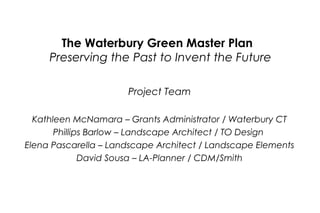
- 1. The Waterbury Green Master Plan Preserving the Past to Invent the Future Project Team Kathleen McNamara – Grants Administrator / Waterbury CT Phillips Barlow – Landscape Architect / TO Design Elena Pascarella – Landscape Architect / Landscape Elements David Sousa – LA-Planner / CDM/Smith
- 8. Waterbury Green Master Plan Civil Engineering + Landscape Architecture Sophisticated Site Design
- 9. Waterbury Green Master Plan Civil Engineering + Landscape Architecture Sophisticated Site Design
- 11. Waterbury Green Master Plan THE PRESENT - PRECEDENTS IN PUBLIC SPACE DESIGN • New Haven Green Civil Engineering + Landscape Architecture Sophisticated Site Design
- 12. Waterbury Green Master Plan THE PRESENT - PRECEDENTS IN PUBLIC SPACE DESIGN • Post Office Square, Boston Civil Engineering + Landscape Architecture Sophisticated Site Design
- 13. Waterbury Green Master Plan THE PRESENT - PRECEDENTS IN PUBLIC SPACE DESIGN • Bryant Park, NYC Civil Engineering + Landscape Architecture Sophisticated Site Design
- 14. Waterbury Green Master Plan THE PRESENT - PRECEDENTS IN PUBLIC SPACE DESIGN • Center City Park Civil Engineering + Landscape Architecture Sophisticated Site Design
- 15. Waterbury Green Master Plan THE PRESENT - PRECEDENTS IN PUBLIC SPACE DESIGN • McLevy Plaza Civil Engineering + Landscape Architecture Sophisticated Site Design
- 16. Waterbury Green Master Plan - Existing Conditions Civil Engineering + Landscape Architecture Sophisticated Site Design
- 17. Waterbury Green Master Plan - Existing Conditions Civil Engineering + Landscape Architecture Sophisticated Site Design
- 25. Key Principles of ‘Complete Streets’ Safe Street Crossings Design for Everyone Complete Streets & Sustainable Transportation for Waterbury Create Many Linkages Multi-Use Streets w/ Bike Lanes Road Diet/Narrow Lanes Slow Traffic Vibrant Sidewalks Integrated Transit
- 26. Harvard Square, Cambridge, MA (photo by D. Sousa) Keene, NH (photo by D. Sousa) Crosswalks should be illuminated with well-placed, numerous pedestrian-level street lights. ISSUE: Pedestrians are exposed to heavy urban traffic at intersections where drivers are often distracted by other stimuli and where multiple travel and turning lanes increase the time pedestrians are exposed in the street. BENEFITS of TOOL: Wider, better-designed and more articulated crosswalks greatly improve pedestrian safety. Extend crosswalks through medians to provide a pedestrian safety zone. Raised crosswalks, speed tables or raised intersections enhance crosswalk visibility and slow vehicle speeds. Pedestrian count down signals at crosswalks improve pedestrian awareness of safe crossing times. Downtown Keene, NH (photo by D. Sousa) Enhanced Crosswalks
- 27. Downtown New Canaan, CT (photo by D. Sousa) York Square, New Haven, CT (photo by D. Sousa) ISSUE: Keene, NH (photo by D. Sousa) Many city block lengths are long resulting in long distances between crosswalks at intersections; this often leads to jaywalking. BENEFITS of TOOL: Mid-block locations that are signalized and protected with medians and curb extensions improve pedestrian safety and result in lower travel speeds. Raised mid-block crosswalks enhance crosswalk visibility and slow vehicle travel speeds. Vassar Street, Cambridge, MA (photo by D. Sousa) Mid-Block Crosswalks
- 28. Photo by Dan Burden, Walkable Communities, Inc. Main Street on the Green, Branford, CT (photo by D. Sousa) ISSUE: Urban streets should be designed for slower travel speeds to provide a more peaceful setting for homes, schools, businesses and shoppers and to improve safety, especially pedestrian and bicycle safety. BENEFITS of TOOL: Streets with fewer vehicle lanes and narrower travel lanes (10’ to 11’ vs. 12’ to 15’) and narrower or no shoulders result in slower travel speeds. An urban street can carry more vehicle traffic at 30 mph than it can at 50 mph because capacity is controlled at signalized intersections. Higher design speeds lead to lower street capacity because higher speed signals require more red clearance time. Narrow Traffic Lanes
- 29. Downtown Lee, MA (photo by D. Sousa) West Hartford Town Center (photo by D. Sousa) Main Street – Branford, CT (photo by D. Sousa) Bulb-outs can be enlarged to provide amenities such as bicycle parking, bus shelters, benches & even sidewalk cafes. ISSUE: Pedestrian crossing distances are wide on many city streets and the visibility of pedestrians is occluded by parked vehicles. Robson Street, Vancouver, BC (photo by D. Sousa) Curb Extensions (Bulb-Outs) BENEFITS of TOOL: Bulb-outs extend the curb-line into the traveled way to reduce the width of the street and reduce crosswalk distances. Pedestrians in Bulb-outs are more visible to motorists, especially rightturning vehicles.
- 30. Bike Box (location unknown) “Cycle Tracks” are a new form of bicycle lane, separate from the street, that are 25% safer than on-street bicycle lanes. A “Bike Box” is a new strategy to improve the visibility and safety of bicyclists at intersections. It clearly defines the bicycle and vehicle zones and gives cyclists a head start across the intersection. Cycle Track – Vassar St., Cambridge, MA (photo by D. Sousa) ISSUE: Bicycle travel is one of the most convenient, lowcost, and efficient forms of travel yet most people do not feel safe riding bikes on city streets. Flatiron District, New York City (photo by D. Sousa) BENEFITS of TOOL: Bicycle lanes indicate an exclusive space for bicycle travel on a street, making shared use of the street much safer for cyclists. Bike lanes create consistent & safer separation between bicyclists and passing motorists. Cycling is the most energy efficient and nonpolluting forms of transportation. Cities that accommodate cyclists attract new residents and commerce. Cycle Exchange, London, England (photo by D. Sousa) Bicycle Lanes
- 31. Downtown Albany, NY (photo by D. Sousa) York Square, New Haven (photo by D. Sousa Vancouver, British Columbia (photo by D. Sousa) ISSUE: Vancouver, British Columbia (photo by D. Sousa) Bus transit is a very practical, efficient and low-cost form of public transit but is not used by large segments of the population. BENEFITS of TOOL: New bus shelters will improve comfort and convenience of bus transit and help to increase bus ridership. Transit Enhancements
- 32. Downtown Ridgewood, NJ (photo by D. Sousa) Downtown Hanover, NH (photo by D. Sousa) Main Street, Branford, CT (photo by D. Sousa) ISSUE: Parking is important to improving access to shops, restaurants and businesses and needs to be convenient to attract retail patrons. BENEFITS of TOOL: Supports the local commercial economy. Provides buffer between pedestrians and moving traffic. Slows traffic, making pedestrian crossings safer. Facilitates safe and convenient curb-side drop-off of passengers. Increases pedestrian activity on the street. Provides cue to motorists that they are entering a low speed area. Charles Street, Boston, MA (photo by D. Sousa) On-Street Parking
- 33. Skaneateles, NY (photo by D. Sousa) Photo by Dan Burden, Walkable Inc Howard Avenue, New Haven, CT (photo by D. Sousa) ISSUE: Prior to the dominance of motor vehicles, city streets were lined with majestic trees; this feature is important to urban livability. BENEFITS of TOOL: Vertical elements and overhead canopy of leaves enclose the street and cause drivers to reflexively slow down. Street trees, ornamental street lights, and bollards, visually reinforce that the street is a pedestrian-dominated, slow traffic zone. Street trees help to cool the urban environment and improve air and water quality. Street Trees and Streetscaping
- 34. Photo by Dan Burden, Walkable Communities, Inc Photo by Dan Burden, Walkable Communities, Inc ISSUE: Urban streets often have multiple lanes creating wide swaths of pavement. BENEFITS of TOOL: Tree-line medians visually narrow the travel lanes and promote slower vehicle speeds. Landscaping provides a visual amenity Medians can have crosswalk passages that provide refuge areas for pedestrians. Midblock median island- Richard Drdul Landscaped Medians
- 35. Reduced radius corner, location unknown Downtown Keene, NH (photo by D. Sousa) ISSUE: The geometry of intersections is often designed for the needs of vehicles rather than pedestrians. BENEFITS of TOOL: Reduced curb radii require vehicles, especially trucks, to make turns at slower, safer speeds. Tighter curb radii lessen the crossing distances for pedestrians in crosswalks. Branford Center - Main Street at Chestnut (photo by D. Sousa) Curb Radius Reduction
- 36. Photo by Dan Burden, Walkable Communities, Inc Photo by Dan Burden, Walkable Communities, Inc ISSUE: Urban streets often have multiple lanes creating wide swaths of pavement. BENEFITS of TOOL: Tree-line medians visually narrow the travel lanes and promote slower vehicle speeds. Landscaping provides a visual amenity Medians can have crosswalk passages that provide refuge areas for pedestrians. Midblock median island- Richard Drdul Landscaped Medians
- 37. Channelized island, location unknown ISSUE: Many intersections on arterial streets present crossing challenges to pedestrians due to right-turn movements and wide crossing distances. BENEFITS of TOOL: Right turn slip lanes limit vehicle turning speeds and improves the visibility of pedestrians. Slip lanes should include pedestrian refuge islands. Channelizing bike lane, location unknown Channelizing Island
- 38. Existing Conditions • Waterbury Green and Exchange Place serve as pulse points – “pulse” points allow for transfer between buses • 30 and 60 minute service • 2 minute transfers between services • North-south buses connect with east-west routes (more than 21% transfers) at the Green • 35% of the bus runs have less than 2 minutes to transfer
- 40. Transfer Times ~5 mi nu tes 2 minute walking radius
- 41. West Main Street Location • Transfer time increases to 5 minutes • A 5 minute transfer time would: – make passengers miss connections and wait longer for connecting service – require holding buses for passengers transferring service – affect reliability of service – see a reduction in service (16% reduction for 30 min. service) • To maintain a 2 minute transfer time, north-south services (Routes 13, 15, 16, 35, 36) have to be re-routed. • This adds travel times and reduces service on those routes
- 42. West Main Street Location • Moving pulse point to W. Main Street and keeping same level of service i.e. 2 minute transfer time between services would require “more buses” and significant changes in bus routing. • Why not “more buses”: – Increases capital and operating costs – Would result in an increase in passenger fares (approximately 21% of operational costs) – Changes in service would require federal and state involvement and “strong” support
- 43. Connecticut’s Town Greens • Waterbury Green is one of 170 in the state, priceless public landscapes that belong to everyone. • Concept of shared open space brought to America by English settlers • Instantly recognizable icons • Living artifacts and one of the few physical connections to our Puritan heritage. • Today a much needed green space in cities and towns “Without the green Connecticut would be a much different place” - Helen Higgins Executive Director, CT Trust for Historic Preservation
- 44. • • • • • • Clark Tavern Nearby Ensign Stanley House Nearby – Provided protection to colonists from Indians in 1700 Clark Tavern occupied by Revolutionary War soldiers. Muddy open space at the intersection of two roads. Swamp – not suitable for home or pasture The Declaration of Independence was read to troops on July 9, 1776 1700 – 1800
- 45. • • • • • Leveled and Fenced in 1825 Boulders hauled off during “Carting-Bee” on July 4, 1825 Corduroy Road replaced by gravel road in 1828 Meeting House moved off the Green in 1835 Planted with grass and trees c. 1840 Hjkdfhkjsdhjsdfhfsdsdhkjddfjskjfdsddfjs dfjdffdjfdskjkhdfj Jdfsjjdfjdfkjsdfklfjdklfjdskldj jhdfjhdfskhfd 1800 – 1850
- 46. • • • • 1850s – First Planned Paths 1873 – Paths Paved 1873 – Saint John’s Church 1893 – Financial Collapse, Demonstrations on Green 1850 – 1900
- 47. • • • • • • • • • • • End of War celebrations Demonstrations during the Depression 1945 Proposal to pave the Green c. 1906 Streets paved 1912 City Hall Burned 1894 Library moved 1902 Fire Dutch Elm Disease 1936 Public Notice Pillar 1946 Bus Stop 1913/14 24 Elms Replaced Elton Hotel 1904 YMCA 1924 Masonic Temple (Mattatuck Museum) 1912 1900 – 1950
- 48. • • • • • 1960s Visited by all 3 Kennedy brothers Vietnam War Protests c. 1980 Bituminous paths replace with concrete 1980 Flagpole Refurbished 1984 New electrical works for the clock 1950 – 2012
- 49. 1851
- 50. 1865
- 51. 1850-1890
- 52. 1890
- 53. 1906
- 55. Olmsted Brothers plan - 1906
- 58. 1900
- 59. 1907
- 61. 1922
- 62. 1954
- 63. 1961 1961
- 64. 1983
- 68. A
- 71. Now it’s your turn! – How did we do? – Please rotate to each of the four tables. Table Topics Include: • • • • Circulation Historic Elements Uses Planting and amenities Leave comments
- 73. Master Plan
- 74. Amphitheatre
- 75. East Plaza
- 76. Pavement Mosaic
- 77. Cooley’s Clock
- 80. Park Building
- 81. Transit Zone & Canopy
- 82. New Haven Green
- 83. Memorial Plaza
- 84. North Promenade
- 85. Potential Complete Streets Improvements