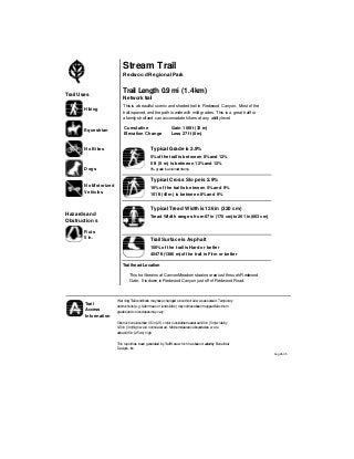
1. Stream Trail
Redwood Regional Park
Trail Length 0.9mi (1.4km)
Typical Grade is 2.9%
This is abeautiful scenic and shaded trail in Redwood Canyon. Most of the
trail is paved, and the pathis wide with mild grades. This is a great trailfor
a family strolland can accomadate hikers at any ability level.
Trail Surface is Asphalt
100% of the trail isHard or better
4547 ft (1386 m) of the trail is Firm or better
Trail Uses
Ruts
5 in.
Cumulative
Elevation Change
Gain 106ft (32 m)
Loss 27 ft (8m)
Hazards and
Obstructions
Trailhead Location
This trailbegins at CanyonMeadow staging areajust throughRedwood
5%of the trail is between 8%and 12%
0 ft (0 m) is between 12%and 12%
8% grade isastandardramp.
Typical Cross Slope is 2.9%
16% of the trail is between 5%and 9%
151 ft (46m) is between 8%and 9%
Tread Width ranges from 67in (170 cm) to 261in (663cm)
Hiking
Equestrian
No Bikes
Gate. It is down inRedwood Canyon just off of Redwood Road.
Typical Tread Width is 126 in (320 cm)
Network trail
Dogs
No M otorized
Vehicles
Warning:Trailconditions mayhave changed sincethistrail w asassessed.Temporary
obstructions(e.g.fallentrees orland slides) maynothavebeen mapped.Maximum
gradesand crossslopesmay vary.
Obstructionslessthan 0.5in(2.5 cm)or outsidethetreadarea120in (3m)w ideby
120in (3m)highwere notmeasured. Minimumclearanceboundaries w ere
atleast0.5in (2.5cm) high.
This reporthas been generated byTrailWarew hich hasbeencreatedby Beneficial
Designs,Inc.
Trail
Access
Information
Aug 26, 05
2. 5% of thetrailis
8%to 12%
Typical CrossSlope 2.9%
Asphalt
100% is Hard or better
Trail Access
Information
16% of thetrailis
5%to 9%
Ruts
Stream Trail
Hiking
Equestrian
No Bikes
Maximum261 in (663 cm)
Typical Tread Width
126 in (320 cm)
5in.
Warning:Trail conditionsmayhavechangedsince
thistrail wasassessed.Temporaryobstructions(e.g.
fallentreesorlandslides)maynothave been
mapped.Maximumgradesandcrossslopesmay
vary.
ThisreportisgeneratedbyTrailWarewhich hasbeen
createdbyBeneficial Designs,Inc.
Typical Grade2.9%
151 ft (46m) is 8% to 9%
4547 ft (1386 m)is Firm orbetter
Minimum 67in (170 cm)
Aug 26, 05
Length 0.9mi (1.4km)
Network trail
0 ft (0 m) is 12%to 12%
8% grade isastandardramp.
3. Stream Trail
Redwood Regional Park
Trail Access Information Summary
page1
FirstSegmentAssessed Jul 14,05
LastSegmentAssessed Jul 14,05
Trail Length 0.9mi (1.4km)
Warning:Trailconditions mayhave changed sincethistrail w asassessed.Temporaryobstructions(e.g.
fallentreesorland slides) maynothavebeenmapped.Maximumgradesand crossslopesmay vary.
Obstructionslessthan 0.5in(2.5 cm)or outsideof thetread area120in(3 m) w ideby120 in (3m)high
w erenotmeasured. Minimum clearance boundariesw ereatleast0.5in(2.5 cm)high.
Typical Grade is 2.9%
Trail Surface is Asphalt
100% of the trail is Hardor better
4547 ft (1386 m) of the trail is Firm or better
Lengthof trailcanbefound ontheSurfaceTypeTableandSurface CategoryTableReports.
Trail Uses
Cumulative Elevation Change
Gain 106ft (32m)
Loss 27ft (8 m)
5% of the trail is between8% and 12%
0 ft (0m) is between 12% and 12%
8% grade isastandardramp.
Locations andlengthscanbe foundon theMaximumGradeTableReports
Typical Cross Slope is 2.9%
16% of the trail is between 5% and 9%
151 ft (46 m) is between8% and9%
Locations andlengthscanbe foundon theMaximumX-SlopeTableReports
TreadWidth ranges from 67in(170 cm) to 261 in (663 cm)
Locations andlengthscanbe foundon theMinimum TreadWidth TableandMinimumClearanceWidth Reports
Typical Tread Width is 126 in (320 cm)
Network trail
Obstructions
Hiking
Equestrian
No Bikes
Ruts 5in.
Locations andlengthscanbe foundon theMinimum Vertical and MaximumTread ObstructionsReports
Aug 26,05This reportis generatedbyTrailWare w hich hasbeencreated byBeneficial Designs,Inc.