Download Editable Powerpoint Maps of India
•
0 gefällt mir•330 views

The powerpoint maps of India provide an immense functionality of seamlessly distributing the states and district of India and then again integrating them. These maps have following capabilities which make them easy to use and understand them.

Empfohlen
Empfohlen
Weitere ähnliche Inhalte
Andere mochten auch
Mehr von http://www.slideworld.com/
Mehr von http://www.slideworld.com/ (20)
Kürzlich hochgeladen
Kürzlich hochgeladen (17)
Download Editable Powerpoint Maps of India
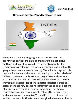
- 1. 800-736-4000 While understanding the geographical construction of one country the political and physical maps are the most useful methods and tools that provide the students as well as the teachers a most effective tool for understanding and teaching the geographical boundaries of a country. The editable maps of India provide the students a better understanding of the boundaries of different states and the locations of major cities and places. It also provides teachers an innovative and creative way in which they can give a clear idea of the important locations, cities and places of the country. It does not limit with the political locations of India, but one can also use it to understand the physical geographic diversity of India which includes the terrains, rivers and mountains of the country. These different terrains can be easily understood by the students through editable maps of India. Download Editable PowerPoint Maps of India
- 2. These editable maps of India are easily available and can be used by the people to identify the state divisions, district divisions, etc. One can put the pull the states and divisions apart, can color or de color a specific state, can select a group of states, can mark the capitals and there are lot of other capabilities in these maps which can be used by the teachers to provide the students a better understanding of the international as well as national boundaries of India. The powerpoint maps of India are also available over the internet to provide which are the most innovative tools while understanding the geographic distribution of the country. With the powerpoint maps of India, one can add many effects such as marking the state capitals, providing the vector map, adding 3-d effects, adding colors and many such functionalities can be easily obtained with these maps. The powerpoint maps of India provide an immense functionality of seamlessly distributing the states and district of India and then again integrating them. These maps have following capabilities which make them easy to use and understand them.
- 3. •Easily integrate and disintegrate the states and union territories boundary •It helps in pointing the major cities and locations of India •It also helps in identifying and marking the national as well as state capital •One can focus on a particular state or region to understand the demographics of that particular location •Different bar graphs and pie chart can be attached in the power points that help in categorization and helps in clarifying the facts and figures of the entire country or any particular state or region •Different icons can be used to segregate different type of locations and places on the basis of some parameters such as state capitals, nation capital, important cities, etc. All these features make these power points an easy and effective tool to understand the geography of India and can be easily obtained over the internet. Power Point Mapsonline Box 46111 Hillsborough county Tampa, FL - 33646 813-995-4000 www.powerpointmapsonline.com Follow Us View Source